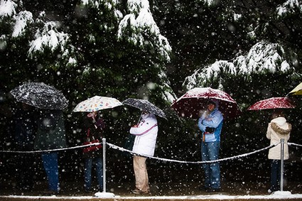
SNOW UMBRELLAS?
Dee Finney's blog
start date July 20, 2011
today's date December 18, 2012
updated 12-26-12
page 403
TOPIC: WINTER WEATHER - 2012 - 2013
WINTER WEATHER PREDICTIONS PREVIOUSLY POSTED:
I GOT A STRANGE E-MAIL YESTERDAY ABOUT THE WINTER STORM WE WERE HAVING WAS CALLED DRACO.
SINCE WHEN DO CALIFORNIA STORMS GET NAMES?
BUT LOOK AT THE DREAMS I HAD RELATING TO WEATHER AND PREPARING FOR THEM.
12-17-12- NAP DREAM - I was somewhere with a friend and she was havng some kind of blood tests, a sugar test, and some other tests. I had a flashlight that used 'D' batteries and it was going dim, and nobody had any spare batteries.
Someone is predicting that the 3 days of darkness starts precisely at midnight tonight.
We have plenty of candles and batteries. :-) and a windup radio too. :-)
NOTE: No such thing happened. The woman who predicted this stated at the end of her article, that the three days of darkness meant that Jesus would be out of contact from anyone for three days.
********************
12-18-12 - DREAM - I only remember being out on my porch and creating charts and guages to measure temperature, and other things in the atmosphere with charts that were colored into diamond shapes within a square about 3 ft on a side.
*****************
The last 4 days, I've woken up at 3:52, 3:52, 3:50, and 3:51. Isn't this a little odd?
******************
12-18-12- MEDITATION. I saw a bright green screen with the word WEATHER at the top, and some smaller boxes, that were probably drop down boxes of different things one might associate with the weather.
A few moments later I saw the word CODEX.
****************
12-19-12 - DREAM - I was working on a computer screen, downloading and editing information given by someone else, and the screen was green and yellow.
*******************
12-19-12 - NAP DREAM - I was working on a computer screen, downloading and editing information given by someone else, and the screen was white and red-violet.
******************
By Seth Cline
A powerful winter storm lingering from the weekend continues to batter the Pacific Northwest with high winds and white out conditions.
The storm, which The Weather Channel has named "Draco," is pulling cold air and moisture from the north Pacific and dumping it inland in the form of deep snows and winds up to 85 mph.
Parts of Washington and Oregon are expected to receive a foot or more of snow Monday, and winter storm warnings have been issued as far east as Wyoming and Colorado.
The conditions have already caused dozens of crashes and power outages in Oregon and Washington, according to The Seattle Times. The blizzard conditions prompted The Weather Channel to issue no travel warnings in the highlands, including the Cascade and Sierra mountain ranges.
In these higher elevations the snow could reach two or three feet of snow, according to the National Weather Service. The NWS reported hurricane-force winds, as strong as 100 mph, in the mountains of the Northwest.
Along the coast, the winds are expected to reach 85 mph, fueling 30-foot waves. Most of the Oregon and Washington coasts have issued flood warnings in anticipation of tidal overflows and heavy rains in low-lying areas.
Forecasters predict the storm will weaken as it moves inland, but expect heavy snows to continue. Idaho, Utah, Colorado, and Wyoming could see up to a foot of snow by Tuesday.
Later in the week the storm is expected to hit the Midwest. By Thursday, Chicago and surrounding areas could feel its strong winds while parts of Iowa, Wisconsin, Minnesota, and the Dakotas could see enough snow to complicate holiday travel plans.
"Draco" is the fourth large winter storm to be officially named by the Weather Channel, which began naming winter storms of sufficient strength in October
SALT LAKE CITY -- A winter snow storm moved through the Rocky Mountain region Tuesday as many people prepared for the start of their holiday travels.
The storm could cause travel delays on major highways such as Interstate 40 in Arizona, Interstate 15 in Utah, Interstate 70 in Utah and Colorado and Interstate 25 in Colorado.
The storm is headed east along the U.S.-Canada border and will eventually impact the Midwest and even the Northeast.
(More: Track Winter Storm Draco)
"Winter Storm Draco's 'second phase' is poised to begin Wednesday," said weather.com meteorologist Jon Erdman. "Snow will spread into the Plains and Upper Midwest, becoming heavy in parts of the Upper Midwest Wednesday night into Thursday."
Just light snow flurries are expected in the Salt Lake City area in northern Utah, said Jeff Zimmerman, a meteorologist with the National Weather Service in Salt Lake City. The Salt Lake City International Airport wasn't expecting delays.
But the snow will continue to come down heavily in the Utah ski resorts in the Wasatch Mountains. The ski areas have received 12-20 inches of snow in the last 48 hours and should get 4-8 inches more, Zimmerman said.
The Utah Avalanche Center has issued a warning for dangerous backcountry snowslides in northern Utah's mountains.
By Thursday, the snow is expected to subside in Utah and Arizona. By then, storms will begin in the Pacific Northwest, where snow and rain is expected, Zimmerman said.
The snow expected in northern Arizona will add to an already thick snowpack.
Two recent storms had combined to blanket the mountains north of Flagstaff with 2 feet of snow, about 20 inches in Flagstaff and along the Mogollon Rim, and about 6 inches in Prescott. The snowfall put Flagstaff above its nearly 17-inch normal for December with the snowiest month yet to come in January.
The fast-moving storm will hit Arizona from west to east Tuesday evening before leaving the state Wednesday with temperatures that will be 10-15 degrees below normal, the National Weather Service said.
For those traveling over the weekend for the holidays, the weather won't be as bitter. Warmer temperatures return Thursday and will back to near-normal on Friday and through the weekend, said Robert Rickey, a meteorologist with the National Weather Service in Flagstaff.
Until then, the major roadways in northern Arizona are expected to be an icy and slushy mess. Gusty winds that send snow blowing through the air also could limit visibility.
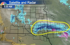
The snow Tuesday may not have been a surprise for many as we had talked about snow and freezing drizzle with light accumulations Mondaynight, however the intensity and ultimately the amount of snow that fell was unexpected by even the weather community. This impressive band of heavy snow that you can see on your left set up right along I-90 and is called convective snow. This is where you get the heaviest snowfall rates, topping 2 inches an hour in some spots Tuesday morning. You typically find these snowfall rates during large storms that have a tremendous amount of moisture…. Which are very common to our east in the Great Lakes and Northeast, as well as the highest elevations of the West Coast. This convective snow develops from strong instability (uplift) in the atmosphere that forms at the perfect height above the surface to get much larger snowflake development. This allows those “golf ball size” flakes to fall to the surface and collect much faster, leading to higher snowfall totals in a shorter amount of time. These totals are listed below along with more information on our next potential winter storm moving in Wednesday afternoon.
According to Winter Weather Expert, Tom Niziol , Blizzard warnings are in effect for parts of six states as Winter Storm Draco begins to emerge from the Rockies and into the Midwest. Draco was named based on the following impacts:
To watch the video and read the rest of this story, visit Weather.com.
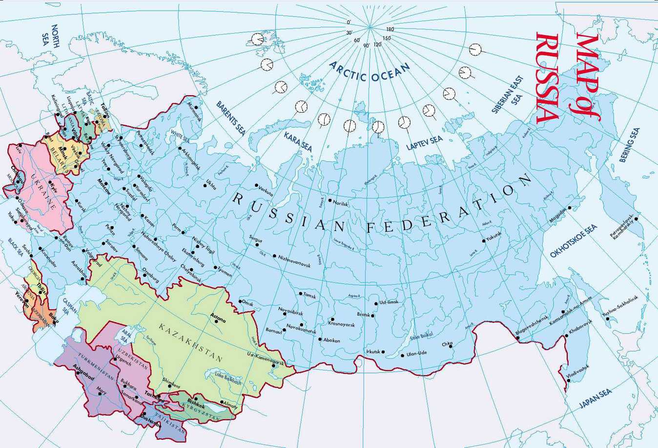
Abnormally low winter temperatures in Russia continue to claim more and more lives. Twenty-one people froze to death in only one day; 147 others were hospitalized with frostbite. The cold weather in central Russia is not going to get any warmer soon. On December 19, the cold has reached St. Petersburg, where temperatures fell below -20 degrees Centigrade. It is 30 degrees below zero in the Ivanovo region, -22C in the Kaluga region, and -25 in Tver.
For the time being, the winter of 2012 has killed 45 people (266 have been hospitalized).
To read the rest of this story, visit Pravda.ru.
Subject: Wind Map- Something might be up

NO wonder they called this storm DRACO

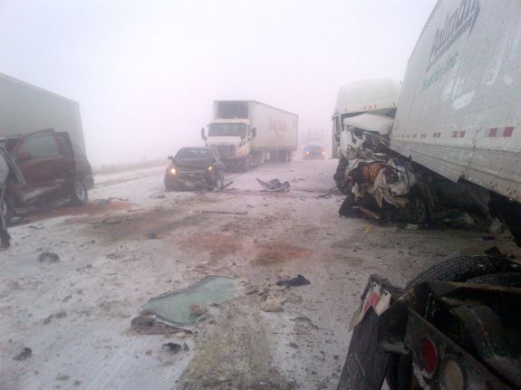
12-26-12 - A REALLY BAD SOUTHERN STORM SYSTEM WENT THROUGH THE COUNTRY ON CHRISTMAS DAY.
IT SPAWNED 34 TORNADOES, SOME OF WHICH DESTROYED A LOT OF TREES AND PROPERTY.
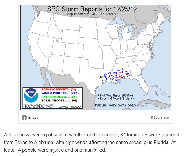
ITS STILL HEADED EAST AND NORTH RIGHT NOW CAUSING MORE DAMAGE.
OVER 100,000 PEOPLE ARE WITHOUT POWER RIGHT NOW.
HERE IS WHAT IS COMING TODAY 12-26-12