The Sumerians and the Caledonians were the world’s first spacemen; both folk lived in early Babylon. They were known the sun is in central place of the solar system, the light of the moon is reflected light; the shade of the Earth causes the lunar eclipse, and the orbits of the various planets. The Babylonians astronomical science was taken from earlier sources. According to the today’s astronomer’s surveys the solar system consist the Sun and 9 planets: Mercury, Venus, Earth, Mars, Jupiter, Saturn, Uranus, Neptune and Pluto.
In a former East Berlin state museum there are an Acadian cylinder, all nine planets are on and the moon. But in this cylinder (and a lot similar) in the solar system the tenth planet is visible.
The astronomers assuming, it was a planet in the asteroids zone between the Mars and the Jupiter, which exploded (the asteroids and meteorites were the parts of a planet once).
Mercury is slow. (1 mercury day= 57,8 earth day) because of this, if was explosion, only one of his side would be covered in with debris. According to the watch, on one of the Mercury side have much more crater, than on the other one.
The Venus temperature is high enough to start melting, the pressure of the atmosphere also high. (96 times higher than on the earth) Under these circumstances the surface supposes to be damaged very quickly, after all a lot of crater on it. One of the most possible explanations, that the planet was impact from space. The water rare on the planet, but there is lot hydrogen, which signals it they were oceans which was tipped out at the time of the explosion.
The frequent sandstorms of Mars have a same effect on the surface. After all on the Red planet there are many craters. He’s two little hold is asteroids. The tipped out water it does not come down only on the Venus. In this context there is a sign of the water (in the form of ice) on the moon. This is impossible unless arrived from space. Uranus and Saturn have a ring. The process to get this ring garden: the attraction of the gravitation umbrella…if debris flowed towards them from exploded planet.
If a planet exploded, the pieces spreading out in the solar system. If you check out the orbit of the comets, they start from certain point: from the supposed place of the missing planet.
NOTE FROM DEE: TAKE A LOOK AT THIS PAGE ABOUT NIBIRU:
http://www.greatdreams.com/nibiru.htm
What comes next is only speculation. A star exploded in Vela constellation. Huge, fiery pieces shoot into the sky. A piece like this, bigger than the largest known planet, takes his direction to our solar system. If the Kuiper belt, the zone of the asteroids consists of the pieces of one planet, then this was the first victim for the intruder vela. The friction or the direct collision blew up the planet. The intruder was big enough to survive the explosion.
The vela was close enough to the Neptune to generate electronic force which disturbs his two moons; pull of the Pluto which start his new orbit around the sun. The gravitation of the Neptune pull the vela inwards, and throw it toward to the Uranus. The vela intruder raced towards to the Saturn. It was close enough to break one moon, creating the ring, speed up the rotation. On Jupiter did not have influence, which is possibly due for his large size, or mostly because he was on his orbit point where the intruder did not go.
The next meeting was planet X. This meeting meant collision, the planet exploded, and throw debris shower onto the neighbors. The intruder slow down the Mars axial rotation broke and cracks the surface, and start approaching to the Earth. Possibly our planet feel it the gravitation effects first.
•
Perturbed the original orbit
• Disproved the axis
• Slow down the rotator velocity
• Created the fluctuation, that we experience as the alternation of an
equinox
The planet tilted and the surface starts cracking. The convection system ceased totally, when the magma flowed out: attracted from the intruder gravitation. The changing of the rotation brought fervid storms. These global tornados beaten up the dust and the debris got into the atmosphere and mixed up with volcano ash. Under short days the peaceful world turned into the chaos of the storm, the darkness, the earthquake and the flood. The fresh water poisoned, the land fluctuated, everywhere volcanic gas, the ash curtain closes out the light, eternal noises day and night.
Between the earth and
the approaching intruder, the electric field wanted to balance each other,
which is created huge, yielded lightings. There was not direct collision;
the Earth would not have remained otherwise. Then continue his way toward
the Venus and the Sun. But some pieces what he carried in his tail, exploded
and throw debris shower on the planet. The tilting of the Earth axis
suggesting that the vela was very close to one of the pole (north side).
Because he was 100 times bigger than the Earth, the gravitation went crazy.
The intruder attracted the water and towards to himself. When the
gravitation effect get to his highest point, the seas of the world became
one gigantic standing wave. Vela was continuing his way so this huge amount
of water plunged back. (sunk Atlantis, Noah survived in his ark) The
catastrophe decimated and dramatized the peoples, and we have to take it
into consideration that our ancestors were getting used to the comfort of
the civilization. Those who survived the first dangerous weeks, and months,
need to face with a new danger: the ice-age arrived. The flood that soaked
the south part of the planet fell down as snow on the northern landscape,
the shift of the earth ace transformed the North Pole into cold place. The
transition was sudden. The water started the regression, which stayed in the
north, froze into firm ice.
You can find this catastrophe in every folk legend. Although the details of
the stories differ, flood myths from around the world have many
similarities.
• Noah from the
Bible
• Nuh from the Koran
• King Ziusudra feom the Sumerian myth
• Utnapishtim from the Epic of Gilgamesh (Babylon)
• Bloodbath from the Egyptian flood myth
• Deucalion from the Metamorphoses (Greek)
• Yu from the Chinese myth
• Manu from the India flood myth
• Also from: Chiricahua Apache, Navajo, Cheyenne, Mayan and Aztecs
Indian…etc
Who escaped, created the ancient civilizations: they were coming out from
nowhere, no earlier traces with a very high culture in they age; then they
started to rot, forgotten the knowledge. (Why: the knowledge was forbidden,
only for high priest and gods can have that knowledge. The catastrophe was a
punishment from the gods - this is what they believe, the myths give
explanation - in order to not get the punishment again, they keep it secret
for a very limited people.)
The humans started everything again.
NOTE FROM DEE: BEFORE CONTINUING, TAKE A LOOK AT THESE THREE OBJECTS IN SPACE:
MORE THAN YOU EVER WANTED TO KNOW ABOUT THE ...
from: http://www.lost-empire-legend.com/missing_planet.htm
1. Charting Imaginary Worlds: Pole Shifts, Ice Sheets, and Ancient Sea Kings [Aeon Journal $] ... From: Aeon V:3 (Dec 1998) Home¦ Issue Contents Charting Imaginary Worlds: Pole Shifts, Ice Sheets, and Ancient Sea Kings Sean Mewhinney In this paper, I aim to examine a little book that has probably influenced more people than Worlds in Collision-- Charles Hapgood's Maps of the Ancient Sea Kings. Ice cores or old maps-- which to believe? Can we learn something about Earth's past from the study of ice cores? Charles Ginenthal, for one, has been convinced by Hapgood that Greenland was ice-free only a few thousand years ago. [1 Ginenthal, of course, is not the only catastrophist to give Hapgood's book his unqualified endorsement. Ian Johnson reviewed it enthusiastically for AEON, [2 while Alasdair Beal praised it to the S.I.S. [3 All three have accepted Hapgood at face value and have used him to criticize the work of scientists. That's not too surprising because Velikovsky and Hapgood were fishing in much the same waters. They share a common theme in catastrophic pole shifts and appeal to much the ... Terms matched: 1 - Score: 264 - 05 Mar 2003 - 78k - URL:
http://www.catastrophism.com/online/pubs/journals/aeon/vol0503/025chart.htm
2. Imaginary Worlds: The Debate Heats Up [Aeon Journal $] ... disappointment. Much of it is not even about Hapgood's maps. First it treats us to two pages about Arlington Mallery, followed by digressions about Robert Louis Stevenson, Tolkien (! ), Comyns Beaumont and even King Arthur. When Mewhinney eventually does turn his attention to the maps, he chooses an interesting selection to discuss: Of the 38 maps featured in Hapgood's book, Mewhinney mentions only 3, and then introduces 10 other maps which are not in Hapgood's book at all. Extraordinarily, he then goes on to severely criticise Hapgood for selection of data: "Hapgood had hundreds of maps to choose from. Not only does he exercise selection over what maps to use, but over which features to attend to and which to ignore." Mewhinney then criticises Hapgood for misrepresenting the views of others. The case he presents is rather flimsy, but then he goes on to commit the same sin himself. Compare Mewhinney's sarcastic footnote 71-- "The Spanish Government has a copy of Columbus' map, but its existence is secret, which was maintained ... Terms matched: 1 - Score: 234 - 05 Mar 2003 - 108k - URL:
http://www.catastrophism.com/online/pubs/journals/aeon/vol0505/011world.htm
3. Old World Maps -- A Response to Charles Ginenthal [The Velikovskian $] ... answers his challenge using only specific information from reputable scholars, scientifically measured data, primary arithmetic and the maps themselves. OLD WORLD MAPS Charles Ginenthal, publisher of The Velikovskian, published "Common Sense About Ancient Maps" (1) in Volume I, Number 2. In his article, he refers to "The Zeno Maps of the North," published in 1558, the Piri Re'is map compiled in 1513, and the Oronteus Finaeus map published in 1532. He also gives the analysis of the Piri Re'is map by Charles Hapgood in his Maps of the Ancient Sea Kings. Zeno's maps show an unglaciated Greenland and the Piri Re'is map shows an unglaciated Antarctica. Hapgood subtitled his book "Evidence of Advanced Civilization in the Ice Age" and Ginenthal says that Antarctica was ice-free in historical times. The United States Air Force and Navy mapping services agreed that, if the ice were removed, Greenland and Antarctica would look much like it is shown on these old maps. Mr. Ginenthal concludes his article with a challenge to bring forth evidence regarding the accuracy ... Terms matched: 1 - Score: 150 - 05 Mar 2003 - 16k - URL:
http://www.catastrophism.com/online/pubs/journals/velikov/vol0202/oldworld.htm
4. Imaginary Worlds [Aeon Journal $] ... short stretch of coastline, if taken in isolation." [27 I tried this with various lengths of coastline; between the Piri Re'is map and modern maps; between various parts of modern maps; and between different parts of the Piri Re'is map. It didn't work the way Mewhinney says except in so very general a way as to make any comparison worthless. What I did find was a correspondence between the Piri Re'is map and the coastline that it represents, based on a Cairo-centered equidistant projection. Mewhinney also states: "Hapgood had hundreds of old maps to choose from. Not only does he exercise selection over what maps to use, but over which features to attend to, and which to ignore." [28 This statement is misleading. Hapgood "used" many maps in his book. Some were simply utilized to illustrate the poorer old maps. How many old maps he may have reviewed and rejected as subject matter may not be known, but it should be obvious that he wanted to focus on maps that appeared to derive from accurate ... Terms matched: 1 - Score: 120 - 05 Mar 2003 - 10k - URL:
http://www.catastrophism.com/online/pubs/journals/aeon/vol0504/19worlds.htm
5. How Old is Greenland's Ice Cap? [SIS C&C Workshop $] ... ) Home¦ Issue Contents How Old is Greenland's Ice Cap? by Alasdair Beal According to a feature article in New Scientist (29th February 1992), deep boreholes now being drilled to a depth of 3000 metres through the Greenland ice cap should yield samples of 'the oldest ice in the world', with an estimated age of 300,000 years. If this is true, it means that the ice cap survived all the climatic upheavals of the ice age and before and also, if Velikovsky (Earth in Upheaval), Hapgood (The Path of The Pole) and Cook (SIS Review, 1991) are to be believed, the associated major geographical changes. If the scientists are right, then those who believe that the Earth has suffered major upheavals in its recent history should pause to consider the significance of these new findings. After all, if Greenland has been glaciated continuously for over 300,000 years, then it suggests that the Earth's poles have been relatively stationary throughout this period. As in many areas, care should be taken before ... Terms matched: 1 - Score: 120 - 05 Mar 2003 - 7k - URL:
http://www.catastrophism.com/online/pubs/journals/workshop/w1992no1/10green.htm
6. Analysis Of Old World Maps [The Velikovskian $] ... doubt on the assumption Schwarz makes of the map's time and origin. If the position of the extrapolated Prime Meridian of longitude were correct with respect to the Oronteus Finaeus map, Mr. Schwarz's argument could have had some validity. But it does not. In order to ascertain whether or not these meridians of longitude are truly related to the original map from which Oronteus Finaeus produced his chart, the lines of longitude must converge at the South Pole as found in Oronteus Finaeus' copy of the original. They do not. Charles Hapgood explains: As our study continued, it gradually began to appear [that the Oronteus Finaeus network of parallels [of latitude and meridians [of longitude did not fit the Antarctic as shown on his world map. Apparently a projection had been imposed by him on a source map originally drawn with a very different kind of map grid. How were we to discover the nature of this original network of parallels and meridians? (2) (Emphasis added.) Thus, the original map from which Oronteus Finaeus drew his world ... Terms matched: 1 - Score: 90 - 05 Mar 2003 - 8k - URL:
http://www.catastrophism.com/online/pubs/journals/velikov/vol0202/analysis.htm
7. Colin Wilson: Earth's Earliest Civilisation and the Giza Meridian [SIS Internet Digest $] ... conference/ This year's Questing Conference has been seen as the most successful ever. Nearly 450 delegates squashed into the Jeffery Hall at London's Institute of Education to hear exclusive lectures from some of the world's top exponents of the alternative history field. The eclectic mix of talks proved to be a winning combination that will ensure stimulating debate for some time to come. Here is a blow by blow account of each one. Colin Wilson: Earth's Earliest Civilisation and the Giza Meridian Last year Colin Wilson asked the question- why did Professor Charles Hapgood come to believe that civilisation was 100,000 years old. Hapgood and his pupils conducted a long-term study into the maps of the ancient sea kings. Among them was the Piri Reis map of 1513, said to have been constructed from 20 or so pre-existing source maps almost certainly of pre-Columbian origin. What made this map so important is that it shows the Patagonian coastline of South America as well as parts of Antarctica before they were even discovered. Moreover, the Buache map of 1737 shows the ice-bound continent in two halves ... Terms matched: 1 - Score: 90 - 05 Mar 2003 - 7k - URL:
http://www.catastrophism.com/online/pubs/journals/i-digest/2000-2/03colin.htm
8. Pole-Shift [Catastrophism & Ancient History Journal $] ... From: Catastrophism and Ancient History VIII:1 (Jan 1986) Home¦ Issue Contents Pole-Shift Richard W. Noone During the International Geophysical Year (1958), Charles H. Hapgood published a book entitled Earth's Shifting Crust that was highly praised by Harvard geology professor Kirtley F. Mather and Albert Einstein. It set forth the idea that a great many problems which have remained unsolved in the history of the earth could be explained by the assumption that the earth's outer shell has slipped over the interior, thus changing the positions of the poles relative to the earth's surface. In the last two and a half decades anenormous amount of new data has reinforced this view. In most of the highly publicized statements on this subject, however, the emphasis has been put not on successive displacements of the earth's outer shell but on continental drift: individual continents simultaneously moving away from or toward one another because of currents in the earth's interior. Professor Hapgood showed that the theory of continental drift (or "seafloor spreading"), as now presented to the public ... Terms matched: 1 - Score: 88 - 05 Mar 2003 - 48k - URL:
http://www.catastrophism.com/online/pubs/journals/cat-anc/vol0801/41pole.htm
9. No title [Aeon Journal $] ... Charles H. Hapgood, Maps of the Ancient Sea Kings/TITLE> From: Aeon III:2 (May 1993) Home¦ Issue Contents BOOK REVIEWS: Charles H. Hapgood, Maps of the Ancient Sea Kings (Chilton Books, New York), 1966. A Review by Ian C. Johnson Charles H. Hapgood, a professor of the history of science at Keene State College in New Hampshire, acknowledged that his book was inspired by Captain Arlington H. Mallery, who was the first to suggest that the Piri Re'is map of 1513 showed a part of Antarctica. Mallery also made the original suggestion that the first map of the Antarctic coast "must have been drawn before the present immense Antarctic ice cap had covered the coasts of Queen Maud Land." In his Preface, Hapgood says ancient voyagers traveled from pole to pole. The ancients had an instrument of navigation for accurately finding the longitudes of places that was far superior to anything possessed by the peoples of classical, medieval, or modern times until the second half of the ... Terms matched: 1 - Score: 88 - 05 Mar 2003 - 51k - URL:
http://www.catastrophism.com/online/pubs/journals/aeon/vol0302/094book.htm
10. The Atlantis Blueprint [SIS Internet Digest $] ... . We have deciphered the code which ties these mysterious sites together as part of an ambitious enterprise undertaken by scientists from Atlantis. Table of Contents Preface: Coins in a fountain- earth dragons- Feng shui- geomancy- cording the Temple- from priest-craft to science- the blueprint- Rand and Colin's collaboration. Chapter One: Hapgood's Secret Quest for Atlantis. Hapgood's death- his work- Mu and Plato's Atlantis -earth crust displacement- collaboration with Albert Einstein- Einstein's death- Professor Ma- Captain Arlington Mallery- Piri Reis- Hapgood approaches President Kennedy- Hapgood writes Rand- a civilisation 100,000 years old? Chapter Two: The Blueprint. Rand writes a screenplay- Donovan's 'Hail Atlantis'- Athanasius Kircher's map of Atlantis- ice-free Antarctica- Plato's 'real Ocean' and oceanographer's 'World Ocean'- the Hudson Bay Pole- Rand and Rose begin correspondence with Hapgood- William Fairfield Warren- Bal Gangadhar Tilak- Atlantis at Last!- Thomas Kuhn- John Anthony West and the Sphinx- the golden section- When the Sky Fell- other books- ...
FROM: http://www.catastrophism.com/intro/search.cgi?zoom_query=hapgood

In 1929, a group of historians found an amazing map drawn on a gazelle skin.
Research showed that it was a genuine document drawn in 1513 by Piri Reis, a famous admiral of the Turkish fleet in the sixteenth century.
His passion was cartography. His high rank within the Turkish navy allowed him to have a privileged access to the Imperial Library of Constantinople.
The Turkish admiral admits in a series of notes on the
map that he compiled and copied the data from a large number of source
maps, some of which dated back to
the fourth century BC or earlier.
The Controversy
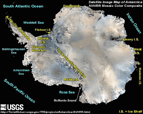
The Piri Reis map shows the western coast of Africa, the eastern coast of South America, and the northern coast of Antarctica. The northern coastline of Antarctica is perfectly detailed. The most puzzling however is not so much how Piri Reis managed to draw such an accurate map of the Antarctic region 300 years before it was discovered, but that the map shows the coastline under the ice. Geological evidence confirms that the latest date Queen Maud Land could have been charted in an ice-free state is 4000 BC.The Piri Reis map shows that the northern part of that continent has been mapped before the ice did cover it. That should make think it has been mapped million years ago, but that's impossible since mankind did not exist at that time.
Further and more accurate studies have proven that the last period of ice-free condition in the Antarctic ended about 6000 years ago. There are still doubts about the beginning of this ice-free period, which has been put by different researchers everything between year 13000 and 9000 BC.
The question is: Who mapped the Queen Maud Land of Antarctic 6000 years
ago? Which unknown civilization had the technology or the need to do
that?
It is well-known that the first civilization, according to the traditional history, developed in the mid-east around year 3000 BC, soon to be followed within a millennium by the Indus valley and the Chinese ones. So, accordingly, none of the known civilizations could have done such a job. Who was here 4000 years BC, being able to do things that NOW are possible with the modern technologies?
ALSO SEE THESE FILES
page 130
February
8, 2012
WHAT'S ALL THIS ABOUT LAKE VOSTOK IN ANTARCTICA?
ADMIRAL BYRD -OPERATION HIGHJUMP
NEW SCHWABENLAND
page 132
February
10, 2012
ADMIRAL BYRD - OPERATION HIGHJUMP
ADMIRAL FORRESTAL
NEW SCHWABENLAND
HOLLOW EARTH
ADMIRALS SUICIDED FOR WHAT THEY KNEW
MORE ABOUT PLANET X
THERE ARE 116 FILES HEREIN