EARTHQUAKE on 15/11/2006 at 11:14 (UTC)
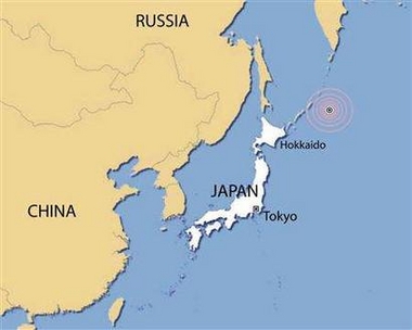
KURIL ISLANDS                          159 km S  Sarychevo
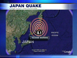
MAGNITUDE: Mw 8.1

Data provided by: BUC  GFZ  INGV LDG  LED  LJU  NEIC NOR  RNS  ZAMG

Latitude    =  46.64 N
Longitude   = 153.36 E
Origin Time =  11:14:15.1 (UTC)
Depth       =  30 Km
RMS         =   1.03 sec
Gap         =  58 degrees
95% confidence ellipse: - Semi major = 7.1 Km
                        - Semi minor = 3.6 Km
                        - Azimuth of major axis = 179 degrees

Number of data used = 414

Preliminary location computed on Wed Nov 15 14:06:22 2006 (UTC)
Done by Gilles Mazet-Roux

Comments :
For information about the tsunami see the web site of PTWC
http://www.prh.noaa.gov/ptwc/bulletins.htm

Message number: 789

All magnitudes estimations :
mb7.0 (BUC)   mb6.4 (GFZ)
Mw7.8 (INGV)  mb6.2 (LDG)   mb6.9 (LED)  
M 7.8 (NEIC)  mb6.4 (NOR)   mb7.0 (ZAMG)               

P.S.: For additional information, please contact EMSC at:
             - Email: mazet[at]emsc-csem.org
             - Web  : http://www.emsc-csem.org (maps available)
             - Fax  : 33 1 69 26 70 00

EARTHQUAKE on 15/11/2006 at 11:28 (UTC)
KURIL ISLANDS                          200 km S  Sarychevo

MAGNITUDE: mb 5.9

Data provided by: BUC  INGV LDG  LED  MAD  NEIC NEWS NOR  ZAMG     

Latitude    =  46.34 N
Longitude   = 153.98 E
Origin Time =  11:28:41.1 (UTC)
Depth       =  33 Km
RMS         =   0.92 sec
Gap         = 166 degrees
95% confidence ellipse: - Semi major = 27.7 Km
                        - Semi minor = 17.3 Km
 

EARTHQUAKE on 15/11/2006 at 19:25 (UTC)
EAST OF THE KURIL ISLANDS              179 km SE Sarychevo

MAGNITUDE: mb 5.8

Data provided by: BEO  BRA  INGV LED  NEIC NEWS NOR  SED  ZAMG     

Latitude    =  47.02 N
Longitude   = 155.07 E
Origin Time =  19:25:24.6 (UTC)
Depth       =  10 Km
RMS         =   1.16 sec
Gap         =  91 degrees
95% confidence ellipse: - Semi major = 9.0 Km
                        - Semi minor = 5.1 Km
                        - Azimuth of major axis = 176 degrees

Number of data used = 309

Preliminary location computed on Wed Nov 15 20:01:19 2006 (UTC)
Done by Julien VERGOZ
 

EARTHQUAKE on 16/11/2006 at 06:20 (UTC)
EAST OF THE KURIL ISLANDS              216 km SE Sarychevo

MAGNITUDE: mb 6.1

Data provided by: BEO  BRA  BUC  GFZ  INGV LDG  LED  NEIC NEWS NOR 
                  ZAMG                                             

Latitude    =  46.35 N
Longitude   = 154.59 E
Origin Time =  06:20:19.1 (UTC)
Depth       =  10 Km
RMS         =   1.22 sec
Gap         =  82 degrees
95% confidence ellipse: - Semi major = 7.3 Km
                        - Semi minor = 4.1 Km
                        - Azimuth of major axis = 174 degrees

Number of data used = 422

Preliminary location computed on Thu Nov 16 06:53:45 2006 (UTC)
Done by Julien VERGOZ

Comments :

Message number: 792

All magnitudes estimations :
mb6.2 (BEO)   mb6.2 (BRA)   mb5.9 (BUC)   mb6.0 (GFZ)  
mb6.0 (INGV)  mb6.1 (INGV)  mb5.9 (LDG)   mb6.1 (LED)  
mb6.1 (NEIC)  mb5.0 (NEWS)  mb5.4 (NOR)   mb5.4 (NOR)  
mb6.0 (ZAMG)                                           


Tsunami Warning Issued For Japan

Wednesday November 15, 2006
Residents in Japan have been advised to flee to higher ground following a tsunami warning there.

The country's meteorological agency issued the warning Wednesday after an enormous 8.1 magnitude earthquake struck several hundred kilometres offshore.

It was predicted to spawn a wave two metres tall or higher, which experts feared would hit the Pacific coast of the northern island of Hokkaido and main island of Honshu any time after 9pm local time (or 7am EST)

Officials suggested about two-thirds of residents in the Hokkaido town of Shibetsu lived along the coast and were in danger. Railway officials ordered local trains to stop at the nearest stations as a precaution.

There were no immediate reports of damage or injuries following the quake.

Japan braces for tsunami

Japan's meteorological agency says a tsunami expected to hit Japan's northeast coast will be at least 6.5 feet high, according to the Associated Press.

Japanese officials were warning people on the Pacific Coast to flee to higher ground.

The Pacific Tsunami Warning Center attributed the disturbance to a major earthquake near the Kuril Islands, north of Japan, and issued a tsunami warning for parts of Japan and Russia. The U.S. Geological Survey registered a 7.8 magnitude quake. NOAA and Japan later reported the quake had a magnitude of 8.1.
 

Update at 7:15 a.m. ET:An official from the town of Shibetsu on Hokkaido told public broadcater NHK that about 4,000 of the town's 6,100 residents lived along the coast and had been told to flee to higher ground, AP reports.

NHK reports officials at the local meteorological agency say "the height of the waves could be several times higher depending on the undersea geological features of the affected areas."

Update at 7:56 a.m. ET: AP reports a "small tsunami hit northern Japan, estimated at 16 inches tall, Japan's Meteorological Agency said. The wave hit Nemuro port in Japan's northernmost island of Hokkaido at 9:29 p.m. and was smaller than the 6 1/2 feet tall or higher initially expected by the agency."

The fisheries association in Hokkaido told NHK "no irregular high tide has been seen" and said they are moving 100 ships out of the harbor. Hawaii and Alaska are on watch for waves related to the earthquake.

Update at 8:41 a.m. ET: The Honolulu Advertiser, another Gannett paper, is reporting that the Pacific Tsunami Warning Center upgraded its advisory for Hawaii to a "tsunami watch."

Update at 9:16 a.m. ET: Japan's Meteorological Agency now says there is little threat of a tsunami to Japan, AP reports.


6-ft wave strikes California coast

POSTED: 11:56 p.m. EST, November 15, 2006
(CNN) -- Although tsunami warnings and watches for parts of Japan and the Pacific Basin were lifted Wednesday, hours after an 8.3-magnitude underwater earthquake struck the region, large waves were reported in Hawaii and on the western coast of the United States.

A 6-foot wave struck Crescent City Harbor in Crescent City, California, and caused "extensive damage" Wednesday afternoon, according to a National Weather Service advisory. In addition, the weather service said tide gauges along the coast of northern and central California have measured surge waves of 1 to 3 feet.

Residents along Japan's Pacific coast had been told to flee the tsunami after the quake hit Wednesday at 8:14 p.m. (1114 GMT) deep under the Pacific Ocean about 1,700 kilometers (1,000 miles) northeast of Tokyo. (How earthquakes are measured)

A wave measuring about 40 centimeters (16 inches) did wash up on some eastern Pacific coastal areas of Japan, officials there said, but nothing like the wave of almost 2 meters (about 6 feet) that had been predicted as a possibility.

At Ewa Beach, Hawaii, a 5-foot wave flooded parking lots, according to CNN affiliate KHON. Ewa Beach is on the southern coast of the Hawaiian island of Oahu.

Initially, tsunami warnings and watches were issued for Hawaii and the coasts of Washington state, British Columbia and Alaska by the Pacific Tsunami Warning Center.

However, Japan's Meteorological Agency, on its Web site, showed watches still in effect for most of the eastern Pacific coast of Hokkaido.

The tsunami warning had been issued for eastern Hokkaido, Japan's northernmost island, the U.S. National Oceanic and Atmospheric Administration (NOAA) said. ( How the tsunami alert system works)

"An earthquake of this size has the potential to generate a destructive tsunami that can strike coastlines in the region near the epicenter within minutes to hours," the NOAA said. (Watch as tsunami warning issued for Japan -- 2:50)

According to the West Coast and Alaska Tsunami Warning Center, a division of the NOAA, a tsunami warning was issued for the Alaska coastal areas from Sand Point to Attu.


Tsunami hits Crescent City
Series of 5- to 6-foot surges wrecks docks, sinks ship hours after 8.1 quake in Japan

Glen Martin, Chronicle Staff Writer

Thursday, November 16, 2006

A tsunami watch was also issued for British Columbia and parts of Washington state. ( Read where tsunami warnings were issued after the quake)

"A tsunami warning means that all coastal residents in the warning area who are near the beach or in low-lying regions should move immediately inland to higher ground," NOAA said.

About 30,000 people live in the Kuril islands, which is located 1100 kilometers north of mainland Japan.

Keiichi Kimura, a Hokkaido Prefectural (state) police officer, told The Associated Press there were no immediate reports of injuries or damage from the earthquake.

Railway officials on Hokkaido stopped trains at nearby stations as a precautionary step, Japan's primary public broadcasting source NHK said.

Tsunami waves -- generated by earthquakes -- are often barely noticeable in the ocean but can rise to great heights once they arrive at shore.

A 9.1-magnitude quake off the coast of Indonesia on December 26, 2004 caused a tsunami that killed more than 200,000 people in 11 countries.

Copyright 2006 CNN. All rights reserved


A tsunami generated by a powerful earthquake in Japan struck the small Northern California fishing port of Crescent City Wednesday, destroying docks, sinking a boat and fraying nerves.

Bill Steven, a commander with the Del Norte County Sheriff's Department, said the tsunami was "more a series of big surges rather than waves," but he said the damage to the town's harbor was significant.

The surges were reported at 5 to 6 feet high.

"The water surged back and forth like a river, and our docks aren't designed to handle swift water," Steven said. "About 50 percent of the harbor was affected. There's a lot of torn-up foam, wood and concrete. We know at least one boat was sunk, and we had to round up about 12 more that were torn from their moorings."

Steven said no fatalities or injuries were reported.

Crescent City residents are particularly sensitive to tsunami threats. The town was struck by a 21-foot-high tsunami in 1964 that killed 11 people and destroyed most of the town center.

Steven said Del Norte County officials received a notification from the National Weather Service Wednesday morning that a 3- to 5-foot surge resulting from an 8.1 magnitude quake in Japan would hit the Crescent City region at about 11:40 a.m. "We did have a very small surge at that time, and then everybody went back to business as usual," Steven said.

Then at around 2:30, Steven said, residents noticed an ominous sign -- water started running out of the town's harbor, a classic indication of an approaching tsunami.

"You don't like to see that," Steven said. "It looked like a very fast river."

But instead of a large wave, Steven said, the tsunami was manifested as another large surge flowing back into the harbor.

"It went on like that until about 5 p.m., maybe later," Steven said. "Just like a big river surging back and forth. It really hammered our docks. Pieces had to be tied off, whole sections disappeared."

Harbormaster Richard Young, who described the event as a "river within the ocean," estimated the damage to the docks and boats at around $700,000.

Steven said the surges came at a particularly inopportune time for the close-knit, isolated fishing community.

"Everybody was just getting warmed up for the Dungeness crab season," he said. "Unfortunately, this could really slow things down."

Steven, who was born the year after the killer waves hit the town in 1964, said his father often reminisced about the event.

"He was especially amazed by the tremendous field of debris it left," he said. "It's still a major topic of conversation in this town."

A tsunami warning system for the Pacific Coast has since been put in place, but residents say it failed to alert them to Wednesday's surges.

"We hear sirens all the time, but we didn't hear anything for this thing," said Don Thomsen, the manager of the Curly Redwood Lodge. Thomsen said there are three stages to a tsunami alert.

"First you have a warning, then a watch, and then it's get the hell out of town," he said.

Thomsen said he was not aware of Wednesday's tsunami until he heard about it from other townspeople.

"We're only three blocks from the harbor," he said. "We didn't know it was coming."

The incident raised concerns about the efficacy of Northern California's tsunami warning system, which is largely managed by the National Weather Service.

"I just think it somehow got past people," Steven said.

The National Weather Service could not be reached for comment.

Steven said a tsunami warning is not in effect for the North Coast.

"We are asking people to stay away from the harbor unless they're boat owners, and we need them to exercise caution at the beaches," he said.


USGS Has Revised Kuril Islands Quake to 8.3 mag. - Small Tsunami Hits Japan


by Mitch Battros - ECM/ECTV


The USGS has just raised the magnitude of the Kuril Islands quake to 8.3 magnitude. A small tsunami did in fact hit the Japanese coast with waves measuring approximately sixteen inches.


Several thousand people fled to higher ground on Japan's northernmost island of Hokkaido. The waves, however, did not swell higher than 16 inches and rapidly diminished in size, and Japan's meteorological agency later withdrew its tsunami warning after about three hours, although it urged continued caution.


A tsunami warning posted for coastal areas of Alaska was later canceled, as were watches for the northern tip of British Columbia and precautionary advisories for the states of Washington, Oregon and California. A watch was in effect for Hawaii. The agency told Japanese coastal residents to flee to higher ground after initially predicting that a 6½-foot tsunami would hit the Pacific coast of its northernmost island of Hokkaido and main island of Honshu after 9:10 p.m. (7:10 a.m. EST).


A wave that hit the port of Nemuro on Hokkaido at 9:29 p.m. was measured at 16 inches, and live video from the area showed calm seas. A few minutes later, a second, 8-inch wave hit the nearby port of Kushiro, the agency said, and the waves got progressively smaller.


The Alaska Tsunami Warning Center said a 7.8-inch wave hit Shemya Island and a 3-inch wave hit Amchitka Island in the Aleutian chain. 


                                      ______________________________


 Thursday November 2nd - Dana Smith, author "D-Day for America" A look at bibilcal prophecy. I have invited Dana Smith to share his views on what he believes, along with millions of other Christians, of today’s prophecy and coming events. From the Prophets to the Apostles, we are warned of this perilous society in which we live. The falling away from the true God --- to a God that doesn't see, nor hear, nor care is putting this nation on a collision course with the D-Day for America.

Website: http://www.ddayforamerica.com/index.html


Tuesday November 7th - John Major Jenkins, author of "Mayan Sacred Science". John has an upcoming special on the History Channel which will air “Decoding the Past: Mayan Doomsday Prophecy”. In a brief conversation with John he realized he had learned a very important and powerful lesson: “How not to make a 2012 documentary filled with doom and gloom”. This lesson reminded me of how we can “raise the bar” reflecting Maya traditions which emphasizes hope, trust, and empowerment”.
Website: http://www.alignment2012.com/


Thursday November 9th - Adrian Gilbert, author “Signs in the Sky”, “The Cosmic Wisdom Beyond Astrology” and forthcoming book “The Mayan Prophecies Revisited” published by A.R.E.. We will be discussing the Israel invasion of Lebanon and its connection to Mayan, Biblical, and Egyptian script of prophecy and predictions.  

Website: http://www.adriangilbert.co.uk/docus/home.html


Tuesday November 14th - Casey Lisse, one of the lead NASA researchers involved in the "Deep Impact" mission. Dr. Lisse has some startling news to disclose about what they found on Comet Temple-1. Lets just say it is yet another true "paradigm shift". This means the text books have to be re-written. Yes, it is that big.

Website: http://deepimpact.jpl.nasa.gov/mission/bio-clisse.html


                                      ____________________________


Preparing For Coming Earth Changes 


I have begun to note it is not just the “external” (earth changes) which is shifting, but humans as well. Remember: we too have magnetic fields which surround each of us. I think it is not unrealistic to conjecture what is happening “externally” is also happening “internally”. I believe current science will acknowledge this notion, showing the Sun's "charged particles" and its influence on Earth's magnetic field is the impetus of change. In-like, this same causal effect occurs with human magnetic fields ushering in a change or "transition". Perhaps this is what our Mayan elders are trying to tell us---- (Mitch Battros)


I will be presenting detailed information on ‘preparing for the coming earth changes’ at cities around the nation. This will include a step-by-step handout for you to take home. I will also present the latest information which includes a demonstration on how magnetic flux has a direct affect on humans. We are coming into “cycle 24” which was predicted “live" on ECM Radio Hour by NASA stating cycle 24 will be up to 50% stronger than ‘cycle 23’ in which we witnessed the largest solar flare ever recorded. This means larger earth changing events in the way of earthquakes, volcanoes, hurricanes, and various storms. But it also means we will be bombarded with charged particles via severe geomagnetic storms from the Sun.


TSUNAMI DATABASE

EARTHQUAKE DATABASE

DREAMS OF THE GREAT EARTHCHANGES  - MAIN INDEX