|
|
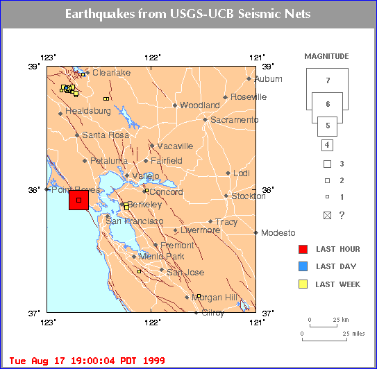
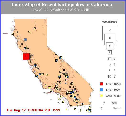
SAN FRANCISCO AREA EARTHQUAKE 8-17-99
|
|
|
|
MAP 5.0 99/08/17 18:06:18 37.91N 122.69W 6.9 0 mi SSW of BOLINAS
Updated 7:15 AM PDT August 18, 1999 SAN FRANCISCO (Reuters) - An earthquake measuring an estimated 5.0 on the Richter scale jolted the San Francisco area Tuesday, breaking glass and sweeping items off shelves but apparently causing no injuries. Don Blakeman, a geophysicist at the U.S. Geological Survey's (USGS) National Earthquake Information Center in Colorado, said the quake hit at 6:06 p.m. local time (9:O6 p.m. EDT) on Aug. 17, 1999 near the coastal town of Bolinas, about 20 miles north of San Francisco. |
TO: EARTHWATCH PAGE
TO: MAIN INDEX