|
Canada Wildfires |
|
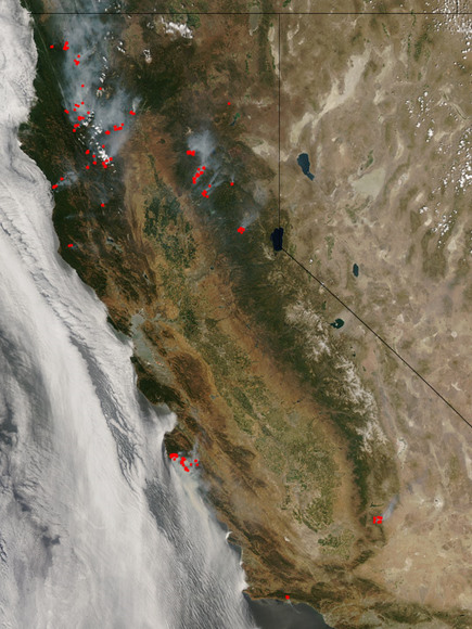
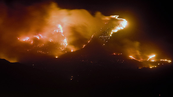
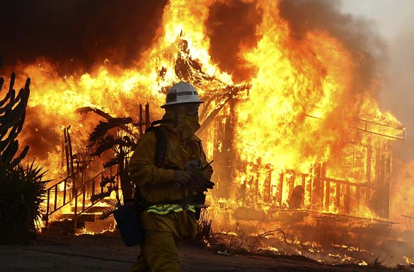
California Wildfires - 7-7-08 |
|
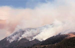
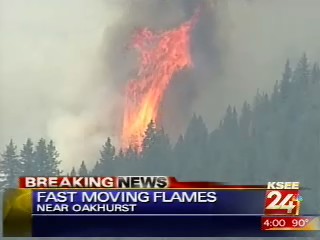
10-24-08 Fire
scorches 38 acres near Beaumont
By JOHN ASBURY
The Press-Enterprise
A
wildfire
west
of
Beaumont
charred
38
acres
of
grassland
on
Friday.
Equipment
used
by
an
individual
in
salvaging
a
vehicle
sparked
the
fire,
which
damaged
no
structures,
according
to
a
Cal
Fire/Riverside
County
Fire
Department
news
release.
Investigators
are
looking
for
anyone
with
information
about
the
fire
and
would
like
to
speak
to
individuals
seen
driving
a
late
model
blue
Chevrolet
or
GMC
pickup
truck
in
the
area,
the
release
stated.
The
fire
burned
toward
Jackrabbit
Trail
off
Highway
60,
but
smoke
was
visible
from
Interstate
10
in
Calimesa.
Anyone
with
information
is
asked
to
call
1-800-633-2836.
The
blaze
burned
away
from
homes
in
rugged
terrain.
Firefighters
doused
the
blaze
in
about
two
hours
after
it
started
about
3:30
p.m.
The
brushfire
created
a
canvass
of
smoke
that
could
be
seen
from
Moreno
Valley
and
San
Jacinto.
Hand
crews
hiked
through
the
hills
to
cut
fire
lines
as
air
tankers
and
helicopters
attacked
the
flames
from
above.
The
afternoon
blaze
was
one
of
the
few
wildfires
of
this
year's
fire
season.
October
has
been
a
notorious
time
for
wildfires
in
past
years
due
to
high
temperatures,
Santa
Ana
winds
and
low
humidity.
Riverside
County
fire
Capt.
Julie
Hutchinson
said
if
Friday's
winds
had
been
worse,
the
outcome
of
the
fire
could
have
been
a
lot
different.
"We're
not
out
of
the
woods
yet.
I
can't
stress
enough
that
California
has
a
year-round
fire
season,"
Hutchinson
said.
"This
time
of
year,
fuels
go
dormant
for
the
winter,
and
we
don't
want
people
to
be
complacent
and
let
their
guard
down."
Riverside
County
firefighters
are
on
an
increased
staffing
pattern
for
a
Red
Flag
warning
issued
through
the
weekend.
Extra
engines
and
crews
from
Northern
California
are
on
standby.
Sunday
marks
the
second
anniversary
of
the
Esperanza
Wildfire
that
killed
five
firefighters
and
charred
the
San
Jacinto
Mountains
south
of
Cabazon
and
Beaumont.
Staff
writer
Gail
Wesson
contributed
to
this
report.
John
Asbury
|
|
10-23-08
Forest Fires Pick Up Around Kentucky
Posted: 8:28 AM Oct 23, 2008
Weather
is making it difficult for
forestry officials trying to fight
several wildfires.
An 80 acre fire
in the Little Bull Creek area of
Knox County is one of them.
Forestry
officials say it's one of 11 fires
burning in the southeastern
forestry district.
They say only
three of the fires are contained,
but at last check, their efforts
have prevented any fires from
reaching homes.
Firefighters in
Rockcastle County are working to
make sure a fire there doesn't
spread.
Early Thursday
morning, the fire could be seen
from the northbound lanes of I-75.
Firefighters
were first called to it Wednesday
afternoon.
They say no
homes are in danger. |
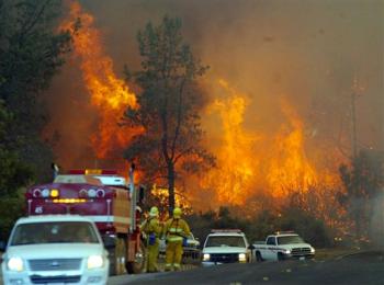
Wildfires burn near L.A.
museum, Mount Baldy
By Andrew Dalton
ASSOCIATED PRESS
October 23, 2008
LOS ANGELES – Wildfires
erupted Thursday near the world-famous Getty
museum in Los Angeles and to the east at the
base of soaring Mount Baldy as hot, dry
weather baked Southern California.
No homes burned and no injuries were
reported.
Firefighters waged furious air attacks on
both blazes, dumping water and retardant
that extinguished the Los Angeles blaze and
quickly slowed flames on the big mountain to
the east. Luckily, winds that hit 50 mph a
day earlier had declined to breezes and the
fires were relatively slow-moving.
The 100-acre fire near the Getty Center
began about 12:50 a.m. and burned up to the
backyard patios of multimillion-dollar homes
before it was extinguished seven hours
later.
The fire started about two miles from the
Getty on a steep slope on the west side of
Sepulveda Pass, which carries the interstate
through the rugged Santa Monica Mountains.
Nearby Interstate 405 was closed for
about four hours until 6 a.m., but motorists
who tried alternate routes between the San
Fernando Valley and West Los Angeles jammed
roads for hours afterward.
The Getty and the nearby Skirball
Cultural Center were closed for the day and
classes were canceled for the day at Mount
St. Mary's College.
For miles east of Los Angeles, a 120-acre
blaze was reported at 2 p.m. north of the
city of Upland. Flames rapidly blackened
slopes at the base of 10,064-foot Mount
Baldy, which towers over the region.
The fire was burning uphill and away from
any nearby homes, said Jesse Estrada, a
battalion chief with the California
Department of Forestry and Fire Protection.
Helicopters quickly swooped in to dump
water and fire retardant.
“The forward progress has pretty much
been slowed,” Estrada said. “Initially it
was a pretty fast rate of spread but right
now it's slowed down considerably.”
Many areas of Southern California were
under National Weather Service warnings of
extreme fire danger because of low humidity
and hot weather, with highs in the 90s.
Estrada said steep terrain was more of a
problem than the light winds.
The fire was “slope- and fuel-driven” as
it moved uphill in an area that last burned
in 2003, he said.
The fire near the Getty museum burned
close to where another wildfire began
exactly 30 years earlier. The Mandeville
Canyon fire of Oct. 23, 1978, was the first
of a series of fires that erupted that day
in Southern California, destroying 230 homes
as they swept across thousands of acres of
brush.
On Wednesday, gusty Santa Ana winds drove
a 250-acre wildfire in Fontana and the
canyons of Rancho Cucamonga, about 60 miles
east of Los Angeles.
A containment line around the burned area
was 90 percent completed Thursday but no
flames were visible and authorities expected
to completely surround it by evening, state
fire officials said.
|
Wildfires eat up record 25,153 acres in Virginia
By
Dave Thompson
Published: October 24, 2008So
far in 2008, wildfires in Virginia have
eaten up 25,153 acres, breaking a record
set in 1963, according to a report from
the Virginia Secretary of Agriculture and
Forestry.
But local fire officials aren’t
overly concerned even as fall wildfire
season moves in on the heels of a
rain-starved summer.
“It doesn’t appear to be very bad
right now,” said Monelison Volunteer Fire
Department Chief Rick Hunter.
One mitigating factor, he said, is
the fact that leaves are still on the
trees.
“Once the leaves get to falling,
that hurts us in two ways,” Hunter said.
“Number one, people want to burn them, and
number two, it allows more sunlight to the
forest floor and it dries that
out.”According to the report, the total
acreage burned so far totals more than
three times the amount of land burned in
2007.
Of the more than 25,000 Virginia
acres lost so far this year, 16,000 acres
burned in one day, according to the
report. About 200 fires sparked on Feb. 10
and were aided by a severe windstorm. The
largest was a 1,500-plus-acre
conflagration in the Montvale area of
Bedford County.
The 200 fires, Virginia Department
of Forestry Officials said, demolished the
previous record of 88 fires in a day.
Derek Keiser, with the Virginia
Department of Forestry, said conditions
are nowhere near as fire-friendly as they
were that day.
“You look outside, the grass and all
is still green,” he said. “Those things
kind of make us comfortable.”
Hunter recalled a blaze last
November on Tobacco Row Mountain near
Monroe that destroyed a few hundred acres.
“We’re nowhere near that. Last
November was terribly dry,” he said. “We
haven’t had much rain, (but) we haven’t
had a lot of wind or, you know, high
temperatures, low humidity.”
Keiser said even though indicators
now are not particularly fire-friendly,
people need to be mindful of the fact that
weather is always unpredictable.
“You never know what the forecast is
going to be in November,” he said, adding
“we never let our guard down.”
He added that, in the event of a
fire, conditions are still less than
desirable for suppression efforts.
“Fires tend to burn a little bit
hotter and a little bit faster than they
would in a typical year, because it’s so
dry,” he said.
Overall, he said the area is “in
pretty good shape” compared to last year
but carelessness or inattentiveness can
still do a whole lot of damage.
“The old Smoky Bear thing is, you
know, to try and prevent the forest fires
before they happen,” Keiser said.
|
|
10-22-08 HAMMONTON, NJ
: Route 206 reopened, will remain open tonight unless
smoke thickens
HAMMONTON -- State
Police have reversed an earlier
decision to close Route 206 this
evening because of poor visibility
caused by smoke from a forest fire.
The road will remain open between
Route 30 in Hammonton and Atsion Road
in Shamong Township, according to
Atlantic County Public Information
Officer Linda Gilmore.
Roving patrols will remain on the
perimeter of the area and continue to
assess traffic safety conditions.
Should smoke and fog return and reduce
visibility to dangerously low levels,
the roadway would then be closed,
Gilmore said.
The fire, which
began in Wharton State Forest ealier
this week, as of yesterday had
destroyed about 2,000 acres and
continues to smoulder.
"We have ruled out any natural
causes," said Gregory McLaughlin,
division firewarden for the New Jersey
Forest Fire Service, said Thursday.
"We know that 99 percent of all
wildfires in New Jersey are human
caused -- accidental or intentional.
We really don't know anything else. It
is suspicious. We're going to continue
to investigate the fire. We may never
know (the cause)."
Motorists are advised to avoid the
area. Route 206 reopened around noon
Thursday after being closed on
Tuesday. However, smoke is still
present along the Shamong to Hammonton
stretch, according to officials and
drivers who have witnessed it.
|
118 freeway reopened after flames
briefly threaten
The Associated Press
Article Launched: 10/14/2008
LOS ANGELES—Authorities have
reopened the 118 Ronald Reagan
Freeway in the San Fernando Valley
after flames and smoke from a major
Southern California Wildfire crept
close early in the morning.
The California Highway Patrol
says the 118 was closed in both
directions for the second time in
two days for about an hour Tuesday
morning as the Sesnon Fire on the
west side of the valley surged early
in the day.
The freeway was closed between
5:30 a.m. and 6:30 a.m. between
DeSoto Ave. and Balboa Blvd.
The 118 was the scene of a fatal
wreck Monday when a tow truck
rear-ended a car and killed the
driver in the smoke-filled roadway.
FIRE CLOSES PARTS OF 3 SOUTHERN CALIFORNIA
FREEWAYS
Parts of the 210, 118 and
215 are closed.
One driver is killed in an
accident on a smoke-filled
roadway.
By Francisco Vara-Orta
|
Los Angeles Times Staff
Writer
- 10:04 AM EDT, October
14, 2008
Three major Southern
California freeways have
been closed in some places
this morning because of the
wildfires.
In the San Fernando Valley,
parts of the 210 Freeway and
the 118 Ronald Reagan
Freeway are closed, said
California Highway Patrol
Officer David Porter.
The CHP closed both the
westbound and eastbound
sides of the 118 Freeway
between Balboa Boulevard and
De Soto Avenue about 5:45
a.m., Porter said.
All on- and off-ramps of the
210 Freeway remained closed
between Interstate 5 in
Sylmar and Wheatland Avenue
in Lake View Terrace.
In the Inland
Empire, Interstate
215 is closed from
the 210 Freeway to
Inland Center Drive
in San Bernardino.
At least one person
has died in a
traffic accident
related to the
fires. On the 118 on
Monday, a tow truck
rear-ended a car,
killing the driver
on a roadway
obscured by smoke,
resulting in a fiery
wreck.
francisco.varaorta@latimes.com
|
Wind-driven wildfires
claim 2 near Los Angeles
Last
Updated: Monday, October 13, 2008
A wildfire burns about 30 kilometres north
of downtown Los Angeles on Monday morning.
(Morry Gash/Associated
Press)
Two huge wildfires driven by strong
Santa Ana winds threatened neighbourhoods near
Los Angeles on Monday, burning dozens of
mobile homes, forcing frantic evacuations on
smoke-choked highways and causing at least two
deaths.
A man who appeared to have been a
transient living in a makeshift shelter was
one of the dead, authorities said. The other
was a motorist who was killed about midday
Monday in a head-on crash on a freeway
entrance ramp as traffic tried to turn around
to escape flames.
'It is a blowtorch we can't get in
front of.'— Insp. Frank
Garrido
Firefighters were struggling with a
2,000-hectare blaze in the San Fernando
Valley's northeastern corner when a new blaze
erupted at midmorning a few kilometres to the
west in mountains above the Porter Ranch area
and quickly grew to 800 hectares as wind blew
up to 80 kilometres an hour, with gusts
reaching more than 100 km/h.
"It is a blowtorch we can't get in front
of," said Insp. Frank Garrido of the Los
Angeles County Fire Department.
The first fire was burning where
neighbourhoods abut rugged canyons below the
mountainous Angeles National Forest.
Los Angeles County fire Capt. Mark
Savage said as many as 38 mobile homes were
destroyed by that blaze early Monday. About
1,000 firefighters from multiple agencies were
deployed.
"We could have had an army there and it
would not have stopped it," Battalion Chief
Mario Rueda said. "Wind is king here. It's
dictating everything we are doing."
Winds turn vegetation to tinder
The dry and warm Santa Ana winds
typically blow between October and February.
As they whistle through Southern California
canyons and valleys, they accelerate, drying
out vegetation and hastening the spread of any
fires that erupt.
"This is what we feared the most,"
Savage said. "The winds that were expected,
they have arrived."
Flames jumped the Foothill Freeway,
which was closed in both directions for about
a five-kilometre stretch in northern Los
Angeles between the 118 Freeway and Interstate
5 amid the morning rush hour, officials said.
"That was quite a jump. That's an
eight-lane fire break," said fire spokesman
Insp. Paul Hartwell.
The Red Cross said about 500 people
have registered at an evacuation centre at San
Fernando High School. Agency spokesman Nick
Samaniego said some evacuees had seen news
footage of their homes burning.
"You can imagine, it's a devastating
situation," he said. "A lot of people on pins
and needles waiting to hear news about their
communities."
Also Monday, a blaze charred more
than half of San Francisco Bay's largest
island but spared scores of historical
structures, including an immigration station
that was the first stop for millions of
immigrants, mostly from China, in the early
1900s. The Angel Island wildfire was about
75-per-cent contained Monday afternoon; the
cause remains under investigation.
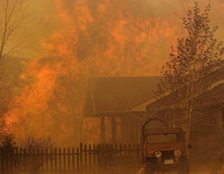
Fire consumes a structure as
fighters battle the blaze early
Monday morning, Oct. 13, 2008,
north of Los Angeles. Intense
Santa Ana winds swept into
Southern California and whipped up
a 3,700-acre wildfire early
Monday, burning mobile homes and
industrial buildings and forcing
the evacuation of eight patients
from a nearby hospital. (AP
Photo/Mike Meadows) |
With files from
the Associated Press
SoCal wildfires keep spreading
12:01 PM, October 13, 2008
Even as the Marek
fire, which has spread
to 3,700 acres and
shrunk to 5%
containment, destroyed
37 mobile homes, new
fires burn near Porter
Ranch, in Santa Clarita
and in San Bernardino
County. A fire just
north of Chatsworth,
near Browns Canyon Road,
is at five acres and
growing quickly.
Air quality in the
area is awful, needless
to say. The American
Lung Assn. of California
is urging people to use
common sense and stay
indoors and to limit
outdoor activity.
All local news
channels have now
switched to full fire
coverage. Our fire
package of stories, pix
and maps, updated as new
info comes in,
is here.
— Veronique de
Turenne
Photo: The Sky
Terrace Mobile Lodge was
hit by the Marek fire.
Credit: Irfan Khan / Los
Angeles Times
|
|
Napa County wildfire forces
evacuations of over 100 homes
A wildfire just east of St.
Helena in Napa County burned has
300 acres of rolling hills
scattered with wineries, fire
officials said.
The blaze just east of St. Helena
had burned 300 acres this morning
and was 40% contained.
By Esmeralda Bermudez, Los
Angeles Times Staff Writer
11:55 AM PDT, October 11, 2008
Residents of more than 100 Napa
County homes remained under
evacuation orders today as a
wildfire just east of St. Helena
burned 300 acres of rolling hills
scattered with wineries, fire
officials said.
More than 1,500 firefighters
worked through the night battling
the fire, which started at 5:45
p.m. near Deer Park. By 7 a.m. the
blaze was 40% contained, said
CalFire spokesman Daniel Berlant.
|
|
|
Warm Winds Heighten Fire Danger in California
Multiple Blazes in Southern Part of
State Have Burned More Than 15,000 Acres; Emergency Is
Declared in Two Counties
LOS ANGELES -- In the latest flare-up in a busy
year for California fires, winds threatened to push
a major wildfire south and west where it could rip
through more-populated areas, including Simi Valley
and Malibu, even as a second fire north of Los
Angeles was brought under control.

Dousing flames
from land and sky, more than 1,000
firefighters are battling two major blazes
on the northern fringe of Los Angeles.
Video Courtesy Reuters. (Oct 14).
The blazes, along with another fire farther
south, in San Diego County, are the first to erupt
during what is typically the most intense period of
Southern California's fire season. As more than
2,500 firefighters worked to contain the blazes,
which have consumed more than 15,000 acres, warm
Santa Ana winds risk
kicking up new fires. That could
force firefighters to spread their
resources more thinly to cope with new
threats.Gov. Arnold
Schwarzenegger declared a state of
emergency in Los Angeles and Ventura
counties, and more than 1,800 people
were evacuated, though many were later
allowed to return to their homes. The
fires have resulted in one death and the
loss of 50 structures, including homes
and mobile homes.
As of midday Tuesday, the Marek
fire, which began early Sunday on
national forest land, was 70% contained.
But farther west, firefighters were
battling to get the upper hand on a fire
that started Monday morning and doubled
in size overnight to nearly 10,000
acres. That fire, dubbed the Sesnon
fire, was burning on the northwestern
edges of the San Fernando Valley,
creeping toward the Granada Hills
neighborhood. Though fire officials
appeared to be making progress, they
cautioned that unpredictable winds could
hamper their efforts.
Late autumn, when hot daytime
temperatures combine with gusty winds,
can create the most dangerous fires, but
recently California has been dealing
with blazes throughout the year. "It's
fire season all year round now," Gov.
Schwarzenegger said during a news
conference Tuesday.
Already this year, 1.54 million
acres -- an area roughly the size of
Delaware -- have burned in California,
compared with 1.52 million acres during
2007. That has been an added strain on
the state's overstretched budget.
Gov. Schwarzenegger sought Tuesday to
reassure the public that the state still
had adequate funds for firefighting.
"Though we've had budget problems in our
state and an economic slowdown, we don't
spare one dollar when it comes to
fighting fires," he said.Last
year, he said, the state spent an
estimated $500 million on firefighting,
an amount likely to be exceeded this
year. While fires are a recurring
problem in the state, last year's
devastating fires in Southern California
focused the public's attention on the
danger, in part because the flames
spread through more-populated areas,
burning down more than 3,000 homes and
claiming 10 lives.
The increase in the amount of land
burned recently has forced local
governments to shift resources to
another problem: landslides. Burned
areas are usually denuded of vegetation,
so that hillsides can collapse under
even moderate rainfall.
Santa Barbara County, for example,
the site of a fire this summer, is now
girding for massive flooding and
landslides that could run across Highway
101, the airport and sections of the
city of Santa Barbara's downtown.
"You can try to stop the fire, but
you can't stop the flooding," said Santa
Barbara County emergency-operations
chief Michael Harris. He said the county
expects it could be coping with 300,000
cubic yards of debris, or about 30,000
dump trucks' worth, and it has set up
evacuation centers for residents.
Because the major fire in Santa
Barbara County occurred in the summer,
local officials had time to clear out
streambeds and treat hundreds of acres
via aerial hydromulching, in which
planes spray an organic slurry mix over
burned land that can help firm up weak
soil.
But fires that rage during October
give authorities little time to prepare
for mudslide damage that comes when the
rainy season begins, typically in
November.
Write to Gabriel
Kahn at
gabriel.kahn@wsj.com and Peter
Sanders at
peter.sanders@wsj.com
|
|
October 15, 2008
Mass exodus as flames bear
down on Los Angeles
Chris Ayres in Los
Angeles
Video: wildfires rage in California |
LA notebook: a burning issue that isn't the
credit crunch
The suburbs of Los Angeles were ablaze
last night amid apocalyptic scenes of
destruction that have resulted in two deaths
and the hasty evacuation of thousands.
The fires are partly the result of a
catastrophic drought in Southern California
that has all but drained the state’s water
reserves. The situation has been worsened by
October’s hurricane-like “Santa Ana” winds,
which have spread the flames at speed.
Officials are hoping that the fires will
not reach the catastrophic proportions of last
year’s inferno, which resulted in the
evacuation of one million people and laid
waste to an area 160 times larger than that
destroyed by the atom bomb detonated over
Hiroshima in 1945. Nevertheless, Governor
Arnold Schwarzenegger declared a state of
emergency in Los Angeles County and
neighbouring Ventura Country, and told
residents to prepare for anything.
LA threatened by huge wildfires
So far, more than 20 square miles of
suburban LA and northern San Diego County have
been scorched, with the worst of the fires
raging in the San Fernando Valley. More than
2,000 firefighters and a fleet of
water-dumping aircraft were trying to control
the blaze last night after it doubled in size.
One person was killed in a car accident
blamed on a firefighting operation that was
trying to prevent flames from reaching the
road. Meanwhile, a homeless man was found dead
in the scorched canyon below the Angeles
National Forest. He appeared to have been
living with a dog in a makeshift shelter, the
authorities said.
About 3,000 homes remained evacuated as
of last night.
“The fire wants to make its way to the
[Pacific] coast, and we’re going to do our
level best to stop it,” said Brian Humphrey, a
spokesman for the Los Angeles Fire Department.
“Two-thirds of our department is on the line.”
Fire officials yesterday put several of
LA’s fire-prone communities on alert,
including the celebrity enclave of Malibu.
|
|
|
|
|
|
|
|
|
|
Fire still threatens homes west of Yosemite
Park
7-26-08
MIDPINES, CALIF. - A fast-spreading wildfire
raged out of control Sunday near an entrance to
Yosemite National Park after forcing residents to
evacuate 170 homes and leading authorities to cut
power to the park.
The blaze had charred about 25 square miles, or
16,000 acres, since Friday as wooded slopes ignited
amid hot, dry conditions that have plagued
California for months. The steep terrain west
of the park is overgrown with dense brush that was
fueling the flames, fire officials said.
"There's no fire history in the past 100 years.
That's one of the reasons this fire's been able to
burn so erratically," Daniel Berlant, spokesman for
the
California Department of Forestry and Fire
Protection, said Sunday.
Officials ordered the evacuations of 170 homes
under immediate threat. About 2,000 homes faced at
least some danger from the fast-spreading flames,
according to the Department of Forestry and Fire
Protection.
About 900 firefighters were battling the fire
and hundreds more were headed to the scene along the
Merced River west of
Yosemite, one of the nation's most visited
national parks. Most of the evacuated homes are in
the town of
Midpines, located along Highway 140, about 12
miles from the park.
The highway, which leads to one of two
entrances on the west side of the park, remained
open Sunday morning, according to the
California Department of Transportation.
State fire spokeswoman Karen Guillemin said
the cause of the fire "is definitely target
shooting," but he would not elaborate.
The
National Weather Service forecast sunny
weather Sunday with temperatures in the high 90s.
On Saturday, firefighting efforts were
hampered by temperatures over 100 degrees and low
humidity. The weather, coupled with a dry wilderness
area, has made fighting the blaze very hazardous.
"Dozers are trying to push dirt as fast as
they can to get safety zones for our firefighters
that are out there," Guillemin said. "Crews are
cutting brush as fast as they can but it's an
extremely dangerous situation at this point."
Electricity was cut to a wide area, including
the park, to protect firefighters battling flames
beneath power lines, said Department of Forestry
spokeswoman Cheryl Goetz.
|
California wildfires spread along Pacific coast
By Guy Adams
Monday, 7 July 2008 REUTERS
More than 1,700 out-of-control fires have
been reported ? of which 1,400 are partially contained. \
Wildfires have forced thousands of people to flee their
homes in California's hills. More than 2,000 firefighters
spent the weekend battling 300 fires that have now destroyed
more than half a million acres of countryside and at least 69
homes.
A state of emergency has been declared. The holiday town of
Big Sur, a New Age resort on Highway 1 – the famous road that
runs the length of America's west coast – was partially
evacuated, leaving 2,600 houses to their fate.
Television helicopters showed aircraft dropping water on
100ft flames, while journalists interviewed the owners of
1,400 other properties who are being kept on standby, ready to
flee.
The Henry Miller Memorial Library, home to the books and
artefacts of the Tropic of Cancer author, one of the many
writers who have lived in Big Sur, is also at risk.
Freak electrical storms combined with a long-running
drought to start blazes across the region. More than 1,700
out-of-control fires have been reported – of which 1,400 are
partially contained.
Fighting the disaster is reported to have so far cost more
than $300m (£150m) and California's Governor Arnold
Schwarzenegger is trying to secure Federal assistance
|
Big flames surround Big Sur
1 death today
Last Updated: Friday, July
4, 2008
A firefighter in northern California died as 335 wildfires
burned around the state on Friday, mostly along the Big Sur
coastline between San Francisco and Los Angeles.Robert
Roland, a 63-year-old volunteer firefighter, collapsed Thursday
on the fire line in Mendocino County, north of San Francisco,
where he was battling a 2.2-square-kilometre blaze. He later
died at a hospital.
It was the first reported death of a California
firefighter this season, and Gov. Arnold Schwarzenegger ordered
flags at the state capitol to fly at half mast.
The fires are said to be threatening more than 4,500 homes
along the coast. As the blaze in the northern end of the Los
Padres National Forest moved closer to Big Sur on Friday, a fire
320 kilometres south in Santa Barbara County doubled in size
overnight Thursday due to hot winds, according to officials.
An evacuation order has been served to more than 1,700
homes around the city of Goleta, near Santa Barbara. An equal
number of residences were ordered to evacuate in Big Sur earlier
this week.
Kirk Gafill, general manager of Nepenthe, a restaurant in
the Big Sur area, said he and five employees were working
feverishly to protect the cliffside business his grandparents
built in 1949.
Wearing dust masks, the crew scrambled to stamp out
embers, some the size of dinner plates, that were dropping from
the sky.
"This fire is unprecedented in the history of Big Sur so
the community is competing for help from fire agencies as we
just don't have the resources to cope," Gafill told the CBC.
"There is no dedicated support to protect properties from
the fire, hence people are refusing to move. We know we can rely
only on ourselves and our neighbours as fire officials don't
have the resources to secure our properties."
Solemn Independence Day
July 4, U.S. Independence Day, is normally a booming time
for tourism in the region, with visitors settling into vacation
homes or trekking out to campgrounds nestled among redwoods. But
this year, the only out-of-towners in Big Sur are firefighters
working around the clock to save it from flames.
Crews near the Pacific Coast Highway fought back flames
from houses and historic landmarks, including the upscale
Ventana Inn, which was surrounded by crackling, burning brush
Thursday afternoon. Several houses perched on a ridge about a
half kilometre from the inn fell victim to the fire the night
before.
Most of the 335 wildfires burning in the state were
ignited by lightning, according to the California Department of
Forestry and Fire Protection and the U.S. Forest Service. The
number is down from a peak of roughly 1,500 fires only a few
days ago.
In all, the wildfires have scorched more than 1,000 square
kilometres and destroyed at least 65 structures since June 20,
the forestry department said.
With firefighting resources stretched thin early in the
fire season, counties have been recruiting volunteer
firefighters to help with smaller blazes.
|
Wind keeps California fires raging on 2 fronts
By AMANDA FEHD
7-4-08
BIG SUR, Calif. (AP) — A pair of out-of-control wildfires
roared along California's central coast Friday, chewing through
opposite ends of a parched forest and threatening a total of more
than 4,500 homes.
While flames from the stubborn fire in the northern flank of
the Los Padres National Forest inched closer to Big Sur's historic
vacation retreats, state emergency officials said hot winds had
caused a newer blaze 200 miles south in Santa Barbara County to
double in size overnight.
Residents of more than 1,700 homes in and around the city of
Goleta were ordered to evacuate, joining an equal number of people
who were told to leave Big Sur days earlier.
Driven by wind gusts as high as 40 mph, the Santa Barbara
County fire was so fierce early Friday that firefighters at one
point took shelter in about 70 homes they were trying to defend,
said Capt. Eli Iskow of the county fire department.
"Hundreds of firefighters were in place around hundreds of
structures," Iskow said. "I think we saved every one of those
structures in that area."
Wind was less of a problem in Big Sur, which remained eerily
empty under a thick blanket of fog and smoke at the start of the
long holiday weekend. No more properties were lost since Thursday,
but the density of the parched terrain allowed the 13-day-old
wildfire to keep advancing on the storied tourist town, where
flames made their way toward the scenic Pacific Coast Highway and
sent forest creatures running toward the Pacific Ocean for cover.
"It came down into the canyon last night. I couldn't sleep.
It's still in there lurking about," said Kurt Mayer, who ignored
the mandatory evacuation orders to douse his Big Sur Deli with
fire-retardant gel.
Daniel Berlant, a spokesman for the California Department of
Forestry and Fire Protection, said weather forecasts calling for
winds to kick up again in the afternoon had officials worried the
outlook for both blazes was not going to improve anytime soon.
By Friday morning, the Big Sur fire was only 5 percent
contained and had consumed more than 100 square miles and 20
homes, while the Goleta fire was nearly 15 percent contained and
had destroyed about a half-dozen outbuildings and more than 10
square miles.
The Los Padres blazes were two of 335 active wildfires
burning in California, down from a peak of roughly 1,500 fires a
few days ago, but they were commanding the greatest share of
equipment and personnel because of their locations near populated
areas, Berlant said.
"Any time we have structures threatened and lives at risk,
it's a top priority," he said.
Goleta resident Susan Ramirez said she and her husband and
two children evacuated their duplex about 2 miles from the fire
late Thursday as conditions deteriorated. They were staying with
her parents, also in Goleta, and watching the smoke.
"It was completely black, and there was too much ash,"
Ramirez said. "Our eyes were burning, and we were trying to get
out of there as fast as we could."
Since a series of dry lightning strikes ignited more than
1,500 wildfires across central and Northern California on June 21,
more than 520,000 acres, or 814 square miles, of range and forest
land has gone up in flames.
Along with the Goleta and Big Sur fires, another fire
generating concern is in the Sequoia National Forest east of
Bakersfield, where a wind-driven blaze had burned 25 square miles,
destroyed one home and threatened 1,000 more in nearby
communities.
A mobile home fire in Malibu quickly spread to brush Friday,
burning about 25 acres and leading to the evacuation of Malibu
Creek State Park. It was burning not far from a Hindu temple and
the historic King Gillette ranch, built in the 1920's for razor
magnate King C. Gillette.
In Arizona, officials said a blaze southeast of Prescott had
burned four homes since it broke out June 28. The blaze has forced
the evacuation of the mountain town of Crown King and was half
contained Friday night.
Associated Press writers Jacob Adelman in Los Angeles
and Jordan Robertson in Carmel, Calif., contributed to this
report.
|
|
NOTE: I can tell you from personal experience that living with
smoke in the air for days on end is not healthy. I feel really bad
for those people who have asthma and other debilitating lung diseases.
Little children shouldn't be outside playing in this nasty air either.
This is really bad. Some days we could hardly see the sun in the
sky and it wasn't cloudy - just smoke.
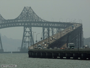
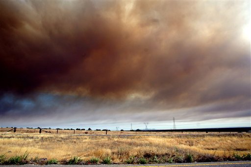
Smoke from hundreds of fires in Northern
California
creates a haze over the Richmond-San
Rafael bridge.
Big Sur wildfires wreak havoc
- Two fires combine near Big Sur,
California, burning 26,763 acres
- Farther inland, Indian fire destroys
more than 10 buildings, burns 59,700 acres
- Firefighters brace for more blazes as
dry thunderstorms threaten parts of California
LOS ANGELES,
California (CNN) -- Smoke climbed high into the
sky Friday as firefighters struggled to contain two
wildfires that combined near Big Sur in California, a
fire official said.
The Gallery and Basin fires
have destroyed 16 homes and burned 26,763 acres in
Monterey County, said Mike Jarvis, spokesman for the
California Department of Forestry and Fire Protection.
The combined blaze is less than
5 percent contained, Jarvis said.
Farther inland, the Indian Fire
west of King City has destroyed more than 10 buildings
and burned more than 59,700 acres, according to
Jarvis.
Several areas near King City
are under mandatory evacuation orders, and several
firefighters have been injured, he said.
State and federal firefighters
battling hundreds of blazes were preparing for a new
generation of
fires through the weekend.
More dry thunderstorms were
predicted to sweep through California on Friday, with
cloud-to-ground lightning that will hit the tinder-dry
grass region like a blast furnace, forecasters warned.
CNN meteorologist Reynolds Wolf
said high winds would accompany the electrical storms.
="true">
Firefighters battle hundreds of blazes in
California
The state has battled more than
1,200 wildfires on state and federal land since last
Friday, when 5,000 to 6,000 lightning strikes hit the
region, Fred Orsborn, a fire information officer for
the Northern Operations Center.
In Northern California, 193,470
acres have burned, Orsborn said.
Federal and National Guard
aerial support has been sent to California to help
battle the fires, but thick smoke from the blazes,
like "early morning fog," has made it difficult for
aircraft to reach the affected areas, Orsborn said.
Several counties said their
damage from the fires reached at least $1 million,
with some estimating damage of up to $4 million,
according to the Forestry and Fire Protection Web site
The state's governor, Arnold
Schwarzenegger, asked President Bush on Friday to
declare a federal state of emergency in California,
saying the incident was "beyond the capabilities of
the state and affected local governments," according
to a news release.
Many of the blazes were "spot
fires" that affected small areas and were put out
quickly, he said. But others spread and continue to
burn.
In Mendocino County in Northern
California, where there are 121 wildfires, 87 remain
uncontrolled, and those fires are only about 5 percent
contained, said Vikki Lowry, a public health
spokeswoman for the county.
About 27,000 acres have been
burned, and several voluntary evacuations are in
place, she said.
The Shasta-Trinity area has 158
fires that have burned about 35,000 acres, according
to the California Department of Forestry and Fire
Protection's Web site. About 5 percent have been
contained.
Two fires in the Sonoma
Lake-Napa region in western California are still
active. One of them, the Walker fire in Lake County,
has destroyed 14,500 acres and is 70 percent
contained, said a spokeswoman for the Sonoma Lake-Napa
unit.
There have been no fatalities
from the fires, but 27 injuries have been reported in
both state and federal jurisdictions, Orsborn said.
Seventeen homes have been destroyed, he said.
Because of the "aggressive
initial action" to control the fires, about 320 had
been contained as of Friday, Jarvis said.
Since the
beginning of the year, there have been 35,155 fires
nationwide that have destroyed approximately 2,031,659
acres, according to the National Interagency Fire
Center Web site.
|
NORTHERN CALIFORNIA
Myriad wildfires pollute air, pose health risks and keep
on spreading
Demian
Bulwa, Chronicle Staff Writer
Friday, June 27, 2008
(06-26) 11:52 PDT SAN FRANCISCO -- Bay
Area residents can expect to remain mired in a smoky haze this
weekend as nearly 1,100 wildfires chew up 250 square miles of
land around Northern California. For those most sensitive, the
foul air could pose health risks, pollution regulators and
meteorologists said Thursday.
Temperatures are expected to top out in the 80s and even
the 90s in hot spots like Livermore, which would make for
great summer weather, "if only you could breathe," said Diana
Henderson, a National Weather Service forecaster.
Existing fires continued to spread Thursday, even as new
fires were discovered. And state and federal fire officials
said they were preparing for the return of the same dry
thunderstorms that sparked most of the recent blazes. The
storms were expected to bring lightning strikes starting late
Thursday and continuing through the weekend.
The Bay Area Air Quality Management District said it
expects pollution levels to remain unhealthy today in portions
of Alameda, Contra Costa, Marin, Napa, Solano and Sonoma
counties. People who are very young or old, or suffer from
lung or heart disease, are most at risk.
Of particular concern, said agency spokesman Aaron
Richardson, are smoke particles smaller than 1/20th of the
diameter of a human hair that are not filtered out of the body
by the nose or throat, and may pass into the bloodstream.
Concern about polluted air was one reason why organizers
canceled Saturday's 100-mile Western States Endurance Run. The
famous footrace from Squaw Valley to Auburn was scrapped for
the first time in its 35-year history because of the "health
risks that have been associated with these wildfires," race
officials said in a statement.
As of Thursday afternoon, officials had identified 1,088
fires in Northern California that covered 159,000 acres and
destroyed at least 18 homes. More than 12,500 state and
federal firefighters were on the job, with 68 helicopters and
14 airplanes dropping water and retardant liquid. Closures
were in place on Highways 32, 36, 70, 89 and 96 and 299.
One of the smokiest fires continued to grow in Lake and
Colusa counties. The Walker Fire was just 10 percent contained
and had the potential to shut down Highway 20 and burn more
than 30,000 acres - or nearly 50 square miles - as it moved
north through steep and rugged terrain, the state's
firefighting agency said.
The Walker Fire had not destroyed any homes in the remote
area, and the popular Wilbur Hot Springs resort that was
evacuated was spared, said Roger Archey, a spokesman for the
state Department of Forestry and Fire Protection. On Thursday,
he said, the two-lane Highway 20 remained open, but was
crowded with emergency vehicles and choked with smoke from the
blaze.
As of Thursday morning, Archey said, nearly 600
firefighters had reported to the blaze, using five helicopters
to drop water and 21 bulldozers to carve out wide perimeter
lines, attempting to stop the fire's advance. The cause
remained under investigation, though it was reported earlier
as lightning.
"It's really gnarly country, a lot of brush and chaparral
and steep terrain," Archey said. "There are fast-burning fuel
types that are problematic, obviously."
Another major concern was the Eagle Fire in Shasta-Trinity
National Forest, which jumped Highway 299 on Wednesday and
prompted the closure of a stretch of the roadway as well as
evacuations near Junction City.
In Monterey County, both directions of Highway 1 south of
Big Sur remained closed in a 12-mile stretch because of what
is now known as the Basin Complex of fires in Los Padres
National Forest. The highway is likely to stay shut for
several more days, according to Caltrans.
The possibility of the flames traveling about a mile west
and reaching Big Sur lessened Thursday, though the combined
fires had burned 24,000 acres and are only 3 percent
contained, a U.S. Forest Service spokesman said.
The fire, which has destroyed 16 homes, is considered to be
in the southern part of California and is thus not included in
the damage report for Northern California.
To view a map showing significant fires in California, go
to sfgate.com/maps/fires2008
E-mail Demian Bulwa at
dbulwa@sfchronicle.com.
This article appeared on page B - 3
of the San Francisco Chronicle
|
Denver & the west
Most wildfires
blamed on dry lightning
mailto:knicholson@denverpost.com
By Howard Pankratz
and Kieran Nicholson
The Denver Post
More than a dozen
wildfires have been
sparked in Colorado in
the past week, most by
"dry lightning," and
the biggest has burned
more than 1,100 acres
in Park County.
The Nash Ranch
fire, which started
Thursday afternoon
east of Guffey, forced
the evacuation of
about 150 homes, said
Linda Balough, a Park
County spokeswoman.
Two structures — a
shed and camper
trailer — have been
lost to the blaze,
Balough said.
About 125 fire
fighters, including a
Rocky Mountain Area
Type II Incident
Management Team,
swarmed into the
Guffey area to battle
the blaze, she said.
Dry conditions,
swirling winds and
high temperatures have
combined to make this
year an active fire
season.
A total of 86,231
acres have burned in
Colorado Colorado
in
2008,
said
Steve
Segin,
spokesman
for
the
Rocky
Mountain
Area
Coordination
Center.
Last
year,
which
included
a
much
tamer
fire
season,
only
26,535
acres
were
lost
to
blazes.
Most
of
the
fires
to
date
have
been
on
the
dry
eastern
plains.
As
fire
season
progresses,
more
blazes
are
expected
in
the
southern
Front
Range,
mostly
in
areas
below
8,500
feet.
The
Nash
Ranch
fire
is
still
confined
to
Park
County,
but
it
could
spread
into
nearby
Teller
and
Fremont
counties,
Balough
said.
A
shelter
has
been
set
up
at
the
local
school
in
Guffey
and
livestock
has
been
taken
to
the
Teller
County
Fairgrounds
in
Cripple
Creek.
Friday,
FEMA
authorized
funds
to
help
fight
the
Nash
Ranch
fire.
The
authorization
makes
Federal
Emergency
Management
Agency
funding
available
to
pay
75
percent
of
the
state's
eligible
firefighting
costs,
Balough
said.
Most
of
the
other
fires
in
the
state
remained
relatively
small
and
in
check
Friday.
The
Miller
Fire
in
the
Pike
National
Forest
south
of
Buffalo
Creek
burned
at
least
six
acres
Friday.
Eight
smoke
jumpers
dropped
into
the
Devils
Canyon
fire
in
Jefferson
County
and
worked
in
the
rugged
terrain
building
a
fire
line
through
the
day
Friday.
That
fire
had
burned
about
seven
acres.
Firefighters
also
battled
a
blaze
on
15
acres
near
Idaho
Springs
north
of
Echo
Lake.
Small
fires
also
had
burned
on
the
Southern
Ute
Reservation
and
outside
of
Boulder.
Firefighters
from
the
state
and
region
also
have
been
sent
to
help
battle
California
fires.
About
300
firefighters
and
60
engines
have
been
deployed
to
fight
more
than
1,000
fires
in
that
state.
Smoke
from
the
hard
hit
area
is
wafting
across
the
country.
Hazy
skies
began
developing
over
the
Denver
area
Friday,
a
direct
result
of
the
the
California
fires,
said
Segin.
He
said
smoke
from
the
California
fires
had
originally
blown
into
Idaho
and
Wyoming,
but
a
cold
front
moving
into
Colorado
pushed
the
smoke
into
the
Front
Range.
"We
call
it
drift
smoke,"
Segin
said.
Howard
Pankratz:
303-954-1939
or
hpankratz@denverpost.com
|
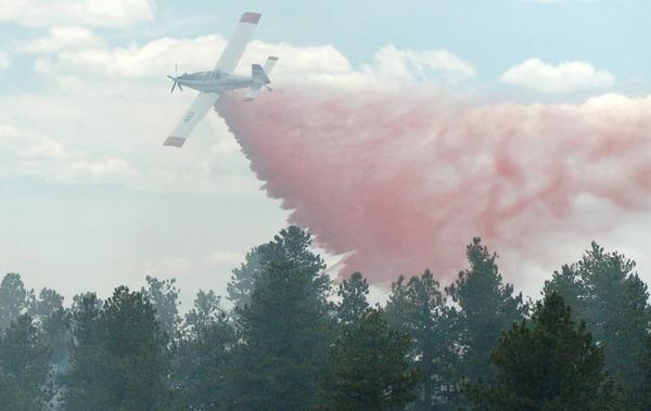
Lightning sparks 800-plus fires in California
Jun 24, 5:23 AM (ET)
By MARCUS WOHLSEN
(AP) Capt. Todd Nelson, of the Sonoma Lake Napa
Fire Dept, chops down trees on a hillsidein Mt.
Madonna...
SAN FRANCISCO (AP) - More than 840 wildfires sparked by an
"unprecedented" lightning storm are burning a swath of
Northern California, alarming the governor and requiring the
help of firefighters from Nevada and Oregon.
Gov. Arnold Schwarzenegger said he was told late Sunday
evening that the state had 520 fires, and he found it "quite
shocking" that by Monday morning the number had risen above
700.
Moments later, a top state fire official standing at
Schwarzenegger's side offered a grim update: The figure was
actually 842 fires, said Del Walters, assistant regional
chief of the California Department of Forestry and Fire
Protection. All but a couple were in the northern part of
the state.
"This is an unprecedented lightning storm in California,
that it lasted as long as it did, 5,000 to 6,000 lightning
strikes," Walters said. "We are finding fires all the time."
Out-of-state assistance, mostly firefighting aircraft,
arrived from Nevada and Oregon after being requested over
the weekend. Schwarzenegger said he had enlisted the help
"because you can never prepare for 500 or 700 or 800 fires
all at the same time."
Part of the reason for the swelling number of wildfires
was that local and state officials were still counting after
fierce thunderstorms Friday night touched off the blazes.
"We didn't get real lucky with this lighting storm,"
Walters said. "It wasn't predicted - which often happens
with these storms that come in off the Pacific, there's no
history of the weather as it approaches the shore - and so
we got hammered."
In Mendocino County alone there were 110 fires, with just
17 contained.
Two of the state's biggest fires had each charred nearly
6 square miles.
(AP) Capt. Todd Nelson, of the Sonoma Lake Napa
Fire Dept, clears trees from a hillside in Mt.
Madonna...
One started in Napa County and quickly moved into Solano
County, and threatened about 250 homes about 40 miles
southwest of Sacramento, said Kevin Colburn, a spokesman for
the California Department of Forestry and Fire Protection.
It was 60 percent contained.
The other was in the Shasta-Trinity National Forest,
about 160 miles north of Sacramento, and threatened about
1,200 homes. The largest of the fires threatened about 1,200
homes, and several youth camps and forced evacuations. The
governor declared a state of emergency in Monterey and
Trinity Counties on Monday.
Along the coast in the Los Padres National Forest, a
2,000-acre wildfire burning south of Big Sur since Saturday
forced the evacuations of 75 homes and businesses, destroyed
one house and threatened hundreds of others.
It also led to an emergency airlift Sunday of eight
endangered California condors. U.S. Coast Guard helicopters
transported the seven juveniles and one adult bird from a
wildlife center to the Monterey Airport.
A second fire in the Los Padres burned more than 57,000
acres and has injured nine firefighters.
In New Mexico, crews dropped 11,500 chemical balls
injected with antifreeze to try to ignite unburned
vegetation and halt a blaze that has charred more than
49,000 acres, largely on grazing allotments on federal land.
Lightening sparked the fire Tuesday in the Lincoln
National Forest about 20 miles southwest of Hope. It was not
threatening any structures.
"The ranchers have already moved a lot of the cattle that
were out there," U.S. Forest Service fire information
officer Deanna Younger said. The grazing areas "will be the
main loss," she said.
|
|
6-23-08 - over 480 fires still burning in CA
Here's a Cal fire update on as many
fires they can get information on (full at link):
Conditions: Summary of Fires by Unit
Siskiyou Unit: 8 fires reporting minor acreage. All fires have been
contained.
Humboldt-Del Norte Unit: 50 fires for more than 200 acres. The Paradise
Fire is Northeast of Shelter Cove and is 500 acres and 5% contained, The
Redcrest Fire is 30 acres, the High Fire is in Humboldt Redwood State
Park with unknown acreage or containment, the Carson Fire is 40 acres
and 50% contained, the Hansen Fire is 2 acres with unknown containment,
the Williams Fire is 25 acres and 50% contained, In the BLM Headwaters
Forest there are three additional small fires buring.
Mendicino Unit: 90 fires have been reported for a total of more than
7,625 acres. The Orr Fire is 200 acres and has evacuations of the Orr
Springs Resort and 50 homes in the area, the Navarro Fire is 1,400 acres
and 5% contained, the Cherry fire is 50 acres and 50% contained, the
Foster Fire is 50 acres and 50% contained, the Table Mtn. Fire is 1,000
acres and 5% contained, the Mallo Pass Fire is 800 acres, and the Juan
Creek fires (2) are at 100 acres each. There are 8 additional fires at
30 acres each.
San Mateo-Santa Cruz Unit: 15 fires have been reported. See
the Whitehurst/Hummingbird Incident link for more information on those
two fires.
Amador-El Dorado Unit:16 fires have been reported. The primary fires of
concern are the Soldier fire located 3 miles northeast of Pollock Pines
and north of Highway 50. The Soldier fire is 35 acres and 35% contained,
the Vineyard Fire is 15 acres with unknown containment, the Bottle Fire
is 22 acres with unknown containment, and the Deer Fire with unknown
acreage and containment (the Deer Fire is a new incident burning within
the Amador-El Dorado Unit).
Nevada-Yuba-Placer Unit: 7 fires reported. The fire of concern is the
Mosquito Fire which is holding at 75 acres.
Butte Unit: 24 fires for a total of more than 1,397 acres. The Rim Fire
has burned 50 acres with unknown containment. Butte County Sheriff's
department is effecting a Precautionary Evacuation Advisory for the Lake
Concow Area for a lighting fire in excess of 100 acres burning off of
Rim Rd. (Also referred to as Andy Mountain Rd.) in the Concow area. The
American Red Cross is setting up an evacuation shelter at the Spring
Valley School at 2771 Pentz Rd. off of Hwy 70. There are four road
closures in effect: Concow Rd. from Yellow Wood Rd. north to the end of
the pavement on Concow Rd, Concow Rd. from Nelson Bar to end of
pavement, Rim Rd. (also known as Andy Mtn. Rd) from Hwy 70 to end of Rim
Rd., Deadwood from Hwy 70 to Concow Rd.
Tehama-Glen Unit: 36 fires for a total of 600 acres.
Shasta-Trinity Unit: 62 fires up to 50 acres in size. Shasta-Trinity
Unit Information (530) 225-2510
Sonoma-Lake-Napa Unit: 5 fires with 4 contained and one (Wild Fire)
burning near Napa West of Fairfield. See the Wild Fire Incident link for
more information.
Lassen-Modoc Unit: 50 fires for a total of 25-40 acres.
Tuolumne-Calavares Unit: 16 fires for a total of 140 acres. Currently
the counties of Tuolumne and Calaveras are experiencing heavy smoke in
low lying areas due to fires caused by heavy lightning activity
yesterday.
Madera-Mariposa-Merced Unit:15 fires reported
The Cunningham Complex (5 fires total) are burning 3,150 acres total,
the Stumpfield Fire is burning 2 acres, the Indian Peak Fire is burning
60 acres, and the Oliver Fire is burning in the Sequoia National Forest.
The Sequoia National Forest has reported 25 fires.
|
|
Calif. firefighters wrestle with dozens of blazes
Over 600 fires were started by dry lightning over the weekend
By DON THOMPSON, Associated Press Writer
SACRAMENTO, Calif. - Thunderstorms sparked as many as 75
wildfires in a wilderness area in far Northern California on
Saturday as officials farther south got close to containing
a blaze that destroyed several homes and forced thousands to
evacuate.
Storms overnight Friday were responsible for the large
number of fires in Shasta-Trinity National Forest, near
Redding. Those fires range in size from less than an acre to
more than 750 acres.
None immediately threatened homes, said Forest Service
spokesman Michael Odle. Teams moved in Saturday on the two
largest fires.
South of
San Francisco, a fire that burned homes and closed a
stretch of highway was 90 percent contained, said officials
of the
California Department of Forestry and Fire Protection.
Officials had expected full containment on Saturday, but
hot weather and stubborn
hot spots
kept fire crews busy. Cal Fire now expects the fire to be
fully contained on Sunday. So far, it had charred 630 acres,
or less than a square mile.
Evacuation orders were lifted Saturday, a day after
roughly 2,000 people fled their homes.
About 650 firefighters were working in hot, dry weather
to contain the blaze, which destroyed as many as 15
buildings, including several homes, and closed scenic
Highway 1 in
Santa Cruz County for hours, fire officials said.
The cause of the fire was still under investigation, Van
Gerwen said.
It was the third major blaze to hit Santa Cruz County in
the past month. A 520-acre blaze charred destroyed 11
buildings in the
Santa Cruz
Mountains, and a fire near Corralitos covered more
than 4,200 acres and destroyed about 100 buildings.
To the south along the coast, firefighters worked against
a nearly 80-square-mile fire in a remote part of the
Los Padres
National Forest in Monterey County. It was about half
contained Saturday.
In New
Mexico, hundreds of firefighters battled blazes in
the northern and southern parts of the state that have
charred more than 100 square miles, including more than
4,000 acres on a ranch owned by
media mogul
Ted Turner.
In a remote southeastern part of the state,
lightning-sparked fires have scorched more than 95 square
miles of mainly desert landscape.
The largest fire, 20 miles southwest of Hope, doubled in
size Friday because of gusty winds and has charred more than
40,000 acres, or about 64 square miles. It was 35 percent
contained. Two other blazes burning about 30 miles west of
Roswell merged Saturday, and have blackened nearly 32 square
miles.
In northern New Mexico, another fire that began as two
blazes burned nearly 7 square miles on
Turner's
Vermejo Park Ranch.
___
Associated Press writer Matt Mygatt in New Mexico
contributed to this report.
U.S. News
Wildfire threatens homes in Northern California
» All news video

AP Photo: San Ramon Valley firefighter Kevin
Rawitzer works on a a burned down house in
Watsonville,...
Firefighters battle blazes
burning in remote areas
By HEATHER CLARK Associated Press Writer
Article Launched: 06/22/2008
Firefighters will burn out vegetation Sunday along a
forest road to stop a 43,000-acre wildfire burning in
southern New Mexico that's destroying grazing
allotments, a U.S. Forest Service fire information
officer said.
Two other lightning-sparked wildfires also have
burned nearly 30,000 acres west of Roswell in southern
New Mexico and the other west of Raton in the northern
part of the state.
The Rocky Fire—started by lightning Tuesday in the
Lincoln National Forest about 20 miles southwest of
Hope—was 35 percent contained Sunday, fire information
officer Deanna Younger said. No structures are
threatened.
The blaze stretches from far western Eddy County
into Otero and Chaves counties and is burning on
Bureau of Land Management, U.S. Forest Service and
private land.
"The game plan today is we've identified forest
roads as boundaries we want to use to control the
fire," Younger said.
Fire crews conducted back burn operations along
Forest Road 67 south of the blaze, which was spreading
through heavier desert vegetation along drainage
ditches, she said.
"The ranchers have already moved a lot of the
cattle that were out there," Younger said. The grazing
areas "will be the main loss."
An air tanker and helicopters were dropping water
and retardant on the fire, she said.
Hotter and drier weather was forecast the next few
days and the wind was picking up Sunday afternoon, she
said.
Also in southern New Mexico, the Bonney Fire, which
started as two separate fires Wednesday, has burned
25,329 acres about 30 miles west of Roswell. The blaze
was 40 percent contained, a news release showed.
The fire was burning on BLM and state land, and no
structures were in danger.
More than 300 fire personnel were helped by rain
that fell on the fire overnight and cooler weather was
in the forecast for Sunday, the release said. Two
water tenders and 17 engines were assigned to the
fire.
Some islands of fuel in the blaze's interior were
still burning, the release said.
More than 300 crew members will check the fire for
hot spots and patrol its perimeter to make sure it
stays within the fire lines.
In northern New Mexico, a Type II Incident
Management Team was brought in for a 4,280-acre
wildfire on the media mogul Ted Turner's Vermejo Park
Ranch nearly 30 miles west of Raton. The West Fork
Fire was 20 percent contained, said fire information
officer Gary Roberts.
About 240 people were assigned to the fire, along
with 13 engines, three helicopters, three bulldozers
and two water tenders.
Lightning strikes slowed the progress of fire crews
Sunday, but they were able to conduct burnout
operations and they were successful in keeping the
fire away from Caliente Canyon, Roberts said.
The lightning-caused fire that broke out Tuesday
has been burning mainly ponderosa pine, pinon and
juniper trees.
In Farmington, a six-block neighborhood was
evacuated for several hours Saturday after a brush
fire burned out of control. Fire officials think
someone was attempting a controlled burn in a nearby
canyon or ditch when the fire grew burned out of
control, Farmington Fire Chief Troy Brown told The
Daily Times.
The residents were allowed back in their homes
Saturday evening after the fire was under control. No
major injuries or damaged structures were reported.
|
2 new wildfires burning in southern
Arizona
Jun.
23, 2008 04:11 PM
Associated Press
TUCSON - Two new wildfires are burning in southern Arizona,
these apparently caused by humans.Coronado National
Forest spokesman Randall Smith says three heavy tankers and one
helicopter are attacking the rapidly growing Nuevo fire. The
fire has charred some 50 acres of grass and brush about a dozen
miles southeast of Arivaca.
A second fire about 1½ miles north of the Nuevo fire has
not been named yet.
|
Calif. wildfires threaten homes, force evacuations
By JORDAN ROBERTSON –
6-13-08
FELTON, Calif. (AP) — Firefighters struggled to gain control
of a series of wildfires burning across Northern California on
Thursday, including a wind-whipped blaze that forced thousands to
leave their homes.
Authorities closed all roads to Paradise, a town of about
30,000 residents about 90 miles north of Sacramento. The blaze,
which started around noon Wednesday, had grown to nearly 13 square
miles and threatened about 1,650 structures.
In the Bonny Doon area, about 10 miles northwest of Santa
Cruz, a wildfire quickly grew to one square mile after it broke
around 3 p.m. Wednesday. It was unclear how many structures had
been damaged, fire officials said.
Evacuations were ordered for 500 residents in the heavily
forested hills. Voluntary evacuations were in place for another
1,000 residents.
Nearly 800 firefighters were battling the blaze, which could
spread to as many as 1,500 acres, Battalion Chief Paul Van Gerwen
said.
Hot temperatures and tinder-dry vegetation prevailed
throughout Northern California, where hundreds of firefighters
were deployed on fire lines from the North Coast wine country to
the Central Valley.
Gov. Arnold Schwarzenegger declared a state of emergency in
Butte County late Wednesday to free up additional firefighting
resources. He declared another one in Santa Cruz County early
Thursday.
Farther south, the state's largest wildfire had charred more
than 16,000 acres in the Los Padres National Forest and was only
16 percent contained.
The fire had spread east to a remote part of the Army's Fort
Hunter Liggett and was moving toward the incident command post
Thursday. But winds were driving the flames away from inhabited
areas of the military base, said Manny Madrigal, a spokesman for
the U.S. Forest Service.
Fort Hunter Liggett spokeswoman Helen Elrod said four
families with homes near the base were evacuated, but the 5,000
military personnel who live there were not in immediate danger.
Wildfires on Tuesday destroyed 32 homes in Stockton, about
50 miles south of Sacramento, and 21 homes in Palermo, about 60
miles north of the state capital.
Meanwhile, a southeastern Colorado wildfire that started on
a military training site doubled in size in one day and was
threatening eight nearby ranches. On Thursday, about 242
firefighters were fighting the fire, which scorched more than 65
square miles of remote and rugged country.
Military officials said Thursday the fire crossed the
Purgatoire River, a natural fire break, and is now burning in
surrounding federal, state and private land.
Officials believe lightning sparked the blaze.
The fire has not been contained at all and low humidity,
high heat and gusting winds have hampered efforts to control the
fire, said Capt. Gregory Dorman of Fort Carson.
In Colorado's Crowley County, prosecutors have decided not
to file criminal charges against a man accused of causing an April
wildfire that killed two volunteer firefighters, destroyed 22
homes and burned 14 square miles of prairie grass.
District Attorney Rod Fouracre said Wednesday that the fire
was an accident.
The Crowley County sheriff's office, however, planned to
issue a summons to Sam Martson, who allegedly violated a county
ordinance by not getting permission to start a prescribed burn on
April 14, Fouracre said. Violations of the ordinance are
punishable by a fine of up to $1,000.
In far eastern North Carolina, smoke from a more than
60-square-mile wildfire was having a serious effect on air quality
hundreds of miles away. The state issued a Code Red notice
forecasting unhealthy air Thursday and Friday for the Triangle
area of Raleigh, Chapel Hill and Durham, as well as the Rocky
Mount area.
Lightning ignited the blaze June 1 on privately owned land
and it has burned in and around the Pocosin Lakes Wildlife Refuge
ever since. Firefighting officials say there is little they can do
to extinguish the wildfire until a massive rainstorm falls.
Associated Press Writers Don Thompson and Samantha Young
in Sacramento, Jason Dearen in San Francisco and Martha Waggoner
in Raleigh, N.C., contributed to this report.
|
Thick dark smoke rises over the valley floor as
firefighters work to contain the Humboldt Fire which has
grown to more than an 8000 acre fire on day two of the
battle Thursday, June 12, 2008 in Paradise, Calif. Hot
temperatures, steady winds and tinder-dry vegetation and
trees have fueled separate blazes from Butte County north of
Sacramento to the Los Padres National Forest in Monterey
County.
(AP Photo/Chico Enterprise-Record, Jason Halley) MANDATORY
CREDIT
By Jason Halley (AP)
Published: 2008-06-13 00:20:05
Location: FELTON, Calif.
Firefighters on Thursday battled a series of fast-growing
wildfires burning across Northern California, including a
wind-whipped blaze that destroyed at least 10 homes and forced
thousands of residents to evacuate.
Authorities closed all roads to Paradise, a town of about
30,000 residents about 90 miles north of Sacramento, and
ordered several thousand Butte County residents to leave their
homes. An evacuation shelter was set up in nearby Chico.
The blaze, which started Wednesday, had grown to nearly 30
square miles and threatened more than 5,000 structures,
according to the California Department of Forestry and Fire
Protection. More than 1,300 firefighters were trying to
contain the blaze, which was only 10 percent contained
Thursday evening.
The fire had spread to the hills of the Butte College
campus, where fire officials had set up their incident command
center, said CDF spokesman Joshpae White.
"The fire is jumping around quite a bit. It's flaring up in
a lot of different areas," White said.
Hot temperatures, steady winds and tinder-dry vegetation
and trees have fueled blazes from Butte County to the Los
Padres National Forest in Monterey County.
In Santa Cruz County, about 900 firefighters were battling
fast-moving wildfire that had grown to 700 acres and destroyed
at least 10 homes in the Bonny Doon community, according to
CDF. It was 25 percent contained Thursday evening.
More than 1,500 residents have been told to evacuate their
homes in the heavily forested hills about 10 miles northwest
of Santa Cruz since the fire broke out Wednesday afternoon.
James Eason, 28, a full-time caretaker for his quadriplegic
dad Jim Eason, 63, said they spent Thursday hanging out with
other evacuees in a supermarket parking lot after spending the
night in a Red Cross shelter in Felton, several miles from the
blaze.
On Wednesday, they evacuated their $1,300-a-month yurt, a
nearly uninsulated wooden-framed structure covered in canvas
where they have lived for the past three months. They weren't
able to check on their home Thursday and planned to spend
another night at the shelter, which was moved to a middle
school in nearby Scotts Valley.
"It's stressful and frustrating, it makes you anxious not
knowing if you're going to have a place to go back to," James
Eason said. "All of a sudden, with the fire, the yurt doesn't
seem so bad. We've started to like it a whole lot."
Gov. Arnold Schwarzenegger declared a state of emergency in
Butte County late Wednesday to free up additional firefighting
resources. He declared another one in Santa Cruz County early
Thursday.
Farther south, another wildfire had charred more than 28
square miles in the Los Padres National Forest and was 40
percent contained.
The fire had spread east to a remote part of the Army's
Fort Hunter Liggett and was moving toward the incident command
post Thursday. But winds were driving the flames away from
inhabited areas of the military base, said Manny Madrigal, a
spokesman for the U.S. Forest Service.
Fort Hunter Liggett spokeswoman Helen Elrod said four
families with homes near the base were evacuated, but the
5,000 military personnel who live there were not in immediate
danger.
Meanwhile, a southeastern Colorado wildfire that started on
a military training site doubled in size in one day and was
threatening eight nearby ranches. On Thursday, about 242
firefighters were fighting the fire, which scorched more than
65 square miles of remote and rugged country.
Military officials said Thursday the fire crossed the
Purgatoire River, a natural fire break, and is now burning in
surrounding federal, state and private land.
Officials believe lightning sparked the blaze.
The fire has not been contained at all and low humidity,
high heat and gusting winds have hampered efforts to control
the fire, said Capt. Gregory Dorman of Fort Carson.
In Colorado's Crowley County, prosecutors have decided not
to file criminal charges against a man accused of causing an
April wildfire that killed two volunteer firefighters,
destroyed 22 homes and burned 14 square miles of prairie
grass.
District Attorney Rod Fouracre said Wednesday that the fire
was an accident.
The Crowley County sheriff's office, however, planned to
issue a summons to Sam Martson, who allegedly violated a
county ordinance by not getting permission to start a
prescribed burn on April 14, Fouracre said. Violations of the
ordinance are punishable by a fine of up to $1,000.
In far eastern North Carolina, smoke from a more than
60-square-mile wildfire was having a serious effect on air
quality hundreds of miles away. The state issued a Code Red
notice forecasting unhealthy air Thursday and Friday for the
Triangle area of Raleigh, Chapel Hill and Durham, as well as
the Rocky Mount area.
Lightning ignited the blaze June 1 on privately owned land
and it has burned in and around the Pocosin Lakes Wildlife
Refuge ever since. Firefighting officials say there is little
they can do to extinguish the wildfire until a massive
rainstorm falls.
Associated Press Writers Don Thompson and Samantha Young in
Sacramento, Jason Dearen in San Francisco and Martha Waggoner
in Raleigh, N.C., contributed to this report.
On the Net: Fire information at
http://www.oes.ca.gov
and
http://cdfdata.fire.ca.gov/incidents/incidents_current
|
|
6-12-08
Calif. wildfires threaten homes, force evacuations
By JORDAN ROBERTSON, Associated Press Writer
FELTON, Calif. - Hundreds of firefighters struggled to
gain control of a series of wildfires burning across
Northern California on Thursday, including a raging
forest fire
that forced hundreds to leave their homes in the
Santa Cruz Mountains.
The blaze in the
Bonny Doon
area about 10 miles northwest of Santa Cruz quickly grew to
700 acres after it broke around 3 p.m. Wednesday, and it was
only 5 percent contained Thursday morning. Mandatory
evacuations were ordered for 500 residents in the heavily
forested hills. Voluntary evacuations were in place for
another 1,000 residents.Nearly 800 firefighters
were battling the blaze, which could spread to as many as
1,500 acres, Battalion Chief Paul Van Gerwen said.
High winds pushed the blaze Wednesday; Thursday's
weather was calmer but temperatures were quickly rising,
with 90-degree weather expected.
"It's getting hotter and drier. We'd like to see the
humidity come up," Van Gerwen said.
More than 50 people had arrived at the evacuation
shelter at
San Lorenzo Valley Middle School in Felton by
Wednesday evening, said Red Cross spokeswoman Lindsay
Segersin.
Dana Price, 51, and her husband had just come home
when they got the mandatory-evacuation call and quickly
packed up their computers, musical instruments and pets —
two dogs, a parakeet and a cat.
"The sad thing is, as you're evacuating, you're
walking around your house thinking, this might be the last
time I see this picture, this might be the last time I'm
doing this," she said.
Hot temperatures and tinder-dry vegetation prevailed
throughout Northern California, where hundreds of
firefighters were deployed on fire lines from the North
Coast wine country to the Central Valley.
In Butte County, several hundred homes were evacuated
ahead of a fast-growing wildfire near Chico, about 90 miles
north of
Sacramento. The blaze, which started around noon
Wednesday, had grown to 6,000 acres and threatened about
1,650 structures. It was only about 10 percent contained
Thursday morning.
"We've had very active winds, low humidity and high
heat. As you know, that's a recipe for disaster," said
Joshpae White, a spokesman for the
California Department of Forestry and Fire Protection.
"It's very remarkable that no structures have been damaged.
I think that's due to the very aggressive firefighting we've
been able to do today."
Gov.
Arnold Schwarzenegger declared a
state of
emergency in Butte County late Wednesday to free up
additional firefighting resources. He declared another one
in Santa Cruz
County early Thursday.
Farther south, the state's largest wildfire had
charred more than 16,000 acres in the
Los Padres
National Forest and was only 16 percent contained.
The fire had spread east to a remote part of the
Army's Fort
Hunter Liggett and was moving toward the incident
command post Thursday. But winds were driving the flames
away from inhabited areas of the
military base,
said Manny Madrigal, a spokesman for the U.S. Forest
Service.
Fort
Hunter Liggett spokeswoman Helen Elrod said four
families with homes near the base were evacuated, but the
5,000 military personnel who live there are not in immediate
danger.
Some training exercises also were moved because of
smoke in the area, and the Army has evacuation plans if the
fire moves closer, Elrod said.
Wildfires on Tuesday destroyed 32 homes in Stockton,
about 50 miles south of
Sacramento,
and 21 homes in Palermo, about 60 miles north of the state
capital. Winds have decreased since then but the extreme
fire danger was expected to last through Thursday.
Meanwhile in southeastern Colorado's Crowley County,
prosecutors have decided not to file criminal charges
against a man accused of causing an April wildfire that
killed two volunteer firefighters, destroyed 22 homes and
burned 14 square miles of prairie grass.
District Attorney Rod Fouracre, who completed the
investigation, said Wednesday that the fire was an accident
and involved no criminal causes.
The
Crowley County sheriff's office, however, planned to
issue a summons to Sam Martson, who allegedly violated a
county ordinance by not getting permission to start a
prescribed burn on April 14, Fouracre said. Violations of
the ordinance are punishable by a fine of up to $1,000.
In far
eastern North Carolina, smoke from a more than
60-square-mile wildfire was having a serious effect on air
quality hundreds of miles away. The state Division of Air
Quality issued a Code Red notice forecasting unhealthy air
Thursday and Friday for the Triangle area of Raleigh, Chapel
Hill and Durham, as well as the Rocky Mount area.
Lightning ignited the blaze June 1 on privately owned
land and it has burned in and around the Pocosin Lakes
Wildlife Refuge ever since. Firefighting officials say there
is little they can do to extinguish the wildfire until a
massive rainstorm falls.
Associated Press Writers Don Thompson and Samantha
Young in Sacramento, Jason Dearen in
San Francisco and Martha Waggoner in Raleigh, N.C.,
contributed to this report.
|
6-11-08Hi all: While watching TV, starting about 11 a.m. yesterday's
fire weather warning came true.
While I watched TV from 11 to 12, a fire that started near I-5 in
the Sacramento area, spread from one house, to surrounding woods, to 5
more homes, threatened a condominium complex, and a mini-mall.
They are still fighting it and the 22 mph winds are driving the
fire eastward - at a really fast pace.
Fast-moving California fire destroys 10 homes
(CNN) --
An aggressive wildfire has burned 10 homes and spread
across 3,000 acres in Northern California, officials
said Thursday.
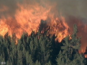
A wildfire in the
Santa Cruz Mountains is causing mandatory
evacuations for neighboring homes.

Flames were threatening at least
50 more homes, the California Department of Forestry and
Fire Protection said.
About 200 children at a 4-H Club
camp were told to take immediate shelter as high winds
fanned the flames in the Santa Cruz mountains.
The wildfire was burning in
rugged terrain in Santa Clara County and moving south
towards Santa Cruz County, south of San Francisco.
About 190 people from the two
counties had been evacuated, officials said.
The Summit Fire began around 5:30
a.m. PT (8:30 a.m. ET) Thursday near Mount Madonna
County Park in Santa Clara County.
Five fixed-wing aircraft and four
helicopters were dropping water on the fire, fanned by
sustained winds of 15 mph to 20 mph with gusts up to 40
mph.
Officials ordered a so-called
Supertanker, a jumbo jet modified to battle fires from
the air.
State fire
officials said at least 149 firefighters but
likely many more were battling the blaze, which is being
fueled by dry brush. Strike teams from across Northern
California were being mobilized.
Aerial video footage from local
TV station helicopters showed structures and vehicles
engulfed.
The Santa Cruz Mountains are
dotted with multimillion-dollar homes.
The Santa Clara and Santa Cruz
sheriffs were handling evacuations.
A Red Cross
evacuation center was established at the Santa Cruz
County Fairgrounds, said Officer Dinah Phillips, a
spokeswoman for the Santa Cruz County Sheriff's Office.
CNN's Augie Martin contributed to
this report.
Wildfires hit homes in
foreclosure capital
Tue Jun 10, 2008 4:56pm
EDT
SAN FRANCISCO
(Reuters) - Four wildfires
fanned by high winds
destroyed seven houses, 20
condominium units and a
small apartment building in
Stockton, California, a city
already reeling from one of
the highest U.S. rates of
mortgage foreclosures.
Two firefighters
suffered minor injuries but
returned to battling the
blaze amid gusting winds and
high temperatures, Stockton
Police spokesman Pete Smith
said.
Smith said authorities
did not yet have a count for
the number of people
displaced by the fires and
have yet to determine how
they started.
Stockton is a city of
nearly 300,000 people and is
about 70 miles east of San
Francisco.
(Reporting by Jim
Christie; Editing by Eric
Walsh)
|
|
FLORIDA Wildfires erupt in Mondex:
Helicopters help combat 200-acre blaze
BY RON BARTLETT
A wildfire that began in the Mondex
area south of Palatka shortly after noon Monday soon
engulfed almost 200 acres by 5 p.m.
Originally two fires, the wind pushed the flames
together and created one big cauldron of smoke and flame
moving west. There was no immediate fear that any
structures were threatened though, firefighters said.
Officials are still looking into the cause.
Observers traveling along State Road 19 could easily see
the smoke above the tree line, and hear the thump of
rotors as two helicopters and a fixed wing spotter
aircraft performed continuous water drops.
Up to 10 tractor crews were on scene, including two from
St. Johns Water Management. The vehicles were
concentrating efforts on the south flank of the fire,
officials said, which was being whipped up by wind.
Some heavy tractors were expected to arrive later in the
evening to improve containment, which stood at 20
percent at 6 p.m.
A command post was set up at the
intersection of State Road 19 and Peniel Road on the
northeast corner of the Mondex.
Firefighters and trucks remained staged there, but were
unable to help because of the lack or access roads and
the intensity of the flames in the interior.
Those gathered were hoping rain predicted for the
evening would dampen the flames, but the storm
apparently went around where it was needed.
“We had a little thunderstorm, but it went off to the
south of us,” said Quin Romay, emergency operations
chief. “No rain so far.”
Mark Fowler, a member of Southwest VFD and the incident
commander, said a lot of work is still to be done before
this fire will be considered safely contained.
“We’ll have crews working out here
into the night until we know the fire won’t jump the
lines,” he said Monday afternoon. “A lot of it is just
going to depend on weather and time - how the weather
works with us or works against us - and the ability of
the (tractors) to get lines put around it so we can get
in there with brush trucks and work that line.”
At the same time as the Mondex erupted Monday afternoon,
a second, smaller fire was reported on the side of the
road off State Road 100 near Florahome.
The blaze flared up in several small sections comprising
less than an acre, but was quickly contained.
“It’s pretty much out,” Romay said. “They’re working on
fully mopping it up.”
Investigators are still looking into the blaze, which
they said was started by an incendiary device.
Officials ask anyone who may have seen a suspicious
vehicle or person on the side of the road to call
329-0379.
rbartlett@palatkadailynews.com
|
|
COLUMBIA, N.C. 6-10-08
(AP) A wildfire that's burned more than 31,000 acres in
and around a North Carolina wildlife refuge is now 40 percent contained.
Eastern North Carolina Wildfire Spreads North And East
Posted by: Sarah Lanse, Web
Producer
The fire destroyed 35,691 acres and is only 40%
contained. It began June 1 from a lightning strike.
Columbia, NC -- The wildfires in eastern
North Carolina spread to the north and east on Monday.
The North Carolina Incident Management Team says the fire
remained moderately active Monday night.
The fire is 40% contained and 20 miles of containment
lines need to be constructed or improved.
Experts say the fire will continue to pose a challenge
for firefighters Tuesday. They expect an increase in wind
speed with gusts reaching 20 miles per hour in the
afternoon.
There are 337 people working to put the fire out. They
come from as far away as
Arizona.
The costs to put out the fire increased to more than $1.1
million.
The fire burned about 35,691 acres. It started from a
lightning strike on June 1.
Source: WFMY News 2
Copyright: 2008 digtriad.com
|
|
Firefighters struggle to gain control of
Santa Cruz wildfire
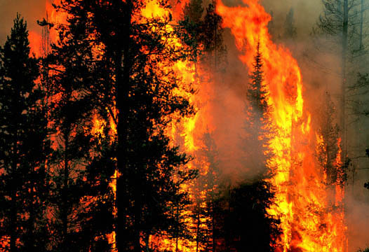
San Francisco - A wind-driven fire burned out of control
in the Santa Cruz mountains Thursday, destroying several
homes and forcing numerous evacuations.The fire
broke out in the early morning and fueled by 60 kilometre
per hour winds quickly grew to over 800 hectares according
to a spokesman for state fire-fighting agency CAL FIRE. The
agency said that five houses had been burnt and at least 50
more were threatened in an area dotted with homes tucked in
the scenic hills. Heavy brush and timber in forests that
have not burned for decades were also contributing to the
fire's ferocity.
Heavy winds were hampering efforts to use aircraft to
fight the fire from the air. Weather forecasts called for
the continuation of the winds through Friday. (dpa)
7:07 p.m. May 24, 2008
GILROY, CA – Firefighters took advantage of
cooler temperatures and calmer winds Saturday as they
struggled to gain control of a wildfire that has burned
centuries-old redwood forests, displaced hundreds of residents
and destroyed at least 20 homes in the Santa Cruz Mountains.
Strong overnight winds up to 45 miles per hour caused the
blaze to grow to more than 3,800 acres and spread from Santa
Cruz County to Santa Clara County early Saturday, according to
the California Department of Forestry and Fire Prevention.
About 50 homes in the small community of Sveadal near Uvas
Canyon County Park were evacuated.
Firefighting efforts were helped by lower temperatures,
lighter winds and higher humidity Saturday, but officials were
concerned that a possible storm could bring lightning and
heavier drafts that could cause the fire to spread, Battalion
Chief Dave Shew said.
The fire was still only about 35 percent contained Saturday
and was expected to grow to 4,000 acres before it's brought
under control over the next week, fire officials said. Four
firefighters have suffered minor injuries.
The fire that started Thursday has destroyed 38 structures
and threatens another 570 buildings in the mountainous region
about 15 miles south of San Jose.
“As long as we don't have this fire contained, then the
homes are still threatened,” Shew said. “We don't consider
this to be anywhere near contained. I wouldn't say we're out
of the woods yet.”
More than 3,000 personnel, seven air tankers, 12
helicopters and 144 fire engines were being deployed to battle
the blaze. Crews were focused on building fire lines to keep
the blaze from getting bigger, Shew said.
Smoke from the wildfire has left a haze over the San
Francisco Bay area that was expected to linger through the
three-day Memorial Day weekend.
Gov. Arnold Schwarzenegger visited the Santa Cruz Mountains
to assess the damage Friday and declared a state of emergency
in Santa Cruz County to allow access to funds for the effort.
On Saturday he declared a state of emergency in Santa Clara
County after the fire jumped over into that county, burning
what fire officials estimated was less than 300 acres there.
About 2,000 residents have been asked or ordered to
evacuate their homes since the fire started, and officials say
it's still not safe for them to return, Shew said.
The cause of the fire is still under investigation.
Summit fire destroys animal sanctuary
The flames from the recent Santa Cruz wildfire ravaged
the Taj Meow Animal Sanctuary in Maymens Flat. An
AP article describes the aftermath: "An unscathed bush
of red roses was all that was left on the lot of one burned
house with a sign in front that read "spoiled dogs live
here."
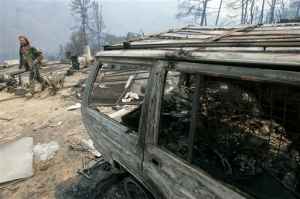
Chris Puett assesses what remains of his animal
sanctuary.
According to the article, of the approximately 120
dogs, cats and birds that owner Chris "Catman" Puett cared
for — mostly abandoned pets — he's lost four dogs and 17
cats. Several cats have returned home ; some with minor
burns. Many animals are still unaccounted for.
"It's burnt to the ground," Puett said of the
three-story building. "There was a pond, and the fish are
all belly up. I'm just trying to round up the survivors."
Meanwhile, Puett is already beginning to buy supplies
and has plans to rebuild. He has left food and water out in
the hopes that more animals will soon return home.
If you would like to help Puett and his animal
sanctuary, Humanity For Cats is accepting donations for
building supplies, food, and other needed items on his
behalf. Please visit
humanityforcats.com. For donation drop offs call
408-997-9332.
Posted By:
Amelia Glynn (Email)
| May 24 2008 at 03:44 PM
|
Wildfire scorches Florida Everglades, prompts
health warnings
MIAMI — A massive and smoky wildfire continues to burn in
the Florida Everglades, prompting health warnings across the
southern part of the state.
Smoke and fog advisories have been issued across South
Florida.
Officials say children, the elderly and people with
breathing problems are being advised to stay indoors.
Officials hope a rise in humidity will slow the spread of
the outbreak, which has so far scorched almost 16,000 hectares of
Everglades National Park.
About 2,000 people from the Everglades Correctional
Institution and the Krome Detention Center were relocated Monday
to other facilities after the flames approached both facilities
|
Florida governor declares wildfire emergency
There are 82 separate wildfires in
Florida today - 5-13-08
5-12-08
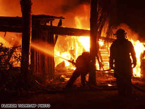
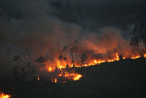
Firefighters work to put out
flames at a house in Malabar,
Florida, early Monday.
Seven to 10
structures, including some homes, have
been destroyed by the largest of the
fires, said Yvonne Martinez of the Palm
Bay Fire Department.
"The fire situation
has been very unpredictable," she said.
"The winds have basically caused what
fires we had yesterday to jump a half a
mile at a time."
Martinez said three
firefighters were injured -- including one
who was airlifted from the scene -- but
she did not know the nature of their
injuries.
Many residents have
been asked to evacuate "because the
situation is so unstable," said Martinez,
adding that "hundreds" were affected.
Children from two
schools in Palm Bay were sent home early
because of the threat of smoke and fire.
Martinez said those schools likely would
be closed Tuesday.
Gov. Crist
activated the National Guard to help
battle the blazes and help with
evacuations.
Authorities believe
the fire burning near Malabar and Palm Bay
in Brevard County may have been started by
arsonists, said Jim Eads of the Florida
Division of Forestry.
Martinez said a
$10,000 reward has been offered for
information leading to the arrest and
conviction of anyone who may have set the
fire.
Two other fires in
Brevard County burned about 200 acres in
Cocoa, but were almost completely
contained, authorities said.
A separate blaze in
Volusia County led to the evacuation of
about 590 homes near LPGA Boulevard, and
people in another 85 homes are on standby
to evacuate, according to Fred Godawa of
the Daytona Beach Fire Department.
That fire has
burned through 600 to 1,000 acres and is
about 20 percent contained, Godawa said
Dense smoke forced
the closure of several roads, including
I-95 for a seven-mile stretch in Brevard
County near Malabar. The interstate was
also closed for a short time Monday
morning near Cocoa.
"I got knots in my
stomach," Cocoa resident Pam Hales told
WKMG on Sunday. "My daughter cooked
Mother's Day dinner and we have not been
able to eat it. We tried to eat but nobody
could eat."
"You wonder if
everything you've worked all of your life
and built and if you are still going to
have it," resident Tim Hales told the
station.
A man who lived
close to a house that was destroyed in
Malabar told CNN affiliate WESH the
homeowners were out of town.
"It's pretty
devastating, especially when it's a friend
of yours, when it's a neighbor caught in
something like this," he told the station.
On Monday morning,
officials called in 100 additional
firefighters to battle the
blazes in Brevard County, said Pamela
Keil with the Florida Division of
Emergency Management.
High winds in the
area threatened to aid the fires, said
Timber Weller of the Division of Forestry.
"Weather conditions are making the
situation ripe for an extreme fire," he
said.
CNN's Nick Valencia contributed to this
report. CNN's Patty Lane and Janet
DiGiacomo contributed to this report
All About
Wildfires •
Florida
(CNN) --
Florida Gov. Charlie Crist declared a state of emergency
Monday as wildfires fed by drought conditions threatened homes
and businesses and forced the closing of part of Interstate 95
in Brevard County.
|
|
Firefighters battle 2,100-acre wildfire near Kitt Peak, AZ
Associated Press - May 12, 2008 2:14 PM ET
TUCSON, Ariz. (AP) - Fire crews are moving toward
containing a wildfire that has charred more than 2,100
acres in southern Arizona's Baboquivari Mountains.
Fire spokesman Bill Watt says the Solano fire was
40% contained as of early Monday. No structures are
threatened and no injuries have been reported.
The fire was started by people Friday morning about
seven miles south of Kitt Peak on the Tohono O'odham
Indian Reservation.
Officials say it is burning mostly on Bureau of
Land Management land near the Baboquivari Wilderness
Area.
About 290 people, including six Hot Shot crews, are
working to ensure containment lines will hold up
against high winds forecast for Monday.
Copyright 2008 The
Associated Press. All rights reserved.
|
|
Wildfire in central
New Mexico fully contained
09:12 PM CDT on Sunday, May 11, 2008
Associated Press
MANZANO, N.M. – A wildfire that burned 59
homes and more than 21 square miles in central New
Mexico's Manzano Mountains was fully contained
Sunday.
Fire information officer Linda Kearns said
about 218 people will remain at the fire to watch
isolated hot spots and islands of fuel in the
interior.
Fire information officer Jim Payne said fire
crews flew over the burned area Sunday, checking the
lines. Firefighters on the ground also continued
cleaning up, looking for hot spots and reseeding
burned areas.
"There's been smoke showing far into the
interior of the fire and of course we're remaining
vigilant to make sure there's no spotting over the
lines. The fire is very inactive right now," Payne
said.
Firefighters had thought the blaze was nearing
containment late last month when winds gusting up to
60 mph sent debris flying over the containment lines
and grounded aircraft who could have dropped water
and retardant from the air. The blaze then burned 50
homes and forced hundreds of people to evacuate.
This time, fire crews are taking no chances.
"We are staying for a few more days. We are
not going to transition out just yet," Payne said.
Fighting the fire, which started April 15, has
cost more than $10.7 million.
|
|
20-acre wildfire burning in northern Arizona
Associated Press - May 12, 2008 7:24 PM ET
FLAGSTAFF, Ariz. (AP) - Firefighters hope to
contain a 20-acre wildfire by Monday night that is
burning less than a half-mile from a housing community
northeast of Flagstaff.
Coconino National Forest spokeswoman Karen Malis-Clark
said Monday there is no immediate threat to the homes
in Doney Park.
She added that the 50-person crew is making good
progress toward containing the Elden Springs fire,
which is just west of U.S. Highway 89.
Authorities have closed a local road, preventing
some residents from getting to their homes.
The fire was first reported Monday morning. The
cause is still under investigation.
Copyright 2008 The
Associated Press. All rights reserved.
|
Wildfire Meant Close Calls For Homes
Updated:
May 11, 2008 05:05 PM PST By SCOTT HARRISON
s.harrison@krdo.com
EL PASO COUNTY - Losing a home to a fire is
difficult for most of us to comprehend--but if anyone
can relate, it's the many homeowners who came
dangerously close to losing their homes and other
property in Saturday's wildfire in El Paso County.
"We'll all remember where we were during the
Mother's Day weekend fire of 2008," remarked Doug
Schmillen. The flames came to within 25 feet of his
home on Peyton Highway near Ellicott, kept at bay by a
firefighter's hose. Schmillen was at work in Black
Forest when his son phoned him about the fire. "It
was pretty surprising. He asked me what I wanted out
of the house. At the time, I didn't know what was
going on."
Doug's wife, Debra, was at home with her son when
the wildfire began to spread. "We'd just got done
having lunch, and I went over to the kitchen sink, and
looked out the kitchen window and saw the fire." The
two left briefly to see which direction the flames
were heading, only to receive an immediate evacuation
order from authorities. Debra and her son grabbed
family photos, important documents and their cat
before leaving. They watched the fire advance from a
short distance away.
"It was a great feeling when the smoke cleared, and
I could see the house still standing," Doug recalls.
He says he believed his home and workshop would not be
damaged because they are made of stucco and tin.
Still, he confesses, "My mind was telling me
everything was okay, but my stomach was turning in
knots. I wish I was there doing something. But when
I saw it going across the prairie in leaps and bounds,
it would have been crazy to stick around."
The Schmillens praised firefighters for their work
in helping to save their home. "We saw there were two
of them," says Debra. "One was in the driveway, the
other one was back here, driving around and putting
out fires. There were people you could see walking
around. They did a very good job. I'm impressed.
It's a very good Mother's Day present."
|
|
Crews battle northern Nevada wildfire
10:00 a.m. May 9, 2008
DAYTON, Nev. – Firefighters have reported progress in
their battle against a 470-acre wildfire that's burning in sage grouse
habitat in the northern end of the Pine Nut Mountains near Dayton.
Kat Gonzales of the Sierra Front Interagency Dispatch Center in
Minden said the fire around Rawe Peak, near the ghost town of Como,
was 40 percent contained Friday morning.
No homes were threatened, and no injuries were reported.
Gonzales said Friday's plans called for a heavy attack by
air tankers and helicopters on the blaze, about 17 miles
east of Carson City.
Crews are facing steep, rugged terrain as the fire is
being fueled by a heavy growth of sagebrush, and pinion and
juniper trees, she said.
The fire was human caused and remains under
investigation, authorities said.
Wildfires, development and industry have steadily cut
into the habitat of sage grouse, a bird about the size of a
chicken that is found on sagebrush plains and high desert
from Colorado to California and north into southern Canada.
The federal government is under a judge's order to
reconsider an earlier decision against listing the sage
grouse as endangered, and the fate of grazing, mining and
energy soon could be at least partially tied to that of the
bird.
|
|
Wildfire contained; 1 home burned, 50 evacuated - El
Paso, TX
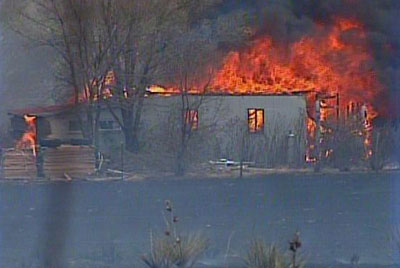 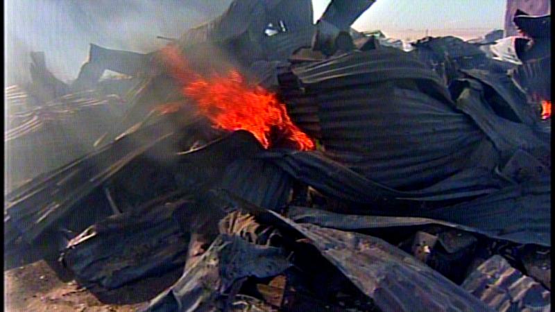 written by:
Colleen Locke , Producer
written by:
Colleen Locke , Producer
reported by:
Kyle Clark , Reporter
EL PASO COUNTY –
The El Paso County Sheriff's Office says a
wildfire that burned around 9,000 acres near the Schriever Air
Force Base Saturday is contained.
The fire is between 85 and 90 percent under control.
Firefighters remained on the scene Saturday night putting out
hot spots.
According to the El Paso County Sheriff's Office, one home
burned. An unknown number of other structures also burned.
"We lost three buildings and these cars and this friend's motor
home," homeowner Richard Baughman told 9NEWS.
Around 50 people were evacuated, according to the sheriff's
office. Earlier, firefighters with the Falcon Fire Protection
District had said the number of those evacuated was "several
hundred."
No one was hurt.
"The wind gusts were very, very strong and consistent. They did
change directions on us a couple of times," said Lt. Lari Sevene
with the El Paso County Sheriff's Office. "They would think they
had it under control had it stopped at a certain road and before
the fire crews could get down and get in front of it would jump
across the road and continue to burn."
"They got a lot of people spread out, but how do you go in five
different directions at the same time?" said homeowner Tim
Melson.
The fire, which started at Highway 94 and Page Road, had reached
Peyton Highway and Enoch Road by 2 p.m. Saturday.
At 4:30 p.m., Peyton Highway was closed from Highway 94 to
Drennan Road. Enoch Road was closed from Highway 94 to Peyton
Highway, according to the Falcon Fire Protection District.
The cause of the fire is unknown, although there is a
possibility it was started by a cigarette thrown from a car.
(Copyright KUSA*TV, All Rights Reserved
|
|
764-acre wildfire burns in San Jacinto Mountains
2:56 p.m. April 30, 2008
MOUNTAIN CENTER – Southern California's early
wildfire season continued Wednesday as a 764-acre blaze burned
uncontained in the San Jacinto Wilderness of the San Bernardino
National Forest.
The fire burned eastward in heavy brush high on remote Apache Peak
near Pacific Crest Trail, about six miles east of the Riverside County
community of Mountain Center, according to the U.S. Forest Service.
Only hand crews were fighting the fire, which erupted
Tuesday 100 miles southeast of Los Angeles.
Meanwhile, cool, moist weather helped firefighters mop up
remnants of a 584-acre wildfire that last weekend threatened
the city of Sierra Madre in the foothills of the San Gabriel
Mountains 15 miles northeast of Los Angeles.
Relative humidity reached 100 percent overnight, aiding
more than 920 firefighters still working the scene.
The burn area was 88 percent contained and officials
hoped for full containment by Friday or earlier, said
Angeles National Forest fire information officer Stephanie
Vela.
The Sierra Madre blaze erupted Saturday during a brief
siege of record-setting heat. The cause remained under
investigation.
|
Wildfire Spreading, Threatening Homes
Wednesday , April 30, 2008 Posted: 07:07 PM
SanIsidroFire, Texas
UPDATE: People being evacuated near
Highway 281 along Encino.
BROOKS COUNTY - Homes are being threatened as a major
grassfire continues to burn north of Hidalgo County, TX.
NEWSCHANNEL 5 is getting word that the fire could be
at least three miles long and three miles wide. The blaze
was first reported around 3:30 p.m.
It initially started near FM 755, about 10 miles north
of San Isidro. Now the flames have spread to three different
ranches and are threatening three to four homes.
Hidalgo County Emergency Manager Tony Pena says they
haven't even started to make a dent in the fire.
Although the wildfire isn't threatening Hidalgo
County, many of the county's resources are being used to
fight the fire. Firefighters from several Valley cities were
called in.
Fire crews also responded to a second grass fire on
North Highway 281 and FM 755 near Rachal. That's located
just north of the Linn-San Manuel area.
Since several fire departments were responding to the
first fire, firefighters from Falfurrias responded to the
second fire. We're told U.S. Fish and Wildlife game wardens
are also assisting.
There's no word on yet how the second blaze began or
how much land has burned.
|
Grand Canyon wildfire 60 percent-contained
Thu May 1, 2008
PHOENIX (Reuters) - A wildfire burning out of control toward the
Grand Canyon was largely contained late on Wednesday, forest service
officials said.
Fire crews with trucks, bulldozers and aircraft achieved "60
percent containment" of the so-called X Fire that blazed a trail
through the Kaibab National Forest in northern Arizona toward the
Grand Canyon, the forest service said.
The blaze, which broke out on Tuesday, had burned 2,030 acres
(820 hectares) of pine forest, grassland and sage brush, fanned by
strong winds and dry conditions.
Firefighters contained the fire more than a mile (1.6 km)
south of the Grand Canyon National Park boundary and were preparing
to begin "mopping up" on Thursday, the forest service said in a news
release.
The park remained open throughout the day, although a
campground was shut indefinitely, and several forest roads and a
trail were closed temporarily.
The Grand Canyon is one of the biggest tourist draws in the
United States, and attracts 5 million visitors a year.
© Thomson Reuters 2008
All rights reserved
|
update 4-30-08
Fire Consumes 2,000 Acres South of Reno
By Andrew
Duncan
14:20, April 30th 2008
A wind-driven fire
consumed an estimated 2,000 acres, or more than 3 square miles,
about 10 miles south of Reno, caused the
evacuation of a school, threatened homes, forced a major highway to
close. Firefighters had to contend with gale-force winds while
battling the huge blaze that raced along the edge of valley south of Reno, the Associated Press reported.
More than 350 firefighters
participated in the mission and about a dozen needed treatment after
the winds gusting up to 68 mph blew dirt, ash and cinders in their
eyes, Reno Fire Department spokesman Steve Frady said Tuesday night.
Five firefighters were taken to hospital.
The Skinner Fire started
just before 2 p.m. and was pushed north toward Pleasant Valley and Andrew Lane before
moving east away from homes, Steve Frady said.
"It was gusting, really
pushing hard. We were getting dust in our eyes continuously," Frady
was quoted diminished a little bit, so that may help us out."
There were no reports of
any other injuries or damage to homes although the blaze surrounded
three homes in the hills between Washoe Valley and Pleasant Valley. Some vehicles on Willbuck Road may
have been burned, Frady said. Students at Pleasant Valley Elementary School were evacuated on buses to Galena High School
on Reno's south side.
The fire has not destroyed visitor facilities at
Grand Canyon
National Park and was not threatening
structures or the community of Tusayan, south of the Grand Canyon,
said Jacqueline Denk, a spokeswoman for the
Kaibab National Forest according to the AP.
High winds fan wildfire near Reno, Nevada; California
fire quieter
By SCOTT SONNER –
4-29-08
RENO, Nev. (AP) — A wildfire fanned by winds gusting up to 68 mph
raced along the edge of a valley south of Reno on Tuesday, threatening
homes and spreading thick smoke over the area.
About 300 firefighters were on the line, battling stiff winds and
thick smoke that could be seen 30 miles away. The fire had burned about
1,200 acres and was growing quickly. The National Weather Service reported
42 mph sustained winds with higher gusts.
"The winds have been horrible" but were diminishing by late evening,
Reno fire spokesman Steve Frady told The Associated Press from the scene.
Some homes were threatened but there were no immediate reports any
had burned in the sparsely populated area on the north edge of Washoe
Valley about 10 miles from Reno.
"The crews are having a hard time holding onto even their gear.
Their hard hats are blowing around. Sage brush is blowing into them. It's
pretty intense up there," Forest Service spokesman Franklin Pemberton
said.
Students at Pleasant Valley Elementary School were bused to another
school because of the conditions. The suspected cause of the fire was
power lines downed by the high winds.
"The whole valley is full of smoke, the winds are terrible," said
David Jones, who lives near the fire and was helping neighbors load up
horses to be hauled away in trailers. "The hills are full of cheat grass
so we're all worried about that."
Dozens of fire engines surrounded homes in the area. Three to four
homes were potentially in the path of the fire as it burned to the
north-northeast.
"So far, it's skirted those homes," Frady said.
In Arizona, crews were battling a 2,000-acre wildfire inside the
Kaibab National Forest near the Grand Canyon. Strong winds were driving
the fire, said Jacqueline Denk, a spokeswoman for the Kaibab National
Forest.
"The bad news is we are expecting very high winds and difficult
conditions tomorrow (Wednesday) as well," Denk said.
The fire has not destroyed any buildings or was immediately
threatening any structures or the community of Tusayan, south of the Grand
Canyon, Denk said.
A smoke column from the fire was visible from the South Rim of Grand
Canyon National Park and Tusayan. Authorities believe the X Fire was
human-caused. A fire investigator was sent to the scene to determine the
specific cause.
In Southern California, firefighters extended containment lines and
stamped out hotspots as calmer weather conditions prevailed at a 538-acre
wildfire that earlier threatened homes.
About 1,000 people were told they could return to homes they fled
since the fire started Saturday. Public schools also reopened in Sierra
Madre, about 15 miles northeast of Los Angeles.
Containment was estimated at 57 percent, and about 1,000
firefighters were busy extending the line around the burn area and dousing
burning stumps and hot ash.
"There's no major flames or smoke showing on the fire," said Robert
Brady, fire information officer with the U.S. Forest Service. "No smoke
showing means that a lot of the heat is gone and that's good."
Weather was cooler, winds were light and the humidity was higher
Tuesday than in recent days. Highs were in the 70s rather than the 90s
that firefighters had faced earlier.
At the same time, Reno is undergoing swarms of earthquakes
http://www.greatdreams.com/reno-quake-2008.htm
North Lde Mountain Hand Crew
and an engine from the North Lake Tahoe Fire Protection District are
responding to a wildfire in the Washoe Valley.
Steve Frady, spokesman for the Reno Fire Department, confirmed a brush
fire started near Eastlake Boulevard in Washoe Valley.
Chief Mike Brown of the NLTFPD said the hand crew, an engine and
overhead were headed down to respond to the wildland fire.
Brown said the crew is fighting the fire on both the East and West
sides of U.S. Route 395 between the Pleasant and Washoe Valleys.
Brown said his firefighters are reporting 40-50 m.p.h winds.
|
SW Idaho crews battle season's first
wildfire
The Associated Press
Article Last Updated: 04/29/2008
Posted: 6:29 AM- BOISE, Idaho -
Fire crews in southwest Idaho are off to an early start in the
2008 wildfire season.
Crews from the Bureau of Land Management on Sunday battled
a 30-acre grass and brush fire four miles south of the Swan
Falls dam.
Investigators say the blaze started from a campfire.
Carrie Bilbao, a BLM fire investigator, says despite a
steady diet of winter snow, many rangeland areas are currently
very dry. Light spring rains and dead vegetation from last
year have created dry conditions on lands the agency manages
across southwest Idaho.
Agency officials are urging campers to use caution and
care with campfires under the current conditions.
|
Wildfire ignites near Idyllwild, visible in Palm
Springs
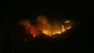
By Colin Atagi • The Desert
Sun • April 29, 2008
Firefighters who are hiking to a blaze burning
near Idyllwild this evening are less than a mile
from the scene as of 9:50 p.m., U.S. Forest
The agency reported about 8 p.m. that the fire
in the San Jacinto Mountains burned about 1.5
acres.
Although it's likely the fire has grown since
then, its actual size will not be known until
firefighters arrive at the scene and survey the
area, according to officials.
Smoke and flames from the wildfire are visible
across the Coachella Valley tonight.
The fire can be seen at least as far east as La
Quinta and was even more visible at the base of
the San Jacinto Mountains.
“It’s coming down the ridge over on to our side of
the mountain ... very high up ... but we can see
it and certainly smell it from Andreas Hills,”
said Marie Weigel in an e-mail to The Desert Sun.
She is wife of Palm Springs City Councilman Lee
Weigel, who lives in the Indian Canyons area.
The fire was reported about 4:35 p.m., U.S. Forest
Service spokeswoman Valerie Baca said.
Firefighters are hiking 3.5 miles, starting at
Keenwild Station, on the Pacific Crest Trail to
reach the blaze in the Apache Peak area, she said.
They are expected to remain at the scene all night
and continue their battle Wednesday morning.
Temperatures are expected to be in the low 50s
this morning with 11 mph winds in the Idyllwild
area, according to AccuWeather.
Winds blew about 26 mph in 60-degree temperatures
this evening.
A helicopter and air tanker were used to battle
the fire this afternoon but had to be grounded.
“The weather caused some problems for us,” Baca
said.
Officials expect to launch the aircraft again
Wednesday morning, Baca said.
As of 9:15 p.m., Cal Fire crews have not been
called in to assist with the fire, officials there
said.
Visit mydesert.com for more updates on the fire
throughout the day.
|
Battle against stubborn California wildfire enters 4th
day
4-29-08
SIERRA MADRE, Calif. (AP) — Lower temperatures and increased
manpower on Tuesday allowed firefighters to tame much of a three-day-old
wildfire that had gotten perilously close to dozens of homes and led
hundreds of people to evacuate.
The fire in the rugged San Gabriel Mountains northeast of Los
Angeles was 57 percent contained early Tuesday after covering 538 acres,
or less than a square mile.
Most of the more than 1,000 people evacuated from their homes had
been allowed to return and public schools in the community of about 11,000
residents were reopening Tuesday. No homes have been lost in Sierra Madre,
15 miles northeast of Los Angeles.
A cool front moved into the area after three days of temperatures in
the 90s. Tuesday's highs were expected to stay in the 70s. Humidity had
increased and there was almost no wind Tuesday morning.
Flames moved close to homes early Monday but firefighters stood
their ground and turned the flames back.
More than 1,050 firefighters were expected to be on fire lines
Tuesday, up from 700 on Monday, said Ed Gililland of the U.S. Forest
Service.
Four firefighters suffered minor injuries, authorities said. One
small outbuilding was destroyed.
The cause of the blaze, which broke Saturday, remained under
investigation.
Elsewhere, crews in central New Mexico had declared 95 percent
containment on a blaze that has burned nine weekend or summer homes and
several outbuildings. The fire blackened 4,832 acres, or 7.5 square miles.
Officials at one point urged a voluntary evacuation of the communities of
Manzano and Torreon, but few people heeded the call.
|
|
California wildfire rages, 1,000 people evacuated
|
|
|
|
Wildfire Scorches
1,100 Acres In Page 20 Structures Threatened But Unharmed By Blaze
By
Pete DeLea
4-19-08
STANLEY - In a small, gravel lot in
downtown Stanley, residents Sam Holt and
Mike Uram peered at a massive wildfire that
interrupted their usual scenic view of the
mountain landscape. A controlled burn by a
Lucas Hollow Road resident burned out of
control Thursday night, and by Friday
morning the fire had spread to 1,100 acres,
fire officials said. Firefighters finally
got the upper hand in the afternoon by
creating a back-burn, which eventually
knocked the blaze out.
"There was white smoke just rolling from
the bottom. It was unbelievable," said Holt,
who stood there and watched the fire for
about 45 minutes Friday afternoon. "It just
gradually came together."
Uram said he woke up to see a ring of
smoke in the distance and knew the fire must
have been large.
"Things happen, but you don't want to see
this," said Uram, who brought his camera
with him to take photos of the blaze, which
had caught the attention of many of
Stanley's residents.
One-Acre Fire Quickly Spread
At about 6:30 p.m. Thursday, the Stanley
Volunteer Fire Department responded to a
call for a small brush fire.
Chief Terry Pettit said firefighters
began to attack the fire but it spread too
quickly, consuming private land between
Lucas Hollow and Keystone roads, about a
mile outside of Shenandoah National Park.
"It was too dangerous to go after,"
Pettit said.
After the fire department realized how
severe the fire was, they called in the
Virginia Department of Forestry, which took
over control of the scene.
Steve Moyer, a forest technician for the
department, said he thought his crews would
be able to get control of the fire quickly
because there were roads on either side of
the blaze.
But, Moyer said, he and his crews would
soon realize that wouldn't be the case.
"If we could have found a place to put
lines down we would have been fine," Moyer
said. "But when you have 50-, 60-, 70-foot
flames shooting up, you can't put people in
front of that. We had to back off."
He said several tractor-trailers with
bulldozers were called in to the scene so
firefighters could fight the blaze with
land-moving equipment.
Blaze Threatened 20 Homes
Meanwhile, the blaze continued to grow
and began to threaten homes, so Stanley
firefighters started protecting the
structures.
"We have been protecting about 20
structures," Pettit said.
Helping Stanley were crews from Luray,
about a dozen firefighters from the Forestry
Department and members of the Augusta Hot
Shots, a wilderness firefighting team based
in Augusta Springs. In total, Pettit said
about 50 firefighters helped battle the
fire.
"The fire company's job is to protect the
structures while the department of forestry
puts out the fire."
Anthony Owen Gochenoul, 18, lived at one
of the homes on Keystone Road. Only the road
separated his house from flames.
"It's scary, but I didn't think it was
going to cross the road," he said, adding
that he's seen larger fires in the area.
"Last time, it was blowing toward here a lot
more."
Pettit said the fire department was on
the scene from Thursday evening until about
1:30 a.m. Friday. Stanley firefighters
returned about 6 a.m. after a flare-up put
more homes in danger.
Pettit said the fire department's job was
to spray down the areas around the homes,
and, depending on the type of roof, sprayed
the houses with foam.
He said local firefighters with the
assistance of the forestry department
created back-burns away from the buildings.
"This isn't our first fire this large,"
said Pettit, who added there have been four
or five fires this size in roughly the same
location in the last decade. "We do have
experience behind us that helps."
Firefighters Gain Control
At about 1 p.m. the fire and back-burn
collided and the blaze was extinguished,
except for minor hot spots in the wooded
area.
No homes were damaged.
Moyer said the person who started the
fire could be charged with a criminal
violation, but most likely will be held
responsible for the cost of fighting the
fire. No cost estimate was available Friday.
Holt said he was glad to see the fire
dwindle.
"If there was a heavy breeze, it could
have spread a lot," said Holt. "Good thing
there was no real intense wind today."
Contact Pete DeLea at 574-6278 or
pdelea@dnronline.com
|
| Hundreds battling huge N.M. wildfire
4-25-08
MANZANO, N.M. (AP) — Firefighters have been able to make some
progress against a blaze that has charred an estimated 4,875
acres in the Manzano Mountains.
"So far they've been able to hold the
line, but there's still a lot of heat on the ground," said fire
information officer Deanna Younger.
There are 506 people assigned to the
blaze, along with four air tankers, five helicopters and more
than a dozen engines. The cost of fighting the blaze is $4.5
million so far.
The fire was 53% contained late Thursday,
and crews planned to continue concentrating on the northern and
southern sides Friday, said fire information officer Dan
Bastion. He said more wind was forecast for Friday.
Ground crews were helped Thursday by
water-dropping helicopters. The air tankers that have been
instrumental in the fight over the last couple of days were
grounded by noon because of strong winds, Younger said.
The fire burned nine homes, nine
outbuildings and two recreational vehicles. It has been burning
in mainly oak brush and pinon, juniper and ponderosa pine trees.
Investigators believe the fire was human
caused.
Cibola National Forest officials said the
Sandia and Mountainair ranger districts will be under increased
fire restrictions beginning Monday because of the severe dry
conditions in the area. Campfires and coal and wood stoves will
be prohibited.
Another fire has burned nearly 25,000
acres of desert grass and shrubs on mostly private ranch land on
the eastern portion of New Mexico's bootheel.
"It's just kind of sitting out there by
itself, not really bothering anybody," said Dan Ware, state
Forestry Division spokesman.
The Center Peak Fire started April 14,
probably from an abandoned campfire south of Animas, he said. No
structures are threatened.
The Forestry Division is monitoring the
fire by air, and ranch personnel are monitoring it on the
ground, Ware said.
Copyright 2008 The Associated Press. All rights reserved
N.M. crews fighting wildfire face 2nd day of windy
weather
4 -21-08
MANZANO, N.M. (AP) — Firefighters braced for windy
weather Monday as they battled a wildfire that had
dashed between two towns in central New Mexico.
More crews poured into the area during the night
and additional air tankers were ordered, officials said.
The blaze was 30 percent contained Monday after
charring nearly six square miles, or 3,745 acres,
between Manzano and Torreon, fighters reported.
Voluntary evacuations remained in effect Monday
for the two towns southeast of Albuquerque, although few
people paid any heed, said Deanna Younger, lead fire
information officer with the New Mexico Type II Incident
Management Team.
"We can't force people to leave their homes," she
said.
The National Weather Service said a red flag
warning remained in effect Monday for parts of the
state, with low humidity and wind up to 30 mph possible
in the afternoon with gusts up to 50 mph.
Crews used bulldozers during the night to cut fire
breaks around the blaze.
"We still have some areas that are unstable,"
Younger said. "We will have red flag (windy) conditions
again today ... and the danger factor is still there.
It's a critical day as far as fire suppression goes."
On Sunday, wind-driven flames jumped a fire line
and crossed the Cibola National Forest boundary onto
private land, Younger said.
Officials urged people to leave about 130 homes
around Manzano and Torreon on Sunday, but few left.
"They were standing there right in the middle of
town watching it go past the town," Younger said.
There was no confirmation whether any buildings
had burned because crews could not get into some areas
to check, Younger said.
Firefighters completely contained a fire Wednesday
near Weed, in southern New Mexico, that burned about 640
acres, fire information officer Margo Whitt said.
|
N. Michigan wildfire burns 6 homes, forces I-75 closed
4-24-08
GRAYLING, Mich. (AP) — Authorities say a wildfire in northern
Michigan has burned six homes and forced part of Interstate 75 to
close.
Up to 20 homes have been evacuated. No injuries have been
reported.
Authorities say a patrolling U.S. Forest Service helicopter
spotted the fire after it started Thursday near Grayling about 175
miles north of Detroit.
Brisk winds, dry, warm conditions and abundant jack pine trees
aided the fire's spread across 1,100 acres, or nearly 2 square
miles.
But Michigan Department of Natural Resources spokeswoman Mary
Detloff says the flames have slowed as it nears a wetland and golf
course.
Federal, state and local firefighters have the blaze about 30
percent contained. The cause wasn't known.
~~~~~~~~~~~~
Grayling-area wildfire under control
Friday, April 25, 2008 | 5:58
By Kristen Abraham
GRAYLING
(WJRT) -- (04/25/08)--More than 1,000 acres in Northern
Michigan were on fire Thursday into Friday. The wildfire
forced the evacuation of 50 homes on Thursday just south of
Grayling in Crawford County.
That's 100 miles north of Saginaw. The Department of
Natural Resources say the forest fire blew across I-75.
The DNR says the fire damaged six homes. Friday
afternoon, it was mostly contained, but was still burning.
Officials say the fire started near the interstate,
sparked by several small fires around a railroad line
Overnight drizzle helped fire crews get a hold of the 1,100
acres smoldering Some of the 50 residents evacuated were back
home Friday.The forest fire forced the closure of
I-75 Thursday. It re-opened around midnight. A DNR transport
vehicle was destroyed. No one has been hurt.
Brisk winds and dry, warm conditions and abundant jack
pine trees helped the fire spread.
A U.S. Forest Service helicopter spotted the fire.
Officials say Northern Michigan is considered a prime location
for wildfires because of dry weather and high winds.
This wildfire may be the tip of the ice berg for what's
to come.
(Copyright ©2008 WJRT-TV/DT. All Rights Reserved.)
|
|
Wildfire engulfs 27 acres in New Hampshire
4-24-08
(NECN) - A large wildfire was burning on the slopes of
Mount Major in Alton, New Hampshire Friday afternoon.
Firefighters from southern and central New Hampshire
have been battling the blaze since late Thursday. By noon
Friday it had spread across 27 acres, and was still
burning out of control.
Helicopters air-lifted water from nearby Lake
Winnipesaukee to dump on the fire.
Mount Major is popular hiking mountain, boasting
spectacular views of the Lake. Trails remain closed while
the fire is burning.
|
|
Pilot issued maydays before crashing at wildfire
Reported by: ABC15.com staff
Last Update: 4/23 6:34 pm
posted by:
Jeffrey Wolf , Web Producer
created: 4/24/2008 4:59:33 PM
FORT CARSON – The pilot killed when his plane
crashed during a wildfire at Fort Carson called in
a series of maydays and said, "I'm going down,"
just seconds after dropping retardant on the fire.
That is according to a preliminary
investigation report by the NTSB into the crash
that killed 42-year-old Gert Marais of Montana on
April 15.
Marais was based in Sterling.
The report does not pinpoint the cause of the
crash. The NTSB says that process could take
several months.
The fire was contained on Wednesday after it
burned about 14 square miles at a remote part of
Fort Carson
(Copyright KUSA*TV. All rights reserved.)
NTSB Issues Preliminary Report On CO Air
Tanker Downing
Fri, 25 Apr '08
Says Pilot Made Series Of Mayday Calls
Before Impact
It's sad enough when we must report
on the loss of a pilot's life. It's even
harder to bear when it appears the pilot in
question saw his end coming... Ed.
NTSB Identification: DEN08GA076
14 CFR Public Use
Accident occurred Tuesday, April 15, 2008 in
Fort Carson, CO
Aircraft: Air Tractor AT-602, registration:
N602AA
Injuries: 1 Fatal.
This is preliminary information, subject
to change, and may contain errors. Any errors
in this report will be corrected when the
final report has been completed.
On April 15, 2008, approximately 1810
mountain daylight time, an Air Tractor AT-602
single-engine air tanker airplane, N602AA,
was destroyed when it impacted terrain
while maneuvering near Fort Carson, Colorado.
The commercial pilot, who was the sole
occupant, sustained fatal injuries. The
airplane was operated by the Department of
Defense, Fort Carson, Colorado, for public use
firefighting missions, and registered to
Aero-Applicators, Inc., Sterling, Colorado.
Visual meteorological conditions prevailed,
and a company flight plan was filed. The
flight originated from a private airstrip in
Sterling, Colorado.
According to the registered owner, they
were contacted by the Colorado State Forest
Service Pueblo dispatch and requested to
assist with aerial fire suppression efforts at
the 9,800-acre Training Area 25 wildfire near
Fort Carson, Colorado. The airplanes departed
a private airstrip near Sterling, Colorado, at
1700, with full fuel tanks and 500 gallons of
water and Class A foam.
The United States Forest Service (USFS)
air-to-ground contact, who was located near
the intended drop area, stated that he was in
radio contact with the two airplanes when they
arrived to the wildfire area. The USFS contact
informed the accident airplane pilot the
intended drop location and expectations. The
intended drop area was a line of pine trees
located to the north of a gravel road and the
existing wildfire, and the contact wanted the
trees protected in case the wildfire crossed
the road. Prior to the live drop, the accident
pilot performed a dry run, and the second
airplane flew approximately 500 feet overhead
as a spotter. After completing the dry run,
the airplane circled around to the south and
east to set up for the live drop, which was an
east to west flight pattern. The airplane flew
to the west over the top of a tall pine tree,
and the pilot released the load approximately
500 feet west of the intended drop location.
The load was dropped on top of the ground
contact and his vehicle.
After a second or two, the contact
overhead the pilot reported a series of
maydays and "I'm going down." The contact
looked up to the west and observed the
airplane's right wing impact the terrain. The
contact stated the wind was from the southwest
and gusting to 30 to 40 knots.
The accident site was located on a grass
covered hill adjacent to highway 115 at an
elevation of approximately 6,600 feet mean sea
level. The airplane came to rest in an upright
position on a measured magnetic heading of 340
degrees. Examination of the wreckage showed
that the right wing was crushed aft and bent
up, and the fuselage was crushed to the right.
The main landing gear struts and wheel
assemblies were separated. The left wing was
bent forward and the aft fuselage attach
fitting was separated. The right horizontal
stabilizer was bent aft and up, and the left
horizontal stabilizer was bent forward. The
5-blade propeller assembly was separated from
the propeller shaft, and one blade was
separated from the hub.
A
fire burning in a remote portion of the Apache-Sitgreaves
National Forest has crossed over containment lines.
The
Eagle Fire started as a prescribed burn. It has
burned more than 4,000 acres, but most of that burn
was planned, according to the forest managers.
Winds blew it out of control 35 miles South of Alpine.
Highway 191 is still open to motorists.
Fire
crews warn drivers to beware of heavy smoke in the
area.
Copyright 2008 The E.W. Scripps Co. All rights reserved
|
| Forest Service chief says wildfire season
starting out busy
10:05 a.m. April 24, 2008
DENVER – U.S. Forest Service Chief Gail Kimbell
says it looks like it could be a busy wildfire season.
Kimbell points to wildfires burning in Arizona and New Mexico
and last week's fires in eastern Colorado as evidence that it's
already busy. Drought in the Southeast has fueled wildfires
there, helping boost the Forest Service's firefighting costs to
$400 million so far this year.
Kimbell says a proposal in Congress to establish a fund to
pay for catastrophic wildfires would help the Forest Service.
The agency spends about half its roughly $4 billion budget on
firefighting.
|
Crews Plan Burnout to Contain NC Wildfire
Posted: Apr. 24, 2008
MARION, N.C. — Fire crews are
planning to burn about 1,200 acres near a wildfire in western
North Carolina to limit damage from the blaze.Fire team
spokesman Eric Mosley said Thursday about 200 firefighters were
preparing for the burnout by building fire lines along the
perimeter of the area.
The burnout is scheduled to begin Friday.
The blaze has burned about 740 acres north of Marion.
Helicopters, fire engines and bulldozers were brought in to
help firefighters manage the blaze, which is about 50 percent
contained. Mosley said the fire started April 18, but what
caused the fire is still unclear.
Copyright 2008 by The Associated Press. All rights reserved
Wildfire near Marion still not under control
Dale Neal
•
dneal@ashevill.gannett.com
• published April 22, 2008 12:15 am
MARION –
About 280 firefighters, including crews from Idaho,
Arkansas and Oklahoma, continued a four-day battle
today against a wildfire that has burned more than
800 acres in the Pisgah National Forest in the North
Cove area of McDowell County.
Sunrise fire was still about 50 percent contained
around noon today, said Eric Mosley, a spokesman for
the U.S. Forest Service.
The blaze is about 15 miles north of Marion off
U.S. 221. Deborah Walker of the Forest Service said
the firefighters want to contain the blaze between
Bridge Branch and Pond Branch and west of N.C. 105,
which runs along the Linville Gorge Wilderness.
The fire could possibly grow to as much as 2,000
acres later this week as crews plan a backfire to
hold the advancing wildfire on its southern flank,
Walker said. “It’s very tough terrain. The problem
is we have a lot of dead and down trees that were
killed by beetles a few years back. That’s what
feeding the fire.”
Mosley said they hope rain forecasted for
Saturday will help them gain final control over the
blaze.
The Sunrise fire borders the Linville Gorge
Wilderness, which suffered a wildfire last summer
that burned 5,400 acres.
The Sunrise wildfire was sparked by an electrical
fire that destroyed a house Friday morning.
Homeowners from three area subdivisions were
evacuated to help trucks and bulldozers navigate the
winding back roads, but all residents are back in
their homes Monday, Walker said. No houses have been
destroyed.
In Haywood County, 88 firefighters were able to
fully contain the Pinnacle Ridge fire Monday, which
had burned 425 acres around Balsam Gap.
“We’re looking to scale back to a skeleton crew
(today) and Wednesday as the fire creeps down to the
containment lines,” said David Brown, of the N.C.
Forest Service.
The fire is still burning in some pockets, Brown
said. “We had some significant smoke in the Allen
Creek community.”
The Blue Ridge Parkway will reopen today from
U.S. 23-74 at Balsam Gap to N.C. 215 at Beech Gap.
The scenic road was closed over the weekend as the
fire crossed over at the Pinnacle Ridge tunnel.
|
Minnewaska wildfire tied to smoking items
By Christine Pizzuti • Poughkeepsie
Journal • April 24, 2008
The wildfire burning at Minnewaska
State Park since Thursday is believed to have been started by
discarded smoking materials
Yancey Roy, spokesman for the state Department
of Environmental Conservation, would not say
what the exact cause of the fire was. The
conclusion was made given the absence of
tell-tale arson materials or debris associated
with campfires. Also, the point of origin of the
fire was close to the roadway, Roy said.
"Our
investigators are fairly certain this was a
smoking-related fire," Roy said. "Based on the
place of origin and how it spread."
He said Route 44/55 reopened Wednesday night,
as the fire is considered contained.
However, they are being cautious because they
see "red flag conditions," Roy said. These
include warm temperatures, low winds and low
moisture, he said.
The National Weather Service has issued a
fire weather watch for the area from this
afternoon through this evening.
"They're going to be very vigilant about
maintaining control over the fire to make sure
that the weather change doesn't start new
problems," Roy said.
Helicopters are on standby today, Roy said,
and night operations are planned for this
evening as the "mop-up" phase of the fire
continues.
"They are continually looking to dig out the
ground and put out smoldering spots," Roy said.
"It's standard for those operations to take a
while."
Reach Christine Pizzuti at
cpizzuti@poughkeepsiejournal.com or
845-437-4882.
|
|
N.Y. wildfire blackens 3,100 acres
Published: April 21, 2008
NEW PALTZ, N.Y., April 21 (UPI) --
Firefighters said
Monday they made good progress in taming a
wildfire that had burned about 3,100 acres in
New York's Catskill Mountains.
Mid-Hudson News Network reported that while
the blaze was still burning at Minnewaska
State Park, it was 80 percent contained. The
network said there were reports of minor
injuries by fire crews but the only structure
to be destroyed was a ranger hut.
More 200 firefighters from more than 30 fire
departments have been fighting the blaze,
aided by aerial water drops.
The fire started Thursday near New Paltz,
N.Y., about 90 miles north of New York City.
Capt. Dan Walsh of the rangers called it the
largest wildfire in the area in 60 years, The
New York Times reported. The cause had
not been determined, the newspaper said.
© 2008 United Press International. All
Rights Reserved.
|
Wildfire burns near
highway 191 in Eastern Arizona
Reported by: ABC15.com staff
Last Update: 4/23 6:34 pm
Apache-Sitgreaves National Forest
A fire burning in a remote portion of the
Apache-Sitgreaves National Forest has
crossed over containment lines.
The Eagle Fire started as a prescribed
burn. It has burned more than 4,000
acres, but most of that burn was planned,
according to the forest managers.
Winds blew it out of control 35 miles
South of Alpine.
Highway 191 is still open to motorists.
Fire crews warn drivers to beware of heavy
smoke in the area.
|
Copyright 2008 The E.W. Scripps Co. All
rights reserved
Arizona Wildfire
Burns 4,470 Acres
Monday, April 21,
2008
NOGALES,
Ariz. — A wildfire in remote and rugged terrain along
the Arizona-Mexico border grew to 4,470 acres by
Monday morning.
The fire in the
Coronado National Forest was 40 percent
contained. No homes or buildings were threatened by
the blaze, which is about 11 miles west of Nogales,
said Heidi Schewel, a spokeswoman for the Coronado
National Forest.
High winds caused the fire,
first spotted on Friday, to grow over the weekend.
Winds were lighter on Sunday.
Officials attributed the fire's
latest growth to intentional fires that were used for
building protection lines around the blaze.
Crews plan to continue building
and maintaining the protection lines Monday. The fire
was expected to be fully contained by Thursday.
Wildfire is contained near Great Salt Lake
Published: Monday, April 21, 2008 2:16 a.m. MDT
A wildfire that burned more than 1,500 acres of
land near the Great Salt Lake has been contained.
The Pintail Flats fire started Saturday
afternoon and burned between 1,500 and 1,800 acres of
land on the western edge of Ogden Bay, according to a
statement from the Division of Wildlife Resources.
Firefighters had contained the blaze by about
3:30 a.m. on Sunday.
The high winds that fueled the flames continued
to blow Sunday afternoon, and firefighters were still
monitoring for potential flare-ups.
The cause of the fire is unknown but is being
called suspicious
|
Smoldering trash sparked deadly Colo. wildfire
Blaze killed two firefighters and forced 1,200
residents to flee
updated
12:35 a.m. PT, Sat.,
April. 19, 2008
ORDWAY, Colo. - A smoldering trash pile is being
blamed for sparking a wildfire in a Colorado farming
community that left two firefighters dead Tuesday.
No criminal charges are being recommended in the
blaze in Ordway, Colorado, about 120 miles southeast
of Denver. The fire torched at least eight homes and
forced all 1,200 residents to flee.
The flames ignited dry grass under a wood-beamed
bridge over a ditch on a state highway. The two
volunteer firefighters were killed when their fire
truck crashed through the weakened bridge and
plunged into a ditch.
The Colorado Bureau of Investigation has found no
criminal acts by the private property owner.
|
3 injured fighting 600-acre wildfire
By
From
Staff Reports
Published: April 19, 2008A Virginia
Department of Forestry employee was in intensive
care Saturday night at the University of Virginia
Medical Center after suffering upper-body burns
while fighting a large brush fire in Buckingham
County.
Two other firefighters were treated for smoke
inhalation at local medical facilities.
The fire, which covered about 600 acres near
Routes 622 and 676, was brought under control
after about nine hours, said Kevin Flippen of
Buckingham emergency services.
All five of the county’s fire companies battled
the blaze throughout the day.
The brush fire was reported around 12:30 p.m. and
the forestry employee was taken to the hospital at
2 p.m.
The cause of the fire has yet to be determined.
|
|
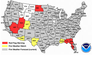
FIRE MAP FOR APRIL, 18, 2008 |
Tennessee Wildfire
Started by Motorcycle Crash
Thursday, April
17, 2008
GATLINBURN, Tenn. — A fire blazing in the Great Smoky
Mountains National Park was started by a motorcycle
crash.
National Park Service spokesman Bob Miller said
the fire had grown to about 10 acres by Wednesday
night and would expand further Thursday while
firefighters worked to contain it.
It began when a rider crashed
his motorcycle on U.S. 129 in a winding area known as
"the Dragon."
Miller said the steep and rocky
terrain prevents firefighters from making a direct
attack on the fire. They were working to contain it
between the highway and the Topoco power line.
Officials said the motorcyclist
walked away from the crash.
|
Colorado wildfire 20 percent
contained after overnight snow
April 17, 2008
DENVER – Overnight snow helped
firefighters extend containment lines Thursday at a
14-square-mile wildfire in southern Colorado that
claimed the life of a firefighting pilot earlier
this week.
The fire at Fort Carson was 20 percent contained,
up from 10 percent the night before.
Snow moved into the area Wednesday night, blanketing
a wide swath of foothills and grasslands. The
National Weather Service could not say how much snow
fell on the fire, but 2 inches was recorded in
nearby Colorado Springs, about 60 miles south of
Denver.
The fire was one of three that erupted on
Tuesday.
A fire in Ordway, a tiny farming community about
120 miles southeast of Denver, killed two
firefighters, destroyed at least eight homes and
prompted authorities to order all 1,200 residents to
evacuate. It was 100 percent contained Wednesday
night.
A blaze near Carbondale in the western Colorado
mountains, about 120 miles west of Denver, was also
100 percent contained. It damaged two buildings and
slightly injured a fisherman.
The Garfield County Sheriff's Department said the
Carbondale fire started after high winds exposed an
ember from a property owner's controlled burn.
No burn ban was in effect, but Carbondale Fire
Chief Ron Leach said his department had not issued
any burn permits – required for controlled burns –
that day. The investigation was continuing, and no
one had been charged.
The causes of the other fires were still under
investigation.
Pilot Gert Marais of Fort Benton, Mont., was
killed Tuesday when his single-engine plane crashed
after dumping fire-retardant slurry on the Fort
Carson blaze. Marais, 42, worked for a Sterling,
Colo., company that supplies aerial firefighting
services to the Colorado State Forest Service.
The National Transportation Safety Board was
investigating.
Volunteer firefighters John Schwartz, 38, and
Terry Devore, 30, were killed at the Ordway blaze on
Tuesday when their fire truck plunged into a ravine
under a bridge that had been damaged by flames. It
wasn't immediately clear if the bridge collapsed
under the weight of the truck or had fallen earlier.
Schwartz and Devore were corrections officers at
a state prison outside Ordway and were members of
the Olney Springs Volunteer Fire Department.
|
Firefighters Hope Storms Will
Help Stifle Colorado Wildfires That Killed 3
ORDWAY, Colo. —
Firefighters resumed the battle Wednesday against three wildfires
that blazed through nearly 20,000 acres in Colorado, killing three
people and forcing hundreds of residents to evacuate.
Two of the dead were volunteer firefighters
who were killed when a bridge damaged by flames collapsed under
their fire truck, a state lawmaker said. The third was the pilot
of an air tanker.
Wind gusted up to 50 mph along the Rocky
Mountain Front Range and eastern plains on Tuesday, fanning flames
that quickly spread across 8,900 acres — or 14 square miles — of
grassland near Ordway. All 1,200 residents of the town were told
to leave, and they had not been allowed back in by Wednesday.
On Wednesday morning, wind was blowing at less
than 10 mph at Pueblo, about 50 miles west of Ordway,
the National Weather Service said. Firefighters hoped rain and
snow expected later in the day would help them corral the blaze.
The Ordway fire was 80 percent contained by
Wednesday morning but had damaged at least 24 buildings, eight
within town limits, fire information officer Katherine Sanguinetti
said.
Authorities said firefighters John Schwartz
Jr., 38, and Terry Davore, 29, died in the bridge collapse. Both
were corrections officers at a state prison outside Ordway and
were members of the Olney Springs Volunteer Fire Department, said
Ari Zavaras, director of the
state Department of Corrections.
State Rep. Cory Gardner, whose district
includes Ordway, told legislative leaders both men had young
children.
Former state Rep. Mark Cloer of Sugar City,
near Ordway, told lawmakers that ranchers would need emergency
feed for cattle because the fire destroyed feedlots.
A firefighting plane crashed near Fort Carson,
killing the pilot, Gert Marais, 42, of Fort Benton, Mont., Fort
Carson spokesman Maj. Sean Ryan said.
Marais worked for a Sterling, Colo., company
that supplies aerial firefighting services to the
Colorado State Forest Service, Ryan said.
The
National Transportation Safety Board was investigating.
Marais was battling a blaze there that charred
9,600 acres — about 15 square miles — and forced the evacuation of
people living near the Army base.
Authorities could not say how many people had
been evacuated at the Fort Carson fire, but none had been allowed
back into their homes by Wednesday morning.
About 300 firefighters were at the fire but no
containment lines had been established, El Paso County sheriff's
Sgt. Jeanette Whitney said.
Firefighting aircraft were grounded for a
safety stand-down after the fatal crash but were cleared to fly
again Wednesday if needed, said Steve Segin, a spokesman for the
Rocky Mountain Area Coordinating Center, which organizes state and
federal firefighting agencies.
A team from the coordinating center was
preparing to take control of the firefighting effort later
Wednesday, an indication of how serious the situation was.
Two shelters were set up at the post and a
third at a nearby community college to house evacuees. The cause
of the fire at the base outside Colorado Springs, about 60 miles
south of Denver, hadn't been determined.
A third fire, near Carbondale in the western
Colorado mountains, damaged at least two homes and left a
fisherman with minor injuries.
Rain was possible in parts of the area during
the afternoon and there was a chance of up to a foot of snow in
Colorado's eastern mountains beginning Wednesday evening and
lasting into Thursday morning, the weather service said.
All but a handful of Ordway residents had left
for the nearby communities of Sugar City and Crowley, where
officials set up a shelter. An unknown number of residents were
allowed to remain in a nursing care facility in a section of
Ordway not threatened by the fire, fire information officer Chris
Sorensen said.
Armed with a chain saw, shovel and hose, Brian
Walker stood ready to save his house from the flames.
"Well, I got a yard, and I got a home and I
want to keep it," said Walker, 45. "I thought if the fire came, I
thought I could do whatever I could to stop it."
Helicopter footage showed at least three
houses fully engulfed in flames near the town about 120 miles
southeast of Denver. Two state highways were closed.
At least three heavy air tankers, each capable
of carrying up to 2,500 gallons of fire retardant, were sent to
Ordway, Segin said.
Crowley County Sheriff Miles Clark said he
asked the Colorado Bureau of Investigation to help investigate the
cause.
All three fires broke out after a wetter than
normal winter was followed by a dry March.
Gov.
Bill Ritter declared a state of emergency, freeing up state
resources to help fight the fires. The Federal Emergency
Management Agency also agreed to provide money for the
firefighting efforts.
The wildfire near Carbondale, in the mountains
about 120 miles west of Denver, blackened about 1,000 acres. It
was about 25 percent contained Wednesday.
|
Big Sur wildfire closes Highway 1
By Monterey County Herald
Article Launched: 04/17/2008 09:45:22 AM PDT
A wildland fire burning just outside Los Padres National
Forest along the Big Sur coast closed Highway 1 in both
directions and forced the evacuation of several
residents Wednesday.
California Department of Forestry and Fire Protection
spokeswoman Jan Bray said the fire was burning in
"extremely heavy and tall brush on steep slopes" uphill
from Highway 1 about 15 miles south of Big Sur.
The fire started around 1 p.m. about a mile south of
the Esalen Institute. Although it appeared to be
threatening structures, the fire was kept at bay and no
houses were damaged, said Joe Pasinato, spokesman for
the U.S. Forest Service.
The Monterey County Sheriff's Office reported that
residents on Dolan Road were supposed to be evacuated in
the early afternoon, but as one resident tried to drive
down a steep, narrow dirt road, the driver swerved to
avoid another car and rolled over, deputies said,
blocking the evacuation route.
It took two hours to remove the wreckage with a
bulldozer, deputies said. The driver was not injured.
Officers aboard the new sheriff's office helicopter
flew over residences and announced evacuations while
other deputies knocked on doors.
Five residents agreed to leave, deputies said, while
two stayed in their homes.
Deputies said they would remain in the area until it
was safe for residents to return, which was predicted to
be sometime late Wednesday.
By 9 p.m., firefighters said the blaze had consumed
10 acres and was
about 60 percentcontained, with full containment likely
by tonight.
Several "hot spots" remained Wednesday, but officials
said there was "no appreciable rate of spread."
One lane of Highway 1 was open by 9 p.m. Wednesday,
with both lanes expected to be opened by this afternoon,
according to the California Highway Patrol.
No injuries to firefighters or residents were
reported.
Crews from the U.S. Forest Service, Cal Fire and the
Big Sur Volunteer Fire Department fought the fire on the
ground, while a Santa Barbara County Fire Department
helicopter dropped water. A state prison inmate fire
crew also helped on the ground.
The California Highway Patrol closed Highway 1 in
both directions just north of Esalen Institute and at
Dolan Creek to the south.
While an early report indicated the fire may have
been started by a car whose driver was changing a tire,
officials later said the cause of the fire has yet to be
determined.
Cal Fire officials said an unrelated controlled burn
is scheduled to take place at 11 p.m. today on the
Silacci Ranch east of Salinas and advised residents not
to be alarmed.
|
DeSoto, FL wildfire mystifies officials: Burning patchwork chars 330
square acres
(Last
updated: April 18, 2008 8:09 PM)
A contained wildfire in DeSoto County is expected to take a week
before burning out.
By CAROL SAKOWITZ
DeSoto News Editor
DeSOTO COUNTY — A wildfire slowly smoldering on property 2 miles
inland from County Roads 760 and 769 is expected to take at least a
week before it burns out, officials from the state Division of
Forestry said.
The Addison Avenue Wildfire, accessed on Addison Avenue and
Southwest Aurin Grade, is invisible from the commonly traveled
roads, which possibly caused a delay in its discovery. It has burned
in uneven patches over an area of approximately 330 square acres,
fueled by the dead trees and debris left by Hurricane Charley.
The wildfire currently is under investigation, according to
Patrick Mahoney, the division's wildfire managment specialist. He
said the investigation is continuing because the source of the fire,
whether natural or manmade, is unknown. Mahoney said that anyone
with knowledge of the source of the wildfire — or any suspicious
fire — should call the Arson Alert line at 800-342-5869. Kelley
Johnson, whose land is part of the fire site, said he first saw
smoke on Sunday afternoon while working on his property. He said he
monitored the wildfire's progress, expecting it to die out in the
cypress swamp area on his land.
|
4.18.2008 9:07 AM
Texas Wildfire Destroys 6 Homes
A Brisk, Deadly Start to the 2008 Wildfire Season
Wildfires near Odessa, Texas, have
destroyed six homes, and led to the evacuation of 150 other
homes, according to the Associated Press. The fire comes just
days after a Colorado wildfire killed three, led to the
evacuation of more than 1,000 residents and burned 11 square
miles.The fires are among more than 13,555 recorded
already in 2008. That's a slightly lower total than the
five-year average to date, but the acreage burned — 1.1 million
— is 45.7% above the five-year average, and 97.7% above the
average since 2000. The totals do not include this week's fires,
including those in Colorado and Texas.
Despite a wet winter that typically tamps down on fire
risk, a particularly dry March has made conditions ripe for
fires in much of the West.
Scientists warn that fire risk will increase with global
warming, as mountain snowpack diminishes, summer heat increases
and vegetation become more susceptible to drying out.
More fire activity is likely today, as the National
Weather Service has announced red flag warnings due to fire risk
across several parts of the U.S.
|
|
WILDFIRE DATABASE ON THIS SITE
DREAMS OF THE GREAT EARTHCHANGES -
MAIN INDEX |