WEATHER ANOMALY PAGE
THIS IS MORE THAN JUST ANOMALIES
WHAT IS IT?????
WEIRD WEATHER ANOMALIES
WHY DOES RADAR SHOW STORMS AND SATTELITE SHOWS NO CLOUDS?
STRANGE CLOUDS SEEN PRIOR TO TERRIBLE TORNADOES .
THIS SEEMS TO BE HAPPENING PRIOR TO EARTHQUAKES AS WELL.
PERHAPS THIS COULD BE USED AS AN EARTHQUAKE OR TORNADO PREDICTOR?
THIS IS JUST AN EXAMPLE OF WHAT HAS BEEN SEEN
. 
THIS IS NOT NORMAL
GWEN Ground Wave Emergency Network
The Truth is Out There and We've Found It
WEATHER AS A WEAPON - NEWS ARTICLE
*******************
Here are some past examples:
4-21-98
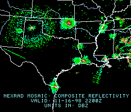
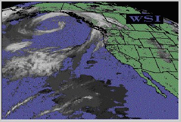
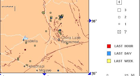
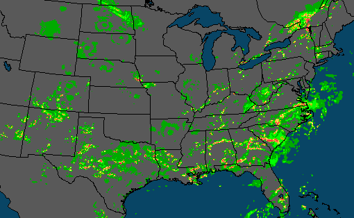
Note that where there is a huge radar blip on the radar, on the sattelite image, there are NO clouds. I am including an earthquake map of the same time period to go with it. Note that an earthquake occurred within an hour of the radar blip. Coincidence? Just asking!
 |
 |
 |
| SATELLITE - 4-21-98 - 9 a.m.P.D.T. | RADAR - 4-21-98 9 a.m. P.D.T. | EARTHQUAKE MAP - 4-21-98 - 9:45 A.M. P.D.T. |
 |
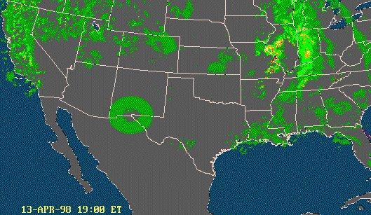
LEFT - STRANGE RADAR ANOMALY -
RIGHT - STRANG RADAR
12:00 HOURS - 4-13-98 ANOMALY - 13:00 HOURS 4-13-98
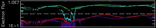
BELOW - ELECTRON FLUX CHART FROM THE SUN - SAME TIME PERIOD |
 |
|
 |
 |
 |
 |
 |
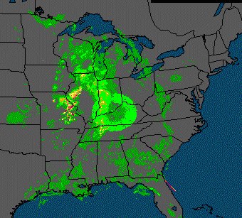
9A.M. TO NOON SATELLITE IMAGES NO CLOUDS 4-9-98 |
9:00 A.M. - 11:00 -
RADAR IMAGE SHOWS TERRIBLE STORMS DIMINSH TO RING OF CLOUDS 4-9-98 |
EASTER SUNDAY
FORECAST 4-9-98 |
CURIOUSER AND CURIOUSER STAR SHOWS EARTHQUAKE RIGHT AFTER THE RED RADAR BURST - 4-9-98
|
|
| MAP OF 7-16-98
See the circles in the Dakotas, and also Wisconsin, and Arkansas these are examples of what we are watching. Are these from HAARP? |
THE TRUTH IS OUT THERE
AND WE'VE FOUND IT
(AFTER KENT STEADMAN FOUND IT AND PUBLISHED IT ON "ORBIT" LAST APRIL) DOCUMENTED
HERE
ON THE RADAR PAGE)
On 12-14-98 I received the following e-mail. I have withheld the sender's name:
Attention Please,
If you have not already been alerted to this.
There is an antennae system built across the united states, one every approximate 200-250 miles. This system is called GWEN, for Ground Wave Emergency Network. It was built on the premis of being a backup emergency communications network, in the event of a nuclear attack.
Wrong. It is a weather modifications and control system. I suggest that if you correlate the circular patterns showing up in the radar images, to the ground locations of these antennaes, you will have a match up. It looks as if some of the circles are solid and some are hollow. This is probably a repelling or attracting condition altered by the frequency pattern or signature or charge ie. positive/negative.
Great work you all are doing.
*********************
E-mail received 12-18-98
Have you ever considered asking a meteorologist what your "crop circles in the sky are"? Unfortunately, despite the cost of the NEXRAD radar system, it often mistransmits data that is not there, or mistransmits birds, pollution, buildings, etc. as data. Your "mystery circles" are one of 3 things - most commonly test patterns transmitted by the radar when it is in maintenance. They fill the data display with data so that they can troubleshoot problems. These are the large multicolored rings. They also can be ground clutter, when the radar hits buildings and trees near the site. These are smaller less geometric rings near the radar site. Thirdly, they can be migrating birds. This scared me too at first because unlike the other anomalies they did not originate near the site. Birds taking off at dawn create an "exploding" pattern on the radar.
I have more images and I will soon have a page up detailing the "bird theory" with references to people who have been there and seen the birds, although I am not 100% sure of this theory. I promise that I am not part of any conspiracy - however I have studied in detail and used NEXRAD Doppler radar for about 5 years now.
name withheld
GWEN Ground Wave Emergency Network
If you have any questions or comments, please e-mail Dee777@aol.com