|
12-11-06 Dee, I just read your dreams at greatdreams.com and
to recap -- your two tsunami dreams were in August, 2006 and
11/1/06. I just got out
the newspaper I saved after we had a tsunami in November to look up
the date -- it was November 15, 2006. So hopefully at least the
first tsunami is past.
Our newspaper reporter researched tsunamis and there have been a lot
of them -- not just the one in 1964 that was 15 feet high and killed
11 people that went out of their houses to start cleaning up after
the first wave.
The worst one was in 1700 and washed over the Sierra Nevada
mountains
and created the Great Salt Lake in Utah probably. But there were two
in the 1940s, three in the 1950s, six in the 1960s, two in the
1970s,
one in the 1980s, and two in the 1990s (both after quakes at
Mendocino.)
The tsunami on November 15, 2006 was about 5 feet high and destroyed
1000 feet of docks and 35 boat slips. It was caused by a magnitude
8.1 to 8.3 earthquake off the shore of the Kuril Islands near
Alaska.
The tsunami siren was not sounded this time. One investigation
showed that the reason for that was that the warning was called to
the wrong county headquarters. But in my personal observation --
there was a tsunami warning siren after an offshore earthquake last
year in 2005 (your blue notebook in the August dream) and people
panicked and drove crazy and got into a few accidents. They didn't
know where to go and some went a lot further up the mountains -- not
just to the fairgrounds or middle school to slightly higher ground.
And the mountains have people hemmed in so that you can't really get
to higher ground very easily except on narrow two-lane roads with
hairpin turns around and around the mountain.
So now they printed the instructions -- to walk to higher ground and
don't cause traffic jams that keep emergency vehicles from getting
through. But when have you ever seen an American walk when they
could
take their car?
This is a small town of 5,000 people and the panic here almost
caused
a lot of car accidents. People were driving past our house honking
their horns furiously, squealing their brakes, and shouting at each
other. We stayed put because we live on higher ground already --
though not high enough for a 60 foot wave. That was summer and good
weather. It rained for 37 days -- including the entire month of
November and the day of the tsunami on November 15th so the
evacuation, if it had occurred, would have been even worse than in
summer on slick rain-wet roads and people would have been in winter
coats like your dream of August 2006.
Steve and I went out when it stopped raining for a bit and people
were in shock even a couple of days after the tsunami. Even public
officials like some of the bus drivers were in shock and wandering
around with vacant looks on their faces.
I dreamed about a tsunami washing Steve and me all the way back to
the mountains before we moved here on September 9, 1976. We floated
on the wave. But the water was warm and turquoise in color and the
sand white like in Florida or Indonesia for that matter.
Sheila
NOTE: It was said on the radio that the people who got
the tsunami warning actually drove to the beach to watch it come in.
IDIOTS!!!
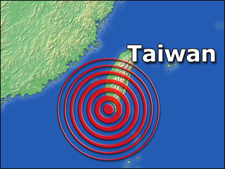
| Powerful quake strikes off Taiwan
Story Published: Dec 26, 2006 at 7:03 AM PST
By Associated Press
TAIPEI, Taiwan (AP) - A powerful earthquake struck off
southwestern Taiwan on Tuesday, briefly prompting fears of a
tsunami on the second anniversary of the quake and deadly
waves that killed thousands in south Asia.
Taiwanese media reported one person died and three were
injured when their home collapsed in the southern city of
Pintung. Other reports said city streets had cracked and a
major bridge was damaged. They said fires were burning out
in the area, apparently caused by downed power cables.
The quake was felt throughout Taiwan. The U.S. Geological
Survey estimated its magnitude at 7.1, while Taiwan's
Central Weather Bureau measured it at 6.7. It was followed
eight minutes later by 7.0 magnitude aftershock, the USGS
said.
Two hours later, an official at Japan's Meteorological
Agency said there was no longer any danger of a destructive
tsunami headed for the Philippines, as had been predicted.
"The danger has passed," said Hiroshi Koide of the agency's
earthquake section. "We predicted tsunami based on the depth
and magnitude of the earthquake. But ultimately, it appears
no large tsunami were triggered."
Phone lines were cut in the southern cities of Kaohsiung
and Pingtung, possibly hindering reports of damage by
residents, the CTI Cable News reported. Several high-rise
hotels swayed violently in Kaohsiung, it said.
Liao Ching-ling, a 30-year-old manager at Kaohsiung's
Ambassador Hotel, said she had never before felt such a
strong quake: "The building swayed so badly that many
panicky guests ran out of their rooms and into the streets."
The initial tremor was centered at sea about 13 miles
southwest of Hengchun on the southern tip of Taiwan, the
bureau said. Hengchun is about 260 miles south of Taipei.
Quakes frequently shake Taiwan, which is part of the
Pacific's "Ring of Fire," an arc of volcanos and fault lines
encircling the Pacific Basin. Most are minor and cause
little or no damage, but a 7.6-magnitude earthquake in
central Taiwan in September 1999 killed more than 2,300
people.
A 9.1-magnitude earthquake off the coast of Indonesia on
Dec. 26, 2004 caused a tsunami that killed at least 230,000
people in 11 countries. Those waves reached as high as 33
feet.
~~~~~
TAIPEI - A powerful earthquake struck off southwestern Taiwan on
Tuesday, triggering a tsunami warning on the second anniversary of
the waves that killed more than 200,000 in southern Asia.
Two hours later, seismologists lifted the warning, saying the
threat of destructive waves had passed.
Taiwanese media reported one person was killed and three
injured in the southern city of Pingtung when their four-story home
collapsed. Three other members of the family were trapped in the
rubble and firefighters were working to free them, the reports said.
One member of the family - an 89-year old man - escaped from
the building unharmed. Initial reports said all the people in the
collapsed building had been freed, but these turned out to be
unfounded.
Elsewhere in Pingtung, 20 other people were injured, media
reports said.
They added that many streets in the city were cracked and a
major bridge was damaged. Several fires broke out in the area,
apparently caused by downed electric power cables.
The U.S. Geological Survey said the quake, which hit at 8:26 p.m.
(1226 GMT), registered magnitude 7.1, while Taiwan's Central Weather
Bureau measured it at 6.7. It was followed eight minutes later by an
aftershock registering 7.0, the USGS said.
Japan's Meteorological Bureau said a one-meter (3.3-foot) tsunami
might be headed toward the eastern coast of the Philippines, but
later lifted the warning."The expected waves did not materialize ...
the danger has passed," said Hiroshi Koide of the agency's
earthquake section. "We predicted a tsunami based on the depth and
magnitude of the earthquake. But ultimately, it appears no large
tsunami was triggered."
According to China Seismological Bureau, two earthquakes --
the first measuring 7.2 on the Richter scale and the second
measuring 6.7 -- hit the South China Sea on Tuesday. The epicenter
was located at 21.9 degrees north latitude and 120.6 degrees east
longitude, about 350 kilometers from the Chinese mainland and 15
kilometers from Taiwan.
Philippine police said coastal areas had been alerted.
The warning underscored the higher level of caution about
tsunami waves in the region since a massive earthquake off Indonesia
exactly two years earlier triggered a powerful tsunami in the Indian
Ocean that killed 230,000 people in a dozen countries.
Tuesday's quake was felt throughout Taiwan. It swayed buildings and
knocked objects off the shelves in the city of Taipei, in the
northern part of the island. Phone lines were cut in the southern
cities of Kaohsiung and Pingtung, possibly hindering reports of
damage by residents, the CTI Cable News reported. Several high-rise
hotels swayed violently in Kaohsiung, it said.Liao Ching-ling, a
manager at Kaohsiung's Ambassador Hotel, said the quake was the
strongest she had ever felt.
"The building swayed so badly that many guests panicked and
ran out of their rooms and into the streets," she said.
The tremor was centered at sea about 23 kilometers (13 miles)
southwest of Hengchun on the southern tip of Taiwan, the bureau
said. Hengchun is about 450 kilometers (260 miles) south of
Taipei.Quakes frequently shake Taiwan, which is part of the
Pacific's "Ring of Fire," an arc of volcanos and fault lines
encircling the Pacific Basin. Most are minor and cause little or no
damage. However, a 7.6-magnitude earthquake in central Taiwan in
September 1999 killed more than 2,300 people.
Thousands of people in residents along Japan's eastern coast
fled to higher ground after an 8.2 magnitude earthquake
triggered tsunami warnings Saturday in parts of the Pacific
region, including Hawaii and Alaska.
The warnings rattled coastal residents more than two
years after giant waves spawned by an Indian Ocean earthquake
killed at least 230,000.
But the largest wave reported by late Saturday was a
16-inch tidal surge along the shores of Chichi-jima, a Pacific
island 620 miles south of Tokyo, more than three hours after
the quake.
Earlier, a tidal swell of about 4 inches was recorded
in Japan's northeastern coastal town of Nemuro, and a higher
tide also was observed in other coastal towns, including
Kushiro, Abashiri and Otaru, Japan's Meteorological Agency
said.
The quake struck around 1:24 p.m. local time about
310 miles east of Etorofu, the largest of a disputed
four-island chain known as the Northern Territories in Japan
and the Kuril islands in Russia.
The Japanese agency initially estimated the magnitude
as 8.3 but later reduced that to 8.2, the same strength
recorded by the U. S. Geological Survey. The quake struck 19
miles below the seabed, the agency said.
There were no immediate reports of injuries or damage
from the quake, but the agency warned that higher than usual
waves could hit the northeastern coast of Japan's main island
of Hokkaido.
Hokkaido officials responded by issuing evacuation
orders to 85,000 people in 22 coastal towns.
Disaster prevention official Haruyuki Komachi said
thousands of people heeded the orders and gathered at
community centers. Police closed off roads to the coast and
train operators suspended some services as a precaution.
The warnings were later downgraded to advisories,
then canceled them altogether on the northwestern coast of
Hokkaido, leading some municipalities to lift evacuation
orders. Advisories in other parts of Hokkaido and towns facing
the Pacific coast were still in effect late Saturday.
"The tidal change so far seems rather small, but a
bigger one may come hours later," Komachi said. "So we have to
stay vigilant into the night in case a second or a third ones
come in bigger waves."
A tsunami warning also was issued for Alaska's
western Aleutian islands, and a tsunami watch was issued for
Hawaii. Both were later canceled, but not before dozens of
people sought refuge in underground shelters on two Aleutian
islands.
The Philippine Institute of Volcanology and
Seismology advised residents along that nation's eastern
seaboard to observe changes in the sea level. About 4,000
people in the northern province of Isabela were evacuated.
Tsunami warnings are issued due to the imminent
threat of a tsunami. Tsunami watches are issued as an advance
alert to areas that could be impacted by a tsunami.
Temblors of magnitude 7 are generally classified as
major earthquakes, capable of widespread, heavy damage.
The Japanese meteorological agency also issued
warnings last November following a magnitude 7.9 quake in a
similar area, but most areas saw waves of only about 7.8
inches.
Seismologists, however, warned that this time the
quake was stronger and cautioned residents to remain vigilant.
Tokyo University seismologist Yoshinobu Tsuji warned
that high waves may still hit the region, hours after a
tsunami warning. "I urge everyone to stay alert," he said.
December 26, 2004, a magnitude-9.0 earthquake off
Indonesia's Sumatra island unleashed giant waves that fanned
out across the Indian Ocean at jetliner speeds, leaving at
least 230,000 dead and millions of homeless in its wake.
Tsunami warning for Hawaii and Alaska
The Courier Mail, Brisbane
From correspondents in Honolulu
January 13, 2007 04:18pm
Article from: Agence France-Presse
THE Pacific Tsunami Warning Centre issued a tsunami watch for Hawaii
and Alaska's western Aleutian islands after a 8.3-magnitude
earthquake in the northern Pacific.
The centre said today the waves could reach Hawaii's shores just
after midnight local time (9pm AEDT). It was expected to hit
Alaska's Dutch Harbor about an hour earlier (8pm AEDT).
The West Coast and Alaska Tsunami Warning Centre said it was not
immediately known if a tsunami was generated.
Japan's Meteorological Agency issued tsunami warnings following the
quake. The agency said waves as high as 1 metre could hit the
northeastern coast of Japan's northern island of Hokkaido.
Officials in towns along Japan's Pacific coast issued evacuation
orders to flee to higher ground.
The United States issued a tsunami warning for Russia, Japan and
Markus Island in the Pacific Ocean following the quake.
The quake struck about 500km east of the Etorofu islands between
northern Japan and Russia, the agency said.
There were no immediate reports of injuries or damage from the
quake.
Tsunami waves - generated by earthquakes - are often barely
noticeable in the ocean but can rise to great heights once they
arrive at shore.
The Tsunami
Warning and Watch are canceled for British Columbia and Alaska.
A tsunami has been observed at the following sites:
Hanasaki Japan 0.1m/0.3ft
Kushiro Japan 0.1 m/0.3ft
Ofunato Japan 0.06m/0.2 ft
Kamaishi Japan 0.07m/0.2ft
Miyako Japan 0.08m/ 0.26ft
Shemya Alaska .32m/1.0 ft
Wave observations are the amplitude above sea level.
No destructive tsunami threat exists
for Alaska, British Columbia, Washington, Oregon, and California. However,
some areas may experience observable effects which could include strong
currents in harbors and bays dangerous to those in or near the water.
These effects are expected to begin at approximately 0440AM PST in the
Pacific Northwest ranging to 0600AM PST in southern California and could
continue for several hours after initial arrival. As local conditions can
cause a wide variation in tsunami wave activity, the all clear
determinations must be made by local authorities. At 8:24 PM Pacific
Standard Time on January 12, an
earthquake
with preliminary magnitude 8.2
occurred east of the Kuril
Islands, Russia.
The
Pacific Tsunami Warning Center
in Ewa Beach, Hawaii will issue a final tsunami message for Hawaii and
other areas of the Pacific outside California, Oregon, Washington, British
Columbia and Alaska. This will be the last West Coast/Alaska Tsunami
Warning Center message issued for this event.
To repeat, NO tsunami watch or warning is in effect for
the U.S. West coast states, Alaska, and British Columbia. See the
WCATWC
web site for basic
tsunami information,
safety rules,
and a
tsunami travel time map
and
table.
(NOTE: Travel time maps and tables indicate predicted
times only, not that a wave was generated.)
Japan Quake Leaves 1 Dead, 170 Injured
By SHIZUO KANBAYASHI
AP
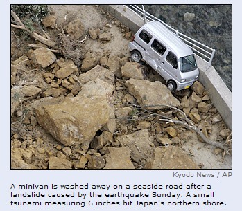
KANAZAWA, Japan (March 25) - A powerful earthquake struck
central Japan on Sunday, killing at least one person and
injuring 170 others as it toppled buildings, triggered
landslides and generated a small tsunami along the coast.
The quake was followed throughout the day by aftershocks.
The magnitude-6.9 quake struck at 9:42 a.m. off the north
coast of Ishikawa, Japan's Meteorological Agency said. The
agency issued a tsunami warning urging people near the sea
to move to higher land.
A small tsunami measuring 6 inches hit the shore 36 minutes
later, the agency said.
The morning quake toppled buildings, triggered landslides,
cut power, interfered with phone service, broke water mains
and snarled public transportation. At least one person was
killed and 170 others were hurt along the country's Sea of
Japan coast, according to the Fire and Disaster Management
Agency.
Television footage of the quake showed buildings shaking
violently for about 30 seconds. Other shots showed collapsed
buildings and shops with shattered windows, streets
cluttered with roof tiles and roads with cracked pavement.
"We felt violent shaking. My colleagues say the insides of
their houses are a mess, with everything smashed on the
floor," Wataru Matsumoto, deputy mayor of the town of
Anamizu, near the epicenter, told NHK.
Chief Cabinet Secretary Yasuhisa Shiozaki confirmed the
death of a 52-year-old woman. NHK said she was crushed by a
falling stone lantern.
"We are doing our best to rescue the victims," he said. "We
are also doing our best to assess the extent of the damage."
The quake knocked down at least 39 homes in Ishikawa and
damaged another 143, the FDMA said. Most of the injuries and
damage were concentrated in the city of Wajima, it added,
about 193 miles northwest of Tokyo.
Takeshi Hachimine, seismology and tsunami section chief at
the Meteorological Agency, said the affected area was not
considered earthquake-prone. The last major quake to cause
casualties there was in 1933, when three people died.
"After the powerful earthquake, aftershocks will continue,"
Hachimine said.
Japan sits atop four tectonic plates and is one of the
world's most earthquake-prone countries. The last major
quake to hit the capital, Tokyo, killed some 142,000 people
in 1923, and experts say the capital has a 90 percent chance
of suffering a major quake in the next 50 years.
In October 2004, a magnitude-6.8 earthquake hit northern
Japan, killing 40 people and damaging more than 6,000 homes.
It was the deadliest to hit Japan since 1995, when a
magnitude-7.2 quake killed 6,433 people in the western city
of Kobe.
Powerful quakes in 1703, 1782, 1812 and 1855 also caused
vast damage in the capital.
According to the U.S. Geological Survey, the epicenter of
Sunday's quake was 225 miles northwest of Tokyo. The USGS
measured its magnitude at 6.7.
Associated Press writers Hans Greimel, Carl Freire and
Mari Yamaguchi contributed to this story.
Strong earthquake strikes Japan
A strong earthquake rocked
Japan on Sunday, killing at least one person
and injuring 150 others. The quake caused
serious damage to many buildings and triggered a
small
tsunami along the coast, officials and media
reports said.
The
magnitude-6.9 quake struck at
9:42 a.m. (0042 GMT) off the
north coast of Ishikawa
prefecture (state), Japan's
Meteorological Agency said. The
agency issued a tsunami warning
urging people near the sea to
move to higher land.
A small
tsunami measuring 10 centimeters
(6 inches) hit the shore 36
minutes later, the agency said.
The warning was lifted after
about an hour.
The quake
toppled buildings, triggered
landslides, cut power,
interfered with phone service,
broke water mains and snarled
public transportation. At
least one person was killed and
150 others were hurt along the
country's Sea of Japan coast,
media reports said.
Fear of
aftershocks and more landslides
caused by the loosening of soil
waterlogged by overnight rains
continued to plague the quake
zone.
Television
footage of the quake showed
buildings shaking violently for
about 30 seconds. Other shots
showed collapsed buildings and
shops with shattered windows,
streets cluttered with roof
tiles and roads with cracked
pavement.
In Ishikawa,
at least 24 people were injured,
six severely, according to
prefectural official Kosaku
Ueno. In neighboring Toyama, at
least two people were injured,
fire official Nobuyuki Shima
said.
Many of the
injured people suffered burns or
were hurt by falling objects and
broken glass, media reports
said.
Chief Cabinet
Secretary Yasuhisa Shiozaki
confirmed the death of a
52-year-old woman. Public
broadcaster NHK said she was
crushed by a falling stone
lantern.
"We are doing
our best to rescue the victims,"
he said. "We are also doing our
best to assess the extent of the
damage."
Kyodo
News agency reported about
30 soldiers had arrived to help
with disaster relief, and
military aircraft were examining
the damage.
Takeshi
Hachimine, seismology and
tsunami section chief at the
Meteorological Agency, said the
affected area was not considered
earthquake-prone. The last major
quake to cause casualties there
was in 1933, when three people
died.
He warned of
likely aftershocks.
"After the
powerful earthquake, aftershocks
will continue," Hachimine said.
"All residents, especially those
who are near the hardest-hit
areas, are advised to use extra
caution. Aftershocks could
further damage what's already
fragile."
Train service
in Ishikawa and nearby Toyama
prefecture was suspended and All
Nippon Airways flights between
Ishikawa and
Tokyo were delayed, Kyodo
said.
Nuclear power
plants owned by Tokyo Electric
Power Co. and Kansai Electric
Power Co. were operating
normally in Niigata and Fukui
prefectures, Kyodo said.
Hokuriku
Electric Power Co. said at least
340 households in the area were
without electrical power.
Japan sits
atop four tectonic plates and is
one of the world's most
earthquake-prone countries. The
last major quake to hit the
capital, Tokyo, killed some
142,000 people in 1923, and
experts say the capital has a 90
percent chance of suffering a
major quake in the next 50
years, the AP said.
In October
2004, a magnitude-6.8 earthquake
hit northern Japan, killing 40
people and damaging more than
6,000 homes. It was the
deadliest to hit Japan since
1995, when a magnitude-7.2 quake
killed 6,433 people in the
western city of Kobe.
Powerful
quakes in 1703, 1782, 1812 and
1855 also caused vast damage in
the capital.
Japan's
Meteorological Agency assigned
Sunday's quake a preliminary
magnitude of 7.1, but later
revised that to 6.9.
According to
the U.S. Geological Survey, the
epicenter of Sunday's quake was
360 kilometers (225 miles)
northwest of Tokyo. The USGS
measured its magnitude at 6.7.
We felt
violent shaking. My colleagues
say the insides of their houses
are a mess, with everything
smashed on the floor," Wataru
Matsumoto, deputy mayor of the
town of Anamizu near the
epicenter, told NHK
|
|
|
|
|
|
|
Tsunami Warning Issued After 2 Earthquakes Shake
Vanuatu
Sunday, March 25, 2007
WELLINGTON, New Zealand — Two
strong
earthquakes struck the South Pacific island nation of
Vanuatu on
Sunday and a tsunami warning was issued for some of its southern
islands, police said.There were no immediate
reports of injuries or damage in the capital, Port Vila.
Australia's Emergency Management Office warned the powerful
quakes could generate a tsunami, said police spokesman Capt.
Arnold Giro.
•
FOXNews.com's Natural Disaster Center
"We are moving (coastal) communities to higher ground"
on the southern islands, he said. "We have advised the islands to
be alert for a possible tsunami."
He said they were still checking on injuries and damage.
A magnitude 7.2 quake hit at 11:40 a.m. local time was
located 210 miles southeast of Port Vila and 75 miles south of the
small volcanic island of Tanna, police said. It occurred 4.7 miles
beneath the earth's surface.
The temblor was followed 28 minutes later by a magnitude
6.0 quake 220 miles southeast of Port Vila and some 85 miles south
of Tanna, according to the U.S. Geological Survey.
Police spokesman Capt. Arnold Giro said emergency
services were still checking the effects of the quakes in remote
islands close to where they were centered.
"We experienced a little bit of movement (in Port Vila)
but not as destructive as might be expected," he told The
Associated Press.
|
EARTHQUAKE on 01/04/2007 at 20:39 (UTC)
SOLOMON ISLANDS
20 km W Mbarasipo
MAGNITUDE: Mw 7.9

Data provided by: BUC GFU GFZ NEIC
Latitude = 8.33 S
Longitude = 156.92 E
Origin Time = 20:39:55.2 (UTC)
Depth = 10 Km
RMS = 1.26
sec
Gap = 31 degrees
95% confidence ellipse: - Semi major = 8.9 Km
- Semi minor = 5.5 Km
- Azimuth of major axis = 164 degrees
Number of data used = 171
Preliminary location computed on Sun Apr 1 21:54:38 2007 (UTC)
Done by Remy Bossu
Message number: 856
All magnitudes estimations :
mb7.0 (BUC) mb5.9 (GFZ) M 7.8 (GFZ)
M 7.8 (GFZ)
M 7.6 (NEIC)
P.S.: For additional information, please contact EMSC at:
- Email: mazet[at]emsc-csem.org
- Web : http://www.emsc-csem.org (maps available)
- Fax : 33 1 69 26 70 00
Magnitude
8.1 Solomon Islands; Tsunami Warning
|
Quote |
TSUNAMI BULLETIN NUMBER 002
PACIFIC TSUNAMI WARNING CENTER/NOAA/NWS
ISSUED AT 2132Z 01 APR 2007
THIS BULLETIN IS FOR ALL AREAS OF THE PACIFIC BASIN EXCEPT
ALASKA - BRITISH COLUMBIA - WASHINGTON - OREGON - CALIFORNIA.
... A TSUNAMI WARNING AND WATCH ARE IN EFFECT ...
A TSUNAMI WARNING IS IN EFFECT FOR
SOLOMON IS. / PAPUA NEW GUINEA / VANUATU / NAURU / CHUUK /
NEW CALEDONIA / POHNPEI / KOSRAE / AUSTRALIA / INDONESIA /
TUVALU / KIRIBATI / MARSHALL IS.
A TSUNAMI WATCH IS IN EFFECT FOR
GUAM / FIJI / N. MARIANAS / YAP / HOWLAND-BAKER /
WALLIS-FUTUNA / BELAU / TOKELAU / KERMADEC IS / SAMOA /
NEW ZEALAND / MARCUS IS. / WAKE IS. / AMERICAN SAMOA / TONGA /
NIUE / COOK ISLANDS / PHILIPPINES / JARVIS IS. / PALMYRA IS. /
JOHNSTON IS. / JAPAN
FOR ALL OTHER PACIFIC AREAS, THIS MESSAGE IS AN ADVISORY ONLY.
AN EARTHQUAKE HAS OCCURRED WITH THESE PRELIMINARY PARAMETERS
ORIGIN TIME - 2040Z 01 APR 2007
COORDINATES - 8.6 SOUTH 157.2 EAST
LOCATION - SOLOMON ISLANDS
MAGNITUDE - 8.1
EVALUATION
IT IS NOT KNOWN THAT A TSUNAMI WAS GENERATED. THIS WARNING IS
BASED ONLY ON THE EARTHQUAKE EVALUATION. AN EARTHQUAKE OF THIS
SIZE HAS THE POTENTIAL TO GENERATE A DESTRUCTIVE TSUNAMI THAT CAN
STRIKE COASTLINES NEAR THE EPICENTER WITHIN MINUTES AND MORE
DISTANT COASTLINES WITHIN HOURS. AUTHORITIES SHOULD TAKE
APPROPRIATE ACTION IN RESPONSE TO THIS POSSIBILITY. THIS CENTER
WILL MONITOR SEA LEVEL DATA FROM GAUGES NEAR THE EARTHQUAKE TO
DETERMINE IF A TSUNAMI WAS GENERATED AND ESTIMATE THE SEVERITY OF
THE THREAT.
ESTIMATED INITIAL TSUNAMI WAVE ARRIVAL TIMES. ACTUAL ARRIVAL TIMES
MAY DIFFER AND THE INITIAL WAVE MAY NOT BE THE LARGEST. THE TIME
BETWEEN SUCCESSIVE TSUNAMI WAVES CAN BE FIVE MINUTES TO ONE HOUR.
LOCATION COORDINATES ARRIVAL TIME
-------------------------------- ------------ ------------
SOLOMON IS. MUNDA 8.4S 157.2E 2039Z 01 APR
|
| Solomon Islands hit by tsunami |
|
Honiara - A tsunami swept ashore
causing damage to towns and villages in the Solomon Islands on
Monday, after a powerful earthquake and there were unconfirmed
reports up to nine people were missing, police said.
The tsunami followed a powerful 7.6 magnitude (this was upgraded
to 8.1) earthquake in the western New Georgia Islands
region, which had prompted the Pacific Tsunami Warning Centre to
issue a tsunami warning for countries in the region.
A spokesperson for the Solomon Islands Office of Emergency
management said there were unconfirmed reports five people were
missing after two villages were inundated by the tsunami in the
far west of the archipelago.
|
7.6 earthquake triggers tsunami in Solomons
3 reported dead; temblor under South Pacific; wider
warnings rescinded
HONIARA,
Solomon Islands - A powerful magnitude-7.6 earthquake
struck off the Solomon Islands on Monday, sending a
tsunami wave crashing into the country’s west coast and
prompting region-wide disaster warnings, officials said.
Sgt.
Godfrey Abiah said police in the capital, Honiara,
reported a wave several yards high had crashed ashore in
the western town of Gizo shortly before communication
lines with the region were cut.
Julian
McLeod of the Solomon Islands National Disaster Management
Office said there were unconfirmed reports that two
villages in the country’s far west were flooded.
“Two
villages were reported to have been completely inundated,”
McLeod told Australian Broadcasting Corp. radio. “We have
received reports of four people missing.”
Later
Monday, Japan’s NHK television said that at least three
people were reported to have died in the Solomons after
the earthquake.
The
U.S. Geological Survey said the earthquake struck at 7:39
a.m. about 6 miles beneath the sea floor, 217 miles
northwest of Honiara.
The
Hawaii-based Pacific Tsunami Warning Center issued a
warning for the Solomon Islands and neighboring Papua New
Guinea. It ordered a lower-level “tsunami watch” for other
places, including most South Pacific countries. The center
said Hawaii’s status could be elevated to warning or
watch.
A
tsunami was also possible at Willis Island and Cooktown in
far northeastern Australia, the Australian Bureau of
Meteorology’s National Meteorological and Oceanographic
Centre said.
Abiah
said police in Gizo had been warning residents to move to
higher ground away from the coast when the tsunami hit.
Communications were lost soon afterward.
In its
report, NHK quoted a local official, who, speaking by
telephone in Gizo, said the quake caused tidal waves and
many houses were destroyed on the coast of Gizo. Three
people were found dead in different locations there, he
said.
“We
have lost radio contact with the two police stations down
there and we’re not getting any clear picture from down
there,” he told The Associated Press by telephone.
A
spokesman for Prime Minister Manasseh Sogavare, Deli Oso,
said the quake was felt in Honiara but there were no
reports of any damage.
The Associated Press and Reuters contributed to this
report.~~~~~~~~~~~~
PRELIMINARY EARTHQUAKE REPORT ==
.
Region: SOLOMON ISLANDS
Geographic coordinates: 7.197S, 156.192E
Magnitude: 6.0 Mw
Depth: 10 km
Universal Time (UTC): 2 Apr 2007 10:49:14
Time near the Epicenter: 2 Apr 2007 21:49:14
Local time in your area: 2 Apr 2007 11:49:14
Location with respect to nearby cities:
76 km (48 miles) SW (220 degrees) of Chirovanga, Solomon
Islands
124 km (77 miles) NW (324 degrees) of Gizo, Solomon
Islands
130 km (81 miles) SSE (147 degrees) of Arawa,
Bougainville, PNG
484 km (301 miles) WNW (301 degrees) of HONIARA, Solomon
Islands
1016 km (631 miles) E (93 degrees) of Lae, New Guinea,
PNG
ADDITIONAL EARTHQUAKE PARAMETERS
________________________________
event ID : US 2007aray
This event has been reviewed by a seismologist at NEIC
For subsequent updates, maps, and technical information,
see:
http://earthquake.usgs.gov/eqcenter/recenteqsww/Quakes/us2007aray.php
or http://earthquake.usgs.gov/
National Earthquake Information Center
U.S. Geological Survey
http://neic.usgs.gov
Tsunami warning sparks panic
The Courier Mail, Brisbane - breaking news
April 02, 2007 12:00am
Article from: AAP
THE threat of a tsunami hitting Queensland eased today
but widespread panic was triggered, with many coastal
residents evacuating their homes and fleeing to higher
ground.
It also sparked a massive emergency response statewide
which involved the cancellation of surgery at hospitals,
the closing and evacuation of beaches and the
cancellation of flights. Emergency services across
Queensland had braced themselves for a possible tsunami
after a strong earthquake off the Solomon Islands early
today.
However, the Bureau of Meteorology said in an update
that "no destructive tsunami is expected, (but) there
may be a small rise in sea levels".
The quake, measuring 8.1, struck at 0640 AEST about
350km west-north-west of the capital Honiara at a depth
of 10km, the Pacific Tsunami
Warning Centre in Hawaii said.
The Australian Bureau of Meteorology's National
Meteorological and Oceanographic Centre in Melbourne
warned a possible tsunami could
affect Willis Island in the Coral Sea at 0830 AEST and
Cooktown in far north Queensland around 0930 AEST.
But the bureau said the Willis Island weather station
reported no noticeable effect of waves at 9am by which
time the tsunami should
have passed.
"They are checking to see if there has been any affect
to beaches," it said.
"Visual inspection in the Cooktown area has shown no
sign of a destructive tsunami.
"This indicates that the possibility of a destructive
has eased considerably."
The warning sparked an emergency disaster response
across the state, with Cairns Base Hospital cancelling
elective surgery and outpatient clinics.
Childcare centres in the Cairns CBD were evacuated while
Townsville City Council activated its local disaster
management group.
Some shops around Cooktown, which was the first
Queensland coasta area expected to be hit, closed for
the day while panicked locals fled in their cars to
higher ground.
"There has been a degree of self-evacuation this morning
and people have shown some vigilance and are on alert,"
said Emergency Management Queensland (EMQ) spokesman
Andrew Berkman.
"We've had it happening from Cairns, Cooktown (and)
Bribie Island (north of Brisbane) even.
"The threat was statewide and so we've had people
packing up and moving away from the beaches there.
"But when the threat came through, it was a serious
threat so we really wanted people to be on alert, so
they should be congratulated for doing that.
"There are obviously logistical issues with moving
people away from coastal areas, but I think it was done
successfully and the warnings reached their mark."
David Young, manager of Cooktown's West Coast Hotel,
said there was a "lot of movement" around the town.
"People are fuelling up cars ... they want to make sure
they can get out just in case," he said.
Penny Johnson from Bart's Bush Adventures in Cooktown
cancelled all her four-wheel-drive tours and closed her
booking centre in the town's centre.
She said Skytrans airlines had cancelled flights between
Cairns and Cooktown until further notice.
"In Cairns apparently there's a lot of traffic heading
up the Kuranda range up to higher ground," she said.
"I think everyone still remembers the impact of the last
one (tsunami in Indonesia)."
Cook shire CEO Mark Pitt said Cooktown was breathing a
collective sigh of relief after a nervous morning.
"There was a fair degree of nervousness as you would
imagine 'cause this isn't something that happens every
day here," he said.
"We're much more used to cyclones rather than tsunamis."
Education Queensland said it was not aware of any
schools closing, but a kindergarten on the Gold Coast
was understood to have been evacuated.
A Geoscience Australia spokeswoman said any resulting
tsunami would have been between 10 and 20cm, posing
little threat to residents in isolated areas.
University of Queensland geophysicist Dion Weatherley
said the earthquake was 30 times smaller than the tremor
which generated the Asian tsunami on Boxing Day 2004.
~~~~~~
Subject: Tsunami - 8 dead -more - Powerful
Earthquakes 4/01/07
Tsunami hits Solomons; 8 reported dead
By EVAN WASUKA, Associated Press Writer
14 minutes ago
HONIARA, Solomon Islands - A powerful
undersea earthquake Monday in the South
Pacific sent a tsunami several yards high
crashing into the Solomon Islands,
devastating at least one village,
officials and residents said.
Police and residents said a wave about 10
feet high struck the western town of Gizo,
inundating buildings and causing
widespread destruction. A man who answered
the telephone at the Gizo police station
said there were initial reports that eight
people, six of them children, had been
killed by the tsunami but they were still
unconfirmed. The phone cut out abruptly
before the man gave his name.
Gizo resident Judith Kennedy said water
"right up to your head" swept through the
town.
"All the houses near the sea were
flattened," she told The Associated Press
by telephone. "The downtown area is a very
big mess from the tsunami and the
earthquake," she added. "A lot of houses
have collapsed. The whole town is still
shaking" from aftershocks.
The
U.S. Geological
Survey said the quake
measured magnitude-8. 0 and struck at
7:39 a.m. about 6 miles beneath the sea
floor, 217 miles northwest of the capital,
Honiara.
The Pacific region from Australia to
Hawaii went on high alert for several
hours after the quake struck between the
islands of Bougainville and New Georgia,
though officials canceled a region-wide
tsunami warning after the danger period
passed.Gizo, a regional center, is just 25 miles
from the earthquake's epicenter.
Another witness in the town, dive shop
owner Danny Kennedy, estimated the height
of the wave at 10 feet.
"I'm driving down the street — there are
boats in the middle of the road, buildings
have completely collapsed and fallen
down," he said in a telephone interview.
"We're just trying to mobilize water and
food, and shelter for people at the moment
because ... in the town alone there's
going to be between 2,000-3,000 homeless.
It's not a very good scene at the moment."
Harry Wickham, who owns a waterfront hotel
in Gizo, said the damage was widespread.
"The waves came up probably about 10 feet
and swept through town," he told
Australia's Nine Network television by
telephone. "There's a lot of water damage
and a lot of debris floating around," he
added.
"Ten feet of water washing through town —
you can imagine what damage it has done
here."
Julian McLeod of the Solomon Islands
National Disaster Management Office said
there were unconfirmed reports that two
villages in the country's far west were
flooded.
"Two villages were reported to have been
completely inundated," McLeod told
Australian Broadcasting Corp. radio. "We
have received reports of four people
missing."
A town in the west, Munda, was believed to
be badly damaged, officials and the
Solomon Islands Broadcasting Corp. said,
but communications were difficult and
details were not confirmed.
The Hawaii-based Pacific
Warning Center reported the quake at
magnitude 8.1, and said a temblor of that
strength could cause a destructive tsunami
and issued a warning bulletin for the
Solomon Islands and neighboring Papua New
Guinea.
It ordered a lower-level "tsunami watch"
for other places, including most South
Pacific countries, but later canceled the
alert. The center said a 6-inch wave had
been reported in Honiara.
Police Sgt. Godfrey Abiah said in
Honiara that police in Gizo had received
warning about a possible tsunami and
were helping people leave the town for
higher ground when the wave hit.
"We have lost radio contact with the
two police stations down there and
we're not getting any clear picture
from down there," he told The
Associated Press by telephone.
A spokesman for Prime Minister
Manasseh Sogavare, Deli Oso, said
the quake was felt in Honiara but
there were no reports of any damage.
~~~~~~~~~~~~~~~~~~~~
Metres-high tsunami crashes into Solomons
From correspondents in Honiara
April 02, 2007 09:27am
Article from: Agence France-Presse
A MASSIVE earthquake struck the Solomon Islands today,
sending a tsunami crashing into the country's west coast
and prompting region-wide disaster warnings, officials
said.
Sergeant Godfrey Abiah, speaking from the capital,
Honiara, said police in the western town of Gizo
reported a wave several metres high crashing ashore.
The tsunami followed a powerful earthquake with a
magnitude of at least 7.8 that struck in the New Georgia
Islands region.
It prompted the Pacific Tsunami Warning Centre to issue
a tsunami warning.
A Solomons national disaster management office program
officer said a wave had hit parts of the far west of the
Solomons, near Bougainville.
"Two villages were reported to have been completely
inundated, also on the nearby island called Molo we
received reports of four people missing following the
tsunami," Julian Mekai told ABC radio.
"We also received confirmed reports of a tsunami hitting
Gizo, the capital of the western province.
"No casualties are reported at this stage but one
unconfirmed report has said one old man .. . . is still
missing."
~~~~~~~~~ *Great Earthquakes in Diverse Places
'Hundreds missing' after Earthquake/Tsunami*
By Michael McKenna
April 03, 2007 01:00am
Article from: The Australian
A LARGE-SCALE relief effort will be launched today to deliver aid to
thousands of Solomon Islanders left homeless after a tsunami in the
Pacific nation left hundreds missing when it washed away entire
villages.
At least 15 people were last night confirmed dead after 10m waves
struck some of the Solomons' most remote western provinces early
yesterday,
sending a wall of water 500m inland.
The tsunami was triggered by a 8.1-magnitude undersea earthquake at
6.40am (AEST) about 350km of the capital of Honiara.
An Australian Government team comprising ministerial officials and the
Red Cross was yesterday sent to begin the rescue effort at Munda in
the
Western Province. The major rescue effort was beginning last night
with food and medical supplies loaded on to ships in Honiara.
Solomon Islands Prime Minister Manasseh Sogavare said last night the
death toll was expected to rise. But it could have been worse if the
giant waves had come at night.
"We are lucky that it happened during the daytime - that the people
observed that the sea receded and that basically is a sign that
something is not right and then most people have taken to higher
grounds," he said.
"Those that have been unfortunate to lose their lives were those
people who were not aware of what is happening."
Mr Sogavare said the full extent of casualties and damage was still
unclear. "Most of the islands are low-lying and the extent of the
damage
is yet to be known," he said.
Buildings were levelled by the earthquake, which created a series of
large waves that continued to lash the Pacific Ocean islands for
several hours and washed away entire coastal villages. The
Solomon Islands Government last night issued a warning to expect more
tsunami activity following advice by Australian seismologists
that another big earthquake was possible in coming weeks.
The quake was one of the biggest in the Pacific Rim since the Boxing
Day quake off Indonesia in 2004, which unleashed massive tsunamis that
killed more than 200,000 people across the Indian Ocean.
An initial alert from the Pacific Tsunami Warning Centre in Hawaii to
Australia yesterday caused widespread panic in north Queensland, where
traffic was gridlocked out of Cairns after radio broadcasts told
people to immediately evacuate the coast.
The confusion continued further down the coast, with ferry services on
Sydney Harbour being halted and surfers on Bondi Beach asked to leave
the water and the beach in preparation for giant seas.
Queensland Premier Peter Beattie was highly critical of the early
warning systems, and telephoned John Howard to get accurate
information on the extent of the threat. "Frankly, we need warning
systems out to sea on islands nearby to give us a better indication,"
he said.
"We were trying to work out the magnitude of it but we were shooting
blind, and I don't believe this is good enough for Australia."
Solomon Islands government spokesman Alfred Maesulia last night
conceded the death toll was likely to "rise significantly", with a
full assessment of the destruction hindered by the isolation of the
hardest-hit areas of the Choiseul province, on the maritime border of
Papua New Guinea, and Western province, where the tourist town of Gizo
was completely submerged by water.
Mr Maesulia said he feared disease outbreaks and untreated injury
could "worsen the situation", particularly in the more isolated
coastal communities.
"The number of deaths and injuries are continuing to rise, and will
rise significantly as we make contact with these remote communities.
It could
be in the hundreds that are missing, entire villages have been wiped
out, we don't know how bad it is."
The Australian Government pledged $2 million last night in initial
emergency and reconstruction assistance.
The Australian-led Regional Assistance Mission to Solomon Islands,
deployed to the strife-torn nation in 2003, was being mobilised under
the direction of the Solomons Government.
Thousands of locals who escaped to higher ground ahead of the waves
slept in bushland without sanitation or shelter.
A Royal Solomon Islands Police spokesman said there was great
uncertainty about the extent of the damage, particularly in Choiseul.
"The southern end of Choiseul is the great unknown at this stage.
There are so many communities that are out of touch and we don't know
what happened," he said.
Officials are not expected to reach the devastated areas until early
this afternoon.
Australian dive shop owner Danny Kennedy said the wave that hit Gizo
was 3m high. "There are boats in the middle of the road, buildings
have
completely collapsed and fallen down," he said. "We're just trying to
mobilise food and shelter for people at the moment because in the town
alone there's going to be 2000 to 3000 homeless."
The lessons of the 2004 Boxing Day tsunami, which hit 13 countries
across the Indian Ocean, appear to have saved hundreds of lives.
Solomon
Islands' Red Cross Secretary-General Charles Keli said the "tell-tale"
signs of the ocean receding from the shore, following a series of 2m
waves, sent people running. A government warning, broadcast about 30
minutes after the earthquake, also gave notice of the imminent danger.
"The waters were moving back into ocean and a lot of people in these
areas evacuated themselves to higher ground," he said.
The Australian Government said it was not aware of any Australian
casualties.
Mr Sogavare called on leaders at all levels to ensure victims received
all the help they needed.
|
QUESTION:
| Re:
Gamma Ray Bursts lead major Earthquakes by
2 weeks |
Quote |
yup, you are right. So watch the sun's
activities, it is all connected to our
weather, including earthquakes. |
|
| Re:
Gamma Ray Bursts lead major Earthquakes by
2 weeks |
Quote |
List of GRB's by date:
GRB 070318A 2007/03/18 07:28:56 Swift
03:14:09 -42:57:42
GRB 070311A 2007/03/11 01:52:54 INTEGRAL
05:50:39 03:21:56
GRB 070309A 2007/03/09 10:01:03 INTEGRAL
17:35:14 -37:58:31
GRB 070306A 2007/03/06 16:41:28 Swift
09:52:19 10:28:16
GRB 070227A 2007/02/27 22:21:58 Swift
08:02:15 -46:18:17
GRB 070224A 2007/02/24 20:27:58 Swift
11:55:57 -13:20:23
GRB 070223A 2007/02/23 01:15:00 Swift
10:13:48 43:07:16
GRB 070220A 2007/02/20 04:44:32 Swift
02:19:16 68:49:05
GRB 070219A 2007/02/19 01:10:16 Swift
17:20:47 69:21:51
GRB 070209A 2007/02/09 03:33:41 Swift
03:04:57 147:22:11
GRB 070208A 2007/02/08 09:10:34 Swift 1340
61:57:30
GRB 070207A 2007/02/07 21:00:44 Konus-Wind
01:06:00 -40:00:00
GRB 070201A 2007/02/01 15:23:11 Konus-Wind
07:39:23 23:49:33
GRB 070129A 2007/01/29 23:35:10 Swift
02:28:03 11:41:50
GRB 070126A 2007/01/26 02:33:26 Swift
02:13:50 -73:31:23
GRB 070125A 2007/01/25 07:20:44 INTEGRAL
07:51:18.08 31:09:02.2
GRB 070124A 2007/01/24 08:41:51 Konus-Wind
14:45:32 54:34:05
GRB 070110A 2007/01/10 07:22:41 Swift
00:03:44.2 -52:58:39.8
GRB 070107A 2007/01/07 12:05:18 Swift
10:37:41.4 -53:12:08.4
GRB 070103A 2007/01/03 20:46:39 Swift
23:30:13 26:52:31
GRB 061222B 2006/12/22 0402 Swift 07:01:25
-25:51:19
GRB 061222A 2006/12/22 03:28:52 Swift
23:52:58 46:31:34
GRB 061218A 2006/12/18 04:05:05 Swift
09:56:53 -35:08:46
GRB 061217A 2006/12/17 03:40:08 Swift
10:41:45 -21:07:05
GRB 061210A 2006/12/10 12:20:39 Swift
09:38:03 15:37:55
GRB 061202A 2006/12/02 0844 Swift 07:02:34
-74:39:53
GRB 061201A 2006/12/01 15:58:36 Swift
22:07:53 -74:36:01
GRB 061126A 2006/11/26 08:47:56 Swift
05:46:29 6423
GRB 061122A 2006/11/22 07:56:50 INTEGRAL
20:15:39 15:31:00
GRB 061121A 2006/11/21 15:22:29 Swift
09:49:00 -13:10:57
GRB 061110B 2006/11/10 21:58:45 Swift
21:35:36 06:52:37
GRB 061110A 2006/11/10 11:47:21 Swift
22:25:12 -02:16:00
GRB 061102A 2006/11/02 01:00:31 Swift
09:53:37 -17:03:58
GRB 061028A 2006/10/28 01:26:22 Swift
06:28:50 46:16:11
GRB 061027A 2006/10/27 10:15:02 Swift
18:03:14 -82:13:39
GRB 061025A 2006/10/25 18:36:01 INTEGRAL
20:04:08 -48:13:25
GRB 061021A 2006/10/21 15:39:07 Swift
09:40:32 -21:55:42
GRB 061019A 2006/10/19 04:19:06 Swift
06:06:27 29:34:21
GRB 061007A 2006/10/07 10:08:08 Swift
03:05:16 -50:29:16
GRB 061006A 2006/10/06 16:45:50 Swift
07:24:21 -79:12:06
GRB 061004A 2006/10/04 19:50:30 Swift
06:30:59 -45:53:37
GRB 061002A 2006/10/02 01:03:29 Swift
14:41:22 48:44:11
GRB 060930A 2006/09/30 09:04:24 INTEGRAL
20:18:22 -23:37:00
GRB 060929A 2006/09/29 19:55:01 Swift
17:32:37.9 29:50:44.3
GRB 060928A 2006/09/28 01:17:05 Swift
08:30:29.90 -42:44:58.5
GRB 060927A 2006/09/27 14:07:35 Swift
21:58:12 05:21:09
GRB 060926A 2006/09/26 16:48:41 Swift
17:35:49 13:02:29
GRB 060923C 2006/09/23 13:33:02 Swift
23:04:30 03:56:32
GRB 060923B 2006/09/23 11:38:06 Swift
15:52:48 -30:54:25
GRB 060923A 2006/09/23 05:12:15 Swift
16:58:29 12:22:44
GRB 060919A 2006/09/19 07:48:38 Swift
18:27:38 -51:01:39
GRB 060912B 2006/09/12 17:33:42 INTEGRAL
18:05:20 -19:52:58
GRB 060912A 2006/09/12 13:55:54 Swift
00:21:08 20:58:17
GRB 060908A 2006/09/08 08:57:22 Swift
02:07:20 00:22:13
GRB 060906A 2006/09/06 08:32:46 Swift
02:42:59 30:20:57
GRB 060904B 2006/09/04 02:31:03 Swift
03:52:51 00:43:11
GRB 060904A 2006/09/04 01:03:21 Swift
15:50:58 44:57:57
GRB 060901A 2006/09/01 18:44:00 INTEGRAL
19:08:38 -6:38:08
GRB 060825A 2006/08/25 02:59:57 Swift
01:12:24 55:48:18
GRB 060814A 2006/08/14 23:02:19 Swift
14:45:21.48 20:35:11.8
GRB 060813A 2006/08/13 22:50:22 Swift
07:27:28 -29:51:01
GRB 060807A 2006/08/07 14:41:35 Swift
16:50:06 31:35:24
GRB 060805B 2006/08/05 14:27:15 Konus-Wind
18:10:05.41 58:09:18.1
GRB 060805A 2006/08/05 04:47:49 Swift
14:43:40 12:35:32
GRB 060804A 2006/08/04 07:28:19 Swift
07:28:48 -27:13:52
GRB 060801A 2006/08/01 12:16:15 Swift
14:12:05 16:59:02
GRB 060729A 2006/07/29 19:12:29 Swift
06:21:21 -62:20:42
GRB 060728A 2006/07/28 22:24:30 Swift
01:06:46 -41:23:10
GRB 060719A 2006/07/19 06:50:36 Swift
01:13:49 -48:22:31
GRB 060717A 2006/07/17 09:07:38 Swift
11:23:26 28:56:53
GRB 060714A 2006/07/14 15:12:00 Swift 1529
-06:32:46
GRB 060712A 2006/07/12 21:07:43 Swift
12:16:14 35:33:34
GRB 060708A 2006/07/08 12:15:59 Swift
00:31:11 -33:43:46
GRB 060707A 2006/07/07 21:30:19 Swift
23:48:19 -17:55:22
GRB 060614A 2006/06/14 12:43:48 Swift
21:23:26 -53:02:02
GRB 060607B 2006/06/07 23:32:44 Swift
02:48:07 14:44:09
GRB 060607A 2006/06/07 05:12:13 Swift
21:58:51 -22:30:20
GRB 060605A 2006/06/05 18:15:44 Swift
21:28:34 -06:03:36
GRB 060604A 2006/06/04 18:19:00 Swift
22:28:58 -10:54:17
GRB 060602B 2006/06/02 23:54:33 Swift
17:49:31 -28:06:31
GRB 060602A 2006/06/02 21:32:12 Swift
09:58:18 00:19:22
GRB 060526A 2006/05/26 16:28:29 Swift
15:31:22 00:14:39
GRB 060522A 2006/05/22 0218 Swift 21:31:48
02:52:33
GRB 060516A 2006/05/16 06:43:34 Swift
04:44:42 -18:06:47
GRB 060515A 2006/05/15 02:27:52 Swift
08:29:09 73:33:02
GRB 060512A 2006/05/12 23:13:20 Swift
13:03:05 41:12:42
GRB 060510B 2006/05/10 08:22:14 Swift
15:56:33 78:33:33
GRB 060510A 2006/05/10 07:43:27 Swift
06:23:28 -01:09:43
GRB 060507A 2006/05/07 01:53:12 Swift
05:59:53 75:14:12
GRB 060505A 2006/05/05 06:36:01 Swift
22:07:03 -27:49:08
GRB 060502B 2006/05/02 05:32:55 Swift
09:03:36 -18:06:32
GRB 060502A 2006/05/02 03:03:32 Swift
16:03:25 66:35:41
GRB 060501A 2006/05/01 08:14:58 Swift
21:53:28 43:58:59
GRB 060429A 2006/04/29 12:19:51 Konus-Wind
07:42:03 -24:57:09
GRB 060428B 2006/04/28 08:54:38 Swift
15:41:24 62:00:35
GRB 060428A 2006/04/28 03:22:48 Swift
08:14:16 -37:09:52
GRB 060427A 2006/04/27 11:43:10 Swift
08:17:12 62:37:02
GRB 060424A 2006/04/24 04:16:19 Swift
00:29:25 36:49:11
GRB 060421A 2006/04/21 00:39:23 Swift
22:54:31 62:43:36
GRB 060418A 2006/04/18 03:06:08 Swift
15:45:40 -03:38:36
GRB 060413A 2006/04/13 18:40:24 Swift
19:25:07.7 13:45:27.3
GRB 060403A 2006/04/03 13:12:17 Swift
18:49:13 08:19:46
GRB 060323A 2006/03/23 14:32:36 Swift
11:37:38 49:58:29
GRB 060322A 2006/03/22 23:00:21 Swift
18:16:58 -36:41:50
GRB 060319A 2006/03/19 00:55:42 Swift
11:45:28 59:59:24
GRB 060313A 2006/03/13 00:12:06 Swift
04:26:26 -10:52:19
GRB 060312A 2006/03/12 01:36:12 Swift
03:03:04 12:49:12
GRB 060306A 2006/03/06 00:49:10 Swift
02:44:23 -02:09:10
GRB 060303A 2006/03/03 22:42:47 Konus-Wind
02:49:18 16:52:08
GRB 060223B 2006/02/23 19:41:04 Swift
16:56:57 -30:48:24
GRB 060223A 2006/02/23 06:04:23 Swift
03:40:51 -17:08:20
GRB 060219A 2006/02/19 22:48:05 Swift
16:07:13 32:19:49
GRB 060218A 2006/02/18 03:34:30 Swift
03:21:36 16:51:57
GRB 060213A 2006/02/13 1309 Swift
09:26:24.5 -09:06:58.5
GRB 060211B 2006/02/11 15:55:14 Swift
05:00:16 14:57:27
GRB 060211A 2006/02/11 09:39:10 Swift
03:53:36 21:29:08
GRB 060210A 2006/02/10 04:58:49 Swift
03:50:55 27:01:32
GRB 060206A 2006/02/06 04:46:53 Swift
13:31:47 35:04:28
GRB 060204C 2006/02/04 20:33:43 Swift
06:10:54 70:10:14
GRB 060204B 2006/02/04 14:34:24 Swift
14:07:10 27:40:59
GRB 060204A 2006/02/04 13:20:04 INTEGRAL
15:29:32 -39:29:11
GRB 060203A 2006/02/03 23:55:34 Swift
06:54:03 71:49:24
GRB 060202A 2006/02/02 08:40:54 Swift
02:23:22 38:21:42
GRB 060130A 2006/01/30 04:56:49 INTEGRAL
15:17:17 -36:56:02
GRB 060124A 2006/01/24 15:54:51 Swift
05:08:10 69:42:33
GRB 060123 2006/01/23 22:22:40 Swift
11:58:47.9 45:30:45.5
GRB 060121A 2006/01/21 22:24:54 HETE 2
09:09:52 45:39:45
GRB 060117A 2006/01/17 06:50:01 Swift
21:51:42 -59:58:49
GRB 060116A 2006/01/16 08:37:27 Swift
05:38:47 -05:26:54
GRB 060115A 2006/01/15 13:08:00 Swift
03:36:10 17:20:38
GRB 060114A 2006/01/14 12:39:46 INTEGRAL
13:01:26 -04:45:33
GRB 060111B 2006/01/11 20:15:43 Swift
19:05:20 70:21:35
GRB 060111A 2006/01/11 04:23:06 Swift
18:24:50 37:36:07
GRB 060110A 2006/01/10 08:01:17 Swift
04:50:57 28:22:47
GRB 060109A 2006/01/09 16:54:41 Swift
18:50:50 31:59:22
GRB 060108A 2006/01/08 14:39:11 Swift
09:47:57 31:54:59
GRB 060105A 2006/01/05 06:49:28 Swift
19:49:54 46: 21:45
GRB 060102A 2006/01/02 21:17:28 Swift
21:55:24 -01:50:45
GRB 051227A 2005/12/27 18:07:16 Swift
08:21:04 31:55:44
GRB 051221B 2005/12/21 20:03:20 Swift
20:49:34 53:03:13
GRB 051221A 2005/12/21 01:51:16 Swift
21:54:51 16:53:32
GRB 051213A 2005/12/13 07:13:04 Swift
16:48:29 -59:12:25
GRB 051211B 2005/12/11 22:06:18 INTEGRAL
23:02:51 55:06:07
GRB 051211A 2005/12/11 02:50:05 HETE 2
06:56:12 32:40:44
GRB 051210A 2005/12/10 05:46:21 Swift
22:00:47 -57:38:02
GRB 051117B 2005/11/17 13:22:54 Swift
05:40:54 -19:14:41
GRB 051117A 2005/11/17 10:51:20 Swift
15:13:37 30:52:11
GRB 051114A 2005/11/14 0430 Swift 15:05:04
60:09:22
GRB 051113A 2005/11/13 15:22:34 Swift
12:28:53 -26:23:26
GRB 051111A 2005/11/11 05:59:41 Swift
23:12:32 18:21:54
GRB 051109B 2005/11/09 08:39:39 Swift
23:01:45 38:40:19
GRB 051109A 2005/11/09 01:12:20 Swift
22:01:10 40:50:14
GRB 051107A 2005/11/07 02:30:45 Konus-Wind
06:16:04 -18:58:37
GRB 051105B 2005/11/05 11:05:49 INTEGRAL
00:38:06 -40:27:33
GRB 051105A 2005/11/05 06:26:41 Swift
17:41:09 34:55:14
GRB 051104A 2005/11/04 22:26:48 Swift
18:44:57 -04:37:31
GRB 051103A 2005/11/03 09:25:43.785 Konus-Wind
09:52:00 69:00:00
GRB 051028A 2005/10/28 13:36:02 HETE 2
01:48:15.1 47:45:12.5
GRB 051022A 2005/10/22 13:07:58 HETE 2
23:55:58 19:37:14
GRB 051021B 2005/10/21 23:31:53 Swift
08:24:08 -45:31:09
GRB 051021A 2005/10/21 13:21:56 HETE 2
01:56:42 09:08:46
GRB 051016B 2005/10/16 18:28:08 Swift
08:48:16 13:39:27
GRB 051016A 2005/10/16 05:23:31 Swift 0814
-18:18:40
GRB 051012A 2005/10/12 17:05:58 Swift
18:02:15 -52:47:40
GRB 051008A 2005/10/08 16:33:21 Swift
13:31:28 42:05:25
GRB 051006A 2005/10/06 20:30:33 Swift
7:23:14 9:30:36
GRB 051001A 2005/10/01 1136 Swift 23:23:53
-31:31:40
GRB 050925A 2005/09/25 09:04:33 Swift
20:13:46 34:20:04
GRB 050922C 2005/09/22 19:55:50 Swift
21:09:34 -08:46:17
GRB 050922B 2005/09/22 15:02:00 Swift
00:23:11 -05:35:55
GRB 050922A 2005/09/22 13:43:35 INTEGRAL
18:04:59 -32:01:21
GRB 050918A 2005/09/18 15:36:39 INTEGRAL
17:50:26 -25:24:51
GRB 050916A 2005/09/16 16:35:52 Swift
09:03:58 -51:25:31
GRB 050915B 2005/09/15 21:23:04 Swift
14:36:23 -67:24:16
GRB 050915A 2005/09/15 11:22:42 Swift
05:26:51 -28:01:49
GRB 050914A 2005/09/14 11:27:14 Swift
03:58:01 -16:38:00
GRB 050911A 2005/09/11 15:59:33 Swift
00:54:46 -38:51:37
GRB 050910A 2005/09/10 05:07:04 HETE 2
17:44:19 -29:46:29
GRB 050908A 2005/09/08 05:42:31 Swift
01:21:50.3 -12:57:20.3
GRB 050906A 2005/09/06 10:32:05 Swift
03:31:13 14:37:30
GRB 050904A 2005/09/04 01:51:44 Swift
00:54:41 14:08:17
GRB 050827A 2005/08/27 18:57:15 Swift
04:17:06 18:13:03
GRB 050826A 2005/08/26 06:18:10 Swift
05:50:54 -02:40:47
GRB 050824A 2005/08/24 23:12:16 Swift
00:48:56 22:35:31
GRB 050822A 2005/08/22 03:49:29 Swift
03:24:19 -46:01:23
GRB 050820B 2005/08/20 23:50:27 Swift
09:02:13 -72:40:03
GRB 050820A 2005/08/20 06:34:53 Swift
22:29:35 19:34:41
GRB 050819A 2005/08/19 16:23:55 Swift
23:54:56 24:51:12
GRB 050815A 2005/08/15 17:25:18 Swift
19:34:17 09:09:58
GRB 050814A 2005/08/14 11:38:56 Swift
17:36:48 46:19:57
GRB 050813A 2005/08/13 06:45:09 Swift
16:08:02 11:15:07
GRB 050807A 2005/08/07 10:59:19 HETE 2
20:13:27 -36:57:06
GRB 050805A 2005/08/05 18:04:00 Swift
22:04:36 29:54:06
GRB 050803A 2005/08/03 19:14:00 Swift
23:22:35 05:47:59
GRB 050802A 2005/08/02 10:08:02 Swift
14:37:08 27:48:23
GRB 050801A 2005/08/01 18:28:02 Swift
13:36:33 -21:57:00
GRB 050730A 2005/07/30 19:58:23 Swift
14:08:15 -03:45:42
GRB 050726A 2005/07/26 05:00:17 Swift
13:20:12 -32:04:19
GRB 050724A 2005/07/24 12:34:09 Swift
16:24:51 -27:31:26
GRB 050721A 2005/07/21 04:29:14 Swift
16:53:46 -28:23:22
GRB 050717A 2005/07/17 10:30:52 Swift
14:17:19 -50:32:21
GRB 050716A 2005/07/16 12:36:03 Swift
22:34:23 38:41:45
GRB 050715A 2005/07/15 22:30:26 Swift
10:22:40 00:03:32
GRB 050714B 2005/07/14 22:40:32 Swift
11:18:46 -15:31:39
GRB 050714A 2005/07/14 00:06:05 INTEGRAL
02:54:51 69:08:53
GRB 050713B 2005/07/13 12:07:17 Swift
20:31:22 60:55:12
GRB 050713A 2005/07/13 04:29:02 Swift
21:22:08 77:04:19
GRB 050712A 2005/07/12 14:00:27 Swift
05:10:46 64:53:55
GRB 050709A 2005/07/09 22:36:36 HETE 2
23:01:29 -38:58:33
GRB 050701A 2005/07/01 11:42:59 Swift
15:09:08 -59:25:06
GRB 050626A 2005/06/26 03:45:16 INTEGRAL
12:26:58 -63:08:03
GRB 050607A 2005/06/07 09:13:02 Swift
20:00:42 09:08:26
GRB 050606A 2005/06/06 19:43:25 Swift
05:38:59 26:19:00
GRB 050603A 2005/06/03 06:29:05 Swift
02:39:54 -25:10:57
GRB 050528A 2005/05/28 04:06:45 Swift
23:34:06 45:56:37
GRB 050525A 2005/05/25 00:02:53 Swift
18:32:34 26:20:23
GRB 050522A 2005/05/22 06:00:35 INTEGRAL
13:20:50 24:45:48
GRB 050520A 2005/05/20 00:06:02 INTEGRAL
12:50:17 30:25:16
GRB 050509B 2005/05/09 04:00:19 Swift
12:36:13 29:00:01
GRB 050509A 2005/05/09 01:46:28 Swift
20:42:21 54:04:12
GRB 050507A 2005/05/07 22:43:18 Swift
03:12:13 -11:04:24
GRB 050505A 2005/05/05 23:22:21 Swift
09:27:07 30:15:18
GRB 050504A 2005/05/04 08:00:59 INTEGRAL
13:24:13 40:40:04
GRB 050502B 2005/05/02 09:25:40 Swift
09:30:10 17:00:07
GRB 050502A 2005/05/02 02:14:17 INTEGRAL
13:29:59 42:38:41
GRB 050422A 2005/04/22 07:52:39 Swift
21:37:49 55:47:55
GRB 050421A 2005/04/21 0451 Swift 20:28:57
73:39:54
GRB 050418A 2005/04/18 11:00:34 Swift
02:57:21 -18:32:16
GRB 050416B 2005/04/16 22:35:54 Swift
08:55:24 11:10:23
GRB 050416A 2005/04/16 11:04:44 Swift
12:33:54 21:02:36
GRB 050412A 2005/04/12 05:44:02 Swift
12:04:28 -01:15:07
GRB 050410A 2005/04/10 12:14:33 Swift
05:58:59 79:35:54
GRB 050408A 2005/04/08 16:22:50 HETE 2
12:02:15 10:52:01
GRB 050406A 2005/04/06 15:58:48 Swift
02:17:42 -50:10:40
GRB 050402A 2005/04/02 06:09:54 Swift
09:05:47 16:35:30
GRB 050401A 2005/04/01 14:20:15 Swift
16:31:31 0201
GRB 050326A 2005/03/26 12:56:04 Swift 0224
-80:57:23
GRB 050319A 2005/03/19 09:31:18 Swift
10:16:37 43:33:55
GRB 050318A 2005/03/18 15:44:37 Swift
03:18:42 -46:24:11
GRB 050315A 2005/03/15 20:59:42 Swift
20:25:53 -42:35:13
GRB 050306A 2005/03/06 03:33:12 Swift
18:49:21 -09:09:43
GRB 050223A 2005/02/23 03:09:06 Swift
18:05:34 -62:28:52
GRB 050219A 2005/02/19 12:41:33 Swift
11:05:39 -40:40:58
GRB 050219B 2005/02/19 21:05:51 Swift
05:25:09 -57:46:12
GRB 050215B 2005/02/15 02:33:12 Swift
11:37:48 40:48:18
GRB 050215A 2005/02/15 02:15:28 Swift
23:13:32 49:19:19
GRB 050209A 2005/02/09 01:00:00 HETE 2
08:26:26 19:00:24
GRB 050202A 2005/02/02 03:35:15 Swift
19:22:14 -38:43:12
GRB 050129A 2005/01/29 20:03:03 INTEGRAL
16:51:12 -03:04:44
GRB 050128A 2005/01/28 04:19:54 Swift
14:38:18 -34:45:57
GRB 050126A 2005/01/26 12:00:53 Swift
18:32:26 42:22:00
GRB 050124A 2005/01/24 11:30:03 Swift
12:51:31 13:01:34
GRB 050123A 2005/01/23 10:22:53 HETE 2
10:31:36 -11:28:29
GRB 050117A 2005/01/17 12:52:36 Swift
23:53:53 65:56:20
GRB 050112A 2005/01/12 11:10:22 Konus-Wind
19:51:58 -16:40:48
GRB 041228A 2004/12/28 10:49:13 Swift
22:26:34 05:03:00
GRB 041226A 2004/12/26 20:34:19 Swift
05:18:11 73:20:56
GRB 041224A 2004/12/24 20:20:57 Swift
03:44:48 -06:39:22
GRB 041223A 2004/12/23 14:06:18 Swift
06:40:44 -37:03:58
GRB 041220A 2004/12/20 22:58:26 Swift
19:25:08 60:37:26
GRB 041219C 2004/12/20 20:30:33 Swift
22:55:52 -76:48:07
GRB 041219B 2004/12/20 07:37:08 Swift
11:10:42 -33:27:29
GRB 041219A 2004/12/19 01:42:55 INTEGRAL
00:24:26 62:49:57
GRB 041218A 2004/12/18 15:46:03 INTEGRAL
01:39:06 71:20:04
GRB 041217A 2004/12/17 07:28:30 Swift
10:59:09 -17:57:00
GRB 041211A 2004/12/11 11:31:47 HETE 2
06:43:12 20:23:42
GRB 041016A 2004/10/16 04:39:39 HETE 2
01:44:58 -04:22:40
GRB 041015A 2004/10/15 13:07:49 INTEGRAL
00:18:53 66:53:12
GRB 041006A 2004/10/06 12:18:08 HETE 2
00:54:50 01:07:14
GRB 040924A 2004/09/24 11:52:11 HETE 2
02:06:19 15:01:26
GRB 040827A 2004/08/27 04:39:26 INTEGRAL
16:26:08 -44:41:04
GRB 040825A 2004/08/25 16:21:37 HETE 2
22:46:34 -02:22:58
List of Earthquakes by date:
[link
to www.seismo.ethz.ch]
You will find a statistically significant
correlation when you plot/math by GRB
leading EQ by 10-14 days.
Here is what led to the Boxing Day Tsunami
EQ in Indian Ocean:
GRB 041228A 2004/12/28 10:49:13 Swift
22:26:34 05:03:00
GRB 041226A 2004/12/26 20:34:19 Swift
05:18:11 73:20:56
GRB 041224A 2004/12/24 20:20:57 Swift
03:44:48 -06:39:22
GRB 041223A 2004/12/23 14:06:18 Swift
06:40:44 -37:03:58
GRB 041220A 2004/12/20 22:58:26 Swift
19:25:08 60:37:26
GRB 041219C 2004/12/20 20:30:33 Swift
22:55:52 -76:48:07
GRB 041219B 2004/12/20 07:37:08 Swift
11:10:42 -33:27:29
GRB 041219A 2004/12/19 01:42:55 INTEGRAL
00:24:26 62:49:57
GRB 041218A 2004/12/18 15:46:03 INTEGRAL
01:39:06 71:20:04
GRB 041217A 2004/12/17 07:28:30 Swift
10:59:09 -17:57:00
GRB 041211A 2004/12/11 11:31:47 HETE 2
06:43:12 20:23:42
Particularly notice these:
GRB 041219A 2004/12/19 01:42:55 INTEGRAL
00:24:26 62:49:57
This was an extraordinarily long burst,
lasting nearly nine minutes in length. It
was detected by both INTEGRAL and Swift,
and the observations agreed closely with
each other. An afterglow has been detected
in radio and infrared wavelengths, with
some followup observations occurring just
minutes after the burst was detected.
GRB 041218A 2004/12/18 15:46:03 INTEGRAL
01:39:06 71:20:04
GRB 041218 is a relatively long burst,
clocking in at about one minute in
duration. An afterglow was positively
identified within hours of the burst,
glowing faintly at magnitude 22.2 in the
red. More interestingly, it was also seen
by an amateur astronomer named Odd Trondal,
observing from Norway. His webpage with
information and images is [link
to www.geocities.com]
GRB 041217A 2004/12/17 07:28:30 Swift
10:59:09 -17:57:00
This ~8 second burst is rather typical
physically as GRBs go, but is far more
important historically because it was the
first seen by the newly-commissioned Swift
satellite. Swift detected the burst near
the edge of its field-of-view, and
immediately notified ground controllers
about the burst. This event showed
scientists that Swift is capable of
performing the tasks for which it was
built.
GRB 041211A 2004/12/11 11:31:47 HETE 2
06:43:12 20:23:42
This relatively long (~100 second
duration) burst was detected by the HETE-2
spacecraft. No optical counterpart or
afterglow has been detected down to 19th
magnitude.
Further research needs to be done on the
length of time of the GRB and the
magnitude of the ensuing earthquake.
Stepwise multiple regression will reveal
the best predictors of interest about GRBs
that determine EQ magnitudes.
Come on, you physical scientists!! Get
busy and do the research!!
Now, also, since there is a Gamma Ray
Burst phenomenon, WHO will find the Cosmic
Ray Burst phenomenon??
Will it be Dr. Paul LaViolette?
And who will find the CRBs are driving the
entire mechanism, including GRBs?
[link
to chandra.harvard.edu] |
|
| Re:
Gamma Ray Bursts lead major Earthquakes by
2 weeks |
Quote |
|
Look at this GRB.
GRB 070318 was a long burst, lasting over
two minutes. It peaked rapidly in gamma
rays, brightening over 12 seconds, then
faded slowly. There may have been two more
weak peaks of emission 140 and 170 seconds
after the first peak, too.
A fading X-ray afterglow was detected by
Swift. There was a weak flare of emission
200 seconds after the initial gamma-ray
peak, and a very bright flare 80 seconds
after that.
There was a very bright optical afterglow.
Swift detected the afterglow in all seven
filters.
Spectra taken using the Very Large
Telescope, Magellan, and Gemini telescopes
all confirm a redshift of approximately
z=0.840, giving this GRB a distance of 7
billion light years.
3/18 that makes this weekend for the the
EQ.
This is a biggy |
|
| Re:
Gamma Ray Bursts lead major Earthquakes by
2 weeks |
Quote |
|
Attention: GRB occurred on 03/28/07 here:
Burst ID Date Time Mission RA Dec
GRB 070328A 2007/03/28 03:53:53 Swift
04:20:28 -34:04:08
Therefore, the clock is now ticking on a
major >6 Richter EQ in 10-14 days. This
>6 EQ will be either in Indonesia area
or on the Ring of Fire
(Australia/Japan/Siberia) but will be in
the Eastern Hemisphere.
Please monitor various EQ recording sites
beginning about a week from now for one
week period to see this prediction either
confirmed or refuted -- made in advance on
3/28/07 here.
If you find a confirmation or refutation
and are so inclined to post your confirm
or refute link, I think we would all
appreciate your response.
Thanks. |
|
|
|
| Re:
Gamma Ray Bursts lead major Earthquakes by
2 weeks |
Quote |
The GRB which occurred on 03/18/07 is
coming up on the expected time frame when
a >6 EQ will result, i.e., about 10-14
days after the offending GRB.
We also had another GRB occur today,
03/28/07, so we should be seeing later on
even more seismic activity. Please keep an
eye on your seismic data page, e.g., [link
to earthquake.usgs.gov]
For the record, today, 3/28/07, there were
these EQs:
MAP 5.9 2007/03/28 21:17:13 -5.955 29.837
10.0 LAKE TANGANYIKA REGION,
CONGO-TANZANIA
MAP 5.0 2007/03/28 16:08:49 -4.831 103.110
81.8 SOUTHERN SUMATRA, INDONESIA
MAP 5.0 2007/03/28 14:28:56 25.587
-109.535 10.0 GULF OF CALIFORNIA
MAP 5.7 2007/03/28 08:08:09 -30.761
-178.095 35.0 KERMADEC ISLANDS, NEW
ZEALAND
MAP 5.1 2007/03/28 04:05:32 37.233 136.520
10.0 NEAR THE WEST COAST OF HONSHU, JAPAN
And also for the record, the >6.0
Richter is yet to be (in the next 4 days,
i.e., by not later than 4/3/07). |
|
| Re:
Gamma Ray Bursts lead major Earthquakes by
2 weeks |
Quote |
The expected >6 Richter EQ has, in
fact, occurred exactly as predicted. Here
is your proof:
Update time = Sun Apr 1 23:00:07 UTC 2007
MAG UTC DATE-TIME
y/m/d h:m:s LAT
deg LON
deg DEPTH
km Region
MAP 6.7 2007/04/01 20:47:32 -7.133 155.661
10.0 SOLOMON ISLANDS
MAP 7.6 2007/04/01 20:39:56 -8.474 156.950
10.0 SOLOMON ISLANDS
[link
to earthquake.usgs.gov]
I have, here, provided further evidence
that a GRB precedes a major EQ by 2 weeks
by predicting the EQ in advance and the
general area of it, i.e., Eastern
Hemisphere, Ring of Fire region.
[link
to earthquake.usgs.gov]
We have had, yet again, 2 more GRBs in the
last days:
Burst List
Burst ID Date Time Mission RA Dec
GRB 070330A 2007/03/30 22:51:31 Swift
17:58:04 -63:46:44
GRB 070328A 2007/03/28 03:53:53 Swift
04:20:28 -34:04:08
These would precede a >6 EQ scheduled
to occur April 11-16.
Watch for them. |
|
| Re:
Gamma Ray Bursts lead major Earthquakes by
2 weeks |
Quote |
|
[link to www.seismo.ethz.ch]
You will find a statistically significant
correlation when you plot/math by GRB
leading EQ by 10-14 days...
Have you done a regression analysis? If
so, would you share it with us?
I notice that you offer a lead-lag factor
of 10-14 days. Isn't a 4-day window a bit
high? I mean, there are so many
earthquakes, you should have no trouble
finding one either 10, 11, 12, 13, 1or 14
days after a gamma ray burst. Does the
statistical analysis take that into
consideration?
Finally, do you have any hypothesis for
the causative?
Hope to hear from you soon.
Duncan Kunz
-- Making friends and convincing GLP'ers
since July 2002. |
|
|
| |
| TSUNAMI
DATABASE EARTHQUAKE
DATABASE
LA AWARE
NEW MADRID
DREAMS OF THE GREAT
EARTHCHANGES -MAIN INDEX
| | | | |
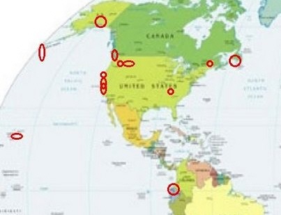
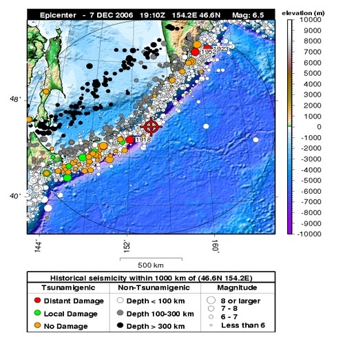
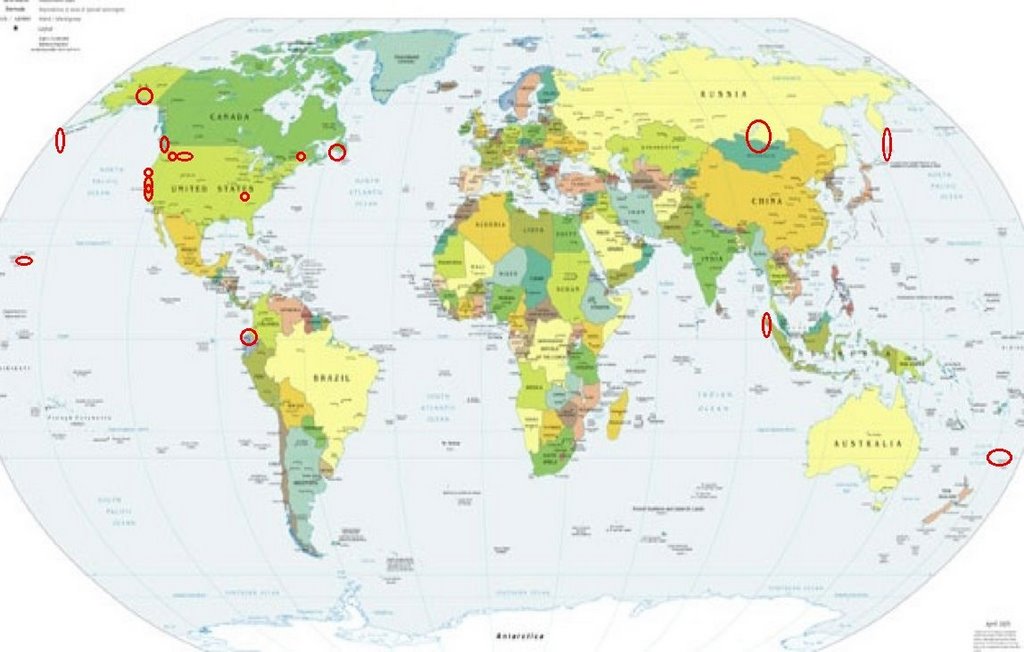
.jpg)